Wildfire updates: Salmon Fire contained, some areas see poor air quality, Hwy 199 closed

For the latest wildfire updates, see this story.
Cooler and more humid air has slowed the growth on a number of Oregon wildfires, allowing for reductions in evacuation orders and the reopening of some recreation sites.
However, active wildfires still have kept U.S. Highway 199 closed on the Oregon-California state line and many popular recreation areas and evacuations in place in the Cascade Range east of Eugene.
Here's the latest on wildfires burning across Oregon.
Salem lifts burn ban
The City of Salem lifted its open burn ban on Tuesday as cooler temperatures and higher humidity lowered fire danger, officials said.
"All outdoor burning, ceremonial and recreational fires will be allowed," a news release said. "City and fire officials ask the community to remain alert and mindful of the dry conditions and practice fire safety when burning outdoors."
Salmon Fire closure lifted as campgrounds, recreation sites reopen
After the 135-acre Salmon Fire, northeast of Oakridge, reached full containment, forest officials lifted the surrounding public lands closure and reopened a number of recreation sites.
"Due to firefighters' quick response to the Salmon Fire, the area is now open again," a news release said. "There were no fire impacts to any recreation sites."
Salmon Creek Falls Campground reopened on Tuesday.
Reopened trails include: Dead Mountain Trail #3566, Salmon Creek Trail #4365, Cross-Country River Trail #4365.
Reopened trailheads include: Flat Creek Trailhead, Salmon Creek Trailhead
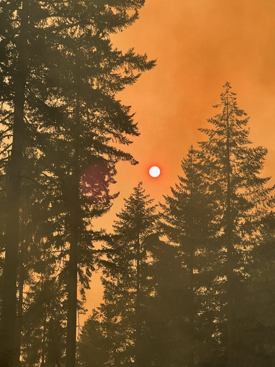
Poor air quality impacting central and southern Oregon
While air quality improved to healthy levels in the Willamette Valley and northwest Oregon, the same is not true for central and southern Oregon.
The Bend and Medford areas were both hit with unhealthy air quality as ocean winds push smoke east. An air quality alert was in place for both areas until at least 5 p.m. Tuesday, but is likely to last longer.
Northwest Oregon's air quality should stay in good shape through the rest of the week, even though the area has missed out on rainfall left over from Hurricane Hilary.
“We should be good on smoke at least into the weekend, but in terms of rainfall, we’re unfortunately the dry spot on the map,” said Tanja Fransen of the National Weather Service.
Currently, there is no forecast of the notorious east winds that brought explosive wildfire growth around Labor Day 2020 and 2022, and long-term forecasts favor what amount to normal autumn conditions.
“The long-term forecast not favoring hotter or drier weather, I’ll take it,” Fransen said.
Highway 199 still closed due to Smith River Complex on Oregon, California border; famed redwood park closed
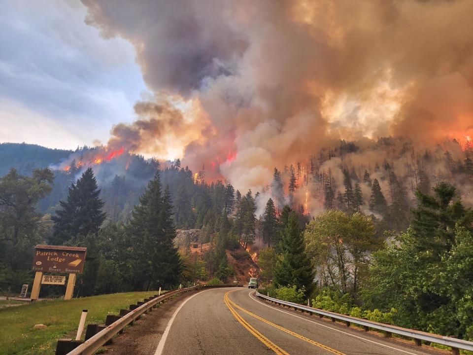
U.S. Highway 199 remains closed at the Oregon and California state line due to the Smith River Complex, burning in the Klamath-Siskiyou Mountains.
The blaze, made up of multiple lightning-ignited fires, grew to 40,000 acres by Tuesday morning, up from 28,712 on Monday. It's burning near the California outposts of Gasquet, and to the northeast of Crescent City.
Power outages have occurred in the area and widespread evacuations and closures are in place.
"Strong northeast winds affected the fire area overnight. Areas of the Kelly fire aligned with Stony Creek (north of Highway 199) and Craigs Creek (south of Highway 199) and made significant movement to the southwest — growing approximately 2.5 miles in the early morning hours," a Tuesday morning report said. "The west side of the Kelly fire moved into the North Fork Smith Roadless Area."
Jedediah Smith Redwoods State Park, home to some of the world’s largest trees, was closed Sunday. Nearby Mill Creek campgrounds also was closed. The fire is about 8 miles from the redwoods.
"Parks anticipate to reopen the campgrounds by Friday if power turns back on and conditions improve. Reservations will be canceled during this time."
The fire is slightly on the Oregon side of the state line, with level 1 and 2 evacuation warnings in place for the southern Illinois Valley. A closure order is also in place for the Rogue River-Siskiyou National Forest.
Two different major incident management teams are managing the north and south ends of the fire. See this page for full details.
Lookout Fire has some evacuation levels downgraded
The fastest-growing wildfire in Oregon, the 12,188-acre Lookout Fire, 3 miles north of McKenzie Bridge, was moderated on Monday and Tuesday morning due to cooler temperatures and higher humidity.
That led to a downgrade in evacuation levels, from level 3 (go now) to level 2 (get set to go) for one location:
Areas north of Highway 126 east of the .5 mile mark on Mill Creek Road to the east end of Taylor Road.
The fire is 5% contained but that number is expected to grow, an update on Tuesday said.
"Firefighters mopped-up ash-pits and hot spots along the 700 road on the fire’s southwest flank, and containment is expected to increase in this area in the coming days," the update said. "North of the 700 Road, bulldozer lines are in place to help utilize Road 2633 as a holding feature on the fire’s west flank."
Winds from the west may increase Tuesday afternoon as the smoke inversion layer begins to lift and a warmer weather trend reaches the area on Wednesday.
A shelter remains in place at Lowell High School for evacuees and small pets from the Bedrock and Lookout fires. A large animal shelter is set up at the Lane County Fairgrounds in Eugene.
The most recent evacuation warnings can be found on this map. A map showing the public land closure around the fire can be found here.
Bedrock Fire reduces evacuation levels, reaches 35% containment
The 30,500-acre Bedrock Fire hasn’t shown major growth and reached 35% containment Tuesday morning.
"Much of the fire perimeter, while not yet declared contained, is now in what fire managers call 'patrol status,'" a Tuesday morning update said. "The fire lines along much of the north, east and southern sections have been secure for many days but firefighters are still working, patrolling and taking any necessary actions to keep remaining pockets of fire inside the perimeter."
Evacuation levels in some areas were reduced Monday afternoon from level 3 (go now) to level 2 (get set) including:
Peninsula Road east of Timber Creek
Big Fall Creek Road east of the intersection with Peninsula.
The most recent evacuation warnings can be found at bit.ly/3YP1YWX. A map showing the public land closure around the fire can be found at bit.ly/3QPvw4Y.
Flat Fire remains 58% contained in southwest Oregon
The Flat Fire, which remains the largest fire of the season in Oregon so far, reached 58% containment by Tuesday morning.
"Fire behavior consists of low rates of spread, backing, creeping, and smoldering limited to scattered pockets of heat and unburned fuels of the interior islands," a Tuesday report said. "Helicopters are engaging isolated areas of heat. Single tree torching is also taking place, however containment lines are not threatened."
Zach Urness has been an outdoors reporter in Oregon for 15 years and is host of the Explore Oregon Podcast. Urness is the author of “Best Hikes with Kids: Oregon” and “Hiking Southern Oregon.” He can be reached at zurness@StatesmanJournal.com or 503-399-6801. Find him on Twitter at @ZachsORoutdoors.
This article originally appeared on Salem Statesman Journal: Wildfire updates: Salmon Fire contained, reopening campground, trails

