Wildfire updates: Six Rivers Complex grows; new fire starts in Siskiyou County
Firefighters worked to suppress several blazes throughout the North State on Wednesday, including one new fire.
Weather continues to be dry and hot, with heat advisories and red flag warnings in place throughout much of the North State.
Daily high temperatures in Shasta and Tehama counties are expected to reach or surpass 105 degrees through Friday, according to the National Weather Service. In Siskiyou County, the forecast is for temperatures to soar into the high 90s to 101 daily.
Those conditions could make it easier for new sparks to catch fire and for current fires to spread, said Emily Heller, meteorologist with the National Weather Service in Sacramento.
The agency issued a heat advisory through 8 p.m. Friday for the Sacramento Valley, from Redding to Sacramento, south to Modesto.
In Siskiyou County, a red flag warning is in effect until 11 p.m. Wednesday. Dry thunderstorms could produce lightning strikes, possibly igniting more fires, the weather service said, and wind gusts could reach 50 mph. A heat advisory is also in effect for the area.
Here's what happened with North State fires as of noon Wednesday.
Curly Fire, Siskiyou County
Firefighters were on the scene of a new fire burning on Wednesday morning on Curly Jack Road near Happy Camp.
The Siskiyou County Sheriff's Office issued evacuation warnings for the area south and east of Highway 96, north of Forest Route 15n12 and west of Elk Creek Road.
For evacuation updates, go to www.facebook.com/SiskiyouCountySheriff or community.zonehaven.com.
Ranch Fire, Shasta County
The 1.9-acre Ranch Fire that started Tuesday morning near Lakehead is fully contained, according to the Shasta-Trinity National Forest.
Firefighters continued to mop up the area on Wednesday.
McKinney Fire, Siskiyou County
The McKinney Fire burning west of Yreka remained 60,392 acres in size on Wednesday morning, according to the Klamath National Forest. It's still 95% contained.
On Tuesday, firefighters flew unmanned aircraft over the burn area to look for pockets of heat, smoke and flames, the U.S. Forest Service said. They're also watching spots that didn't burn for signs it could ignite.
Crews are working to minimize risks from erosion in burn scarred areas. They're placing water bars — "shallow channels or raised barriers laid diagonally across the surface of a road or trail" to channel water and debris "into the vegetation," the U.S. Forest Service said.
Some evacuation orders and warnings are still in effect, according to the Siskiyou County Sheriff's Office.
Highway 96, which cuts through the burn area, is open only to piloted traffic between Beaver Creek to Kohl Creek, according to the California Department of Transportation and the Forest Service. Other roadways within the burn area are closed.
Anyone planning to travel to this or other fire areas should check current road conditions at roads.dot.ca.gov, Caltrans said.
Yeti and Alex fires, Siskiyou County
Combined, the Yeti and Alex fires burned 7,886 acres in the Klamath National Forest between Seiad and Happy Camp. They were 90% contained as of Wednesday morning.
The fires stayed south of Highway 96, and are now burning mostly in isolated pockets of brush, according to the Forest Service.
See the McKinney Fire for road condition information.
More: Electric utility PacifiCorp sued, accused of causing deadly McKinney Fire in Siskiyou County
Six Rivers Complex, Humboldt and Trinity counties
The Six Rivers Complex grew to 23,159 acres as of Wednesday morning, up from 20,052 acres Tuesday morning. Firefighters increased containment to 23%, up from 19% on Tuesday.
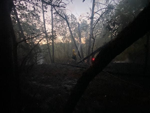
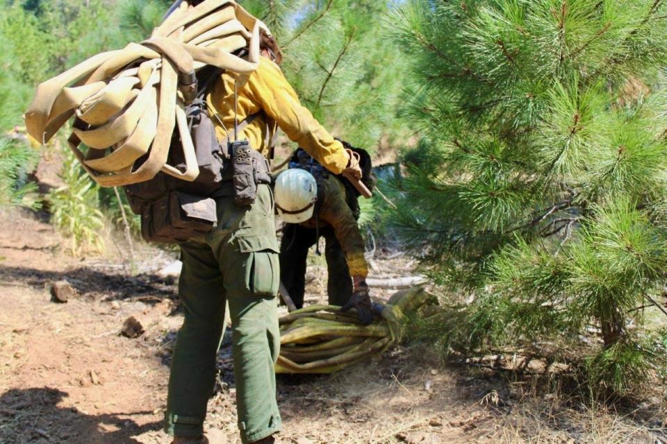
Two of the 12 lightning-caused fires — the Campbell and Ammon fires — are still active, according to the Forest Service. Firefighters are working to protect homes, roads and bridges and important wildlife habitats.
The National Weather Service issued a red flag warning through Wednesday night. Conditions are very dry. Mountain thunderstorms could bring dry lightning and erratic winds, increasing chances for more fire starts along the eastern side of the fire.
Smoke from the fire is hampering motorists' visibility on parts of Highway 299 and Highway 96. Both highways are open, but that could change, Caltrans warned.
Roads leading to evacuation zones are closed, including:
Campbell Ridge Road from Salyer Heights to Seeley McIntosh Road
Forest Route 7N15 at Six Rivers Forest Boundary
Horse Linto Creek Road at Saddle Lane
Friday Ridge Road at Route 6
Titlow Hill Road at Horse Mountain Botanical Area
Go to quickmap.dot.ca.gov for updates on road closures.
Jessica Skropanic is a features reporter for the Record Searchlight/USA Today Network. She covers science, arts, social issues and entertainment stories. Follow her on Twitter @RS_JSkropanic and on Facebook. Join Jessica in the Get Out! Nor Cal recreation Facebook group. To support and sustain this work, please subscribe today. Thank you.
This article originally appeared on Redding Record Searchlight: Six Rivers Complex grows; new wildfire starts in Siskiyou County

