Wildfire smoke near California-Oregon border causes haze. How long will it be smoky?
Even as firefighters progressed battling wildfires and clearing roads, smoke made the air over Shasta and Siskiyou counties unhealthy or even hazardous to breathe on Tuesday.
That smoke could continue to pour into the north Sacramento Valley and north Interstate 5 corridor off and on this week until cooler weather arrives on Friday, according to the National Weather Service.
Winds are blowing smoke south and southeast over Siskiyou and Shasta counties, spreading it from fires now burning in the Klamath National Forest and in northwestern California and Oregon, according to the weather service's Sacramento branch.
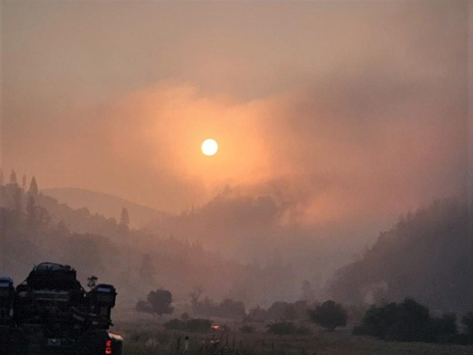
North State residents as far south as Tehama County could sniff smoke on Tuesday morning. By 11 a.m., skies were yellow over Redding and Shasta Lake. The Interstate 5 corridor in Shasta and Siskiyou counties reached levels considered unhealthy to everyone, according to the Environmental Protection Agency's AirNow air quality tracker.
Note to readers: We’ve made this story free as an important public service. If you are able, help power local journalism. Subscribe to the Redding Record Searchlight.
The worst air recorded Tuesday morning was in Yreka and along Highway 96. Pollution in those areas reached levels considered hazardous to all people's health, according to the EPA.
Officials in Tehama and coastal counties issued air quality advisories due to thick smoke, cautioning people not to breathe the smoky air.
For more information, check the Record Searchlight's real-time smoke map at data.redding.com/fires and the EPA's AirNow air quality tracker at AirNow.gov.
Highway 96 reopens
There was also good news.
Highway 96 reopened to motorists, according to a Tuesday morning update from the Klamath National Forest.
Fires burning in the Happy Camp Complex in Siskiyou County closed the highway in mid-August.
One-way traffic controls are in place along stretches of the highway while crews make repairs, remove debris and stabilize slopes and hills around the highway. Motorists should expect delays of up to an hour or more, the forest service said.
East of Seiad, Highway 96 will close to the public between 8 a.m. and 9 a.m., and between 6:30 p.m. and 8 p.m., allowing emergency vehicles carrying firefighters and equipment to reach fires that are still burning in the complex, the forest service said.
For information about county road closures, go to the Siskiyou County Public Works website at co.siskiyou.ca.us/publicworks/page/closures-and-delays.
Here's more about the wildfires burning in Siskiyou and Trinity counties.
Happy Camp Complex
As of Tuesday morning, the Happy Camp Complex of fires reached 22,195 acres, up from 19,205 acres on Monday morning, according to the Klamath update.
Those fires were 31% contained on Tuesday morning, up from 29% on Monday.
Much of the fire's growth occurred on the west side of the complex, where the Elliot Fire reached 9,915 acres, up from 7,877 acres Monday morning. That fire remained 2% contained on Tuesday, according to the forest service.
Fire crews will patrol Highway 96 this week to make sure the road stays safe. They'll also mop up hot spots and strengthen containment lines near the highway.
Also on the complex' west side, firefighters battled the 741-acre Malone Fire near Elk Creek Road, which was 7% contained Tuesday morning. This week, firefighters plan to secure fire lines on the 2,148-acre, uncontained Ufish Fire. Winds made working this fire difficult on Monday night, but crews continued containment efforts on Tuesday.
On the eastern side of the complex, the Head Fire grew to 6,931 acres by Tuesday morning, up from 6,844 acres on Monday. Firefighters increased containment on the fire to 45%, up from 35% on Monday.
A community fire operations update meets at 5:30 p.m. on Tuesday, Aug. 29 at the Karuk Administration Gym, 64236 Second Ave. in Happy Camp.
Deep Fire
People living in Trinity Center breathed cleaner air than their Shasta and Siskiyou neighbors. Pollution reached only moderate levels on Tuesday morning as firefighters continued to make progress battling the 3,924-acre Deep Fire.
Burning southwest of Trinity Center and northwest of Trinity Lake in Trinity County, the Deep Fire grew less than 100 acres between Monday and Tuesday mornings. It was 60% contained on Tuesday, according to a Shasta-Trinity National Forest update.
The blaze scorched trees and brush at the northeast end of Deep Creek on Monday, but rocky terrain blocked most of the fire's progress. On Monday the fire also continued to "back slowly" into Little Salt Creek. Firefighters worked their way north at the Stuart Fork Trail, toward Morris Meadow. This week, crews hope to turn containment efforts east onto the Deer Creek Trail.
"The southern heel of the fire closest to the Van Matre inholdings and the Trinity Alps resort has been cold for several days," the forest service said on Tuesday, with "most evacuation orders were downgraded to warnings."
For evacuation order and warning updates, go to the Trinity County Sheriff's Office Facebook page at facebook.com/people/Trinity-County-Sheriffs-Office/100064589806351/.
Jessica Skropanic is a features reporter for the Record Searchlight/USA Today Network. She covers science, arts, social issues and news stories. Follow her on Twitter @RS_JSkropanic and on Facebook. Join Jessica in the Get Out! Nor Cal recreation Facebook group. To support and sustain this work, please subscribe today. Thank you.
This article originally appeared on Redding Record Searchlight: Wildfire smoke brings poor air quality to Shasta, Siskiyou counties

