Wilmington winter weather: Ice storm warning, higher chance of snow
A storm set to move into the Cape Fear region early Friday is expected to bring freezing rain, ice and snow along with low temperatures that could prolong the impacts of any ice accumulations.
According to an update from the National Weather Service in Wilmington on Thursday evening, freezing rain is set to hit the area around 6-10 a.m. Friday before transitioning to a mix of wintry weather in the afternoon, with some snow expected in the evening and into Saturday morning.
With temperatures predicted to be in the low 20s Saturday evening into Sunday morning and possibly in the teens Sunday evening, rain from the storm will likely re-freeze Saturday night and melt slowly Sunday.
Updated forecasts from the National Weather Service have shifted the "main area of ice accumulation a little bit closer to the coast," said Mark Bacon, a meteorologist with the National Weather Service in Wilmington, on Thursday morning.
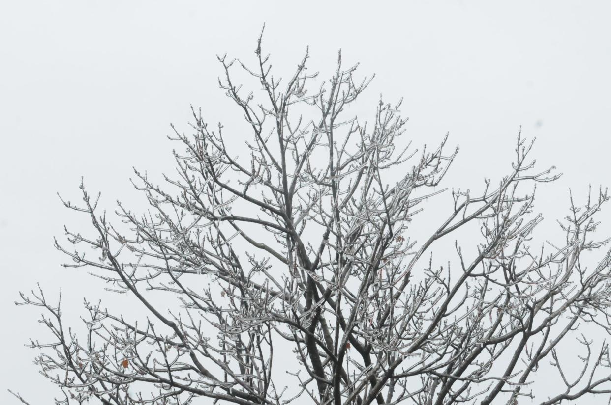
That change in the forecast puts parts of the Cape Fear region under an ice storm warning. An ice storm warning is put in place when an area is expected to get a quarter inch or more of ice accumulation, according to Bacon.
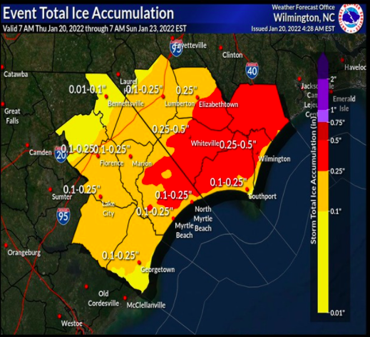
"We've now included more of Brunswick County, just the northern part of New Hanover County and all of Pender County are now in an ice storm warning," Bacon said.
The warning is set to go into effect at midnight Thursday and run through Saturday at noon, but the area can expect to see the bulk of the wintery weather on Friday.
"Most of the freezing rain will come Friday during the day into Friday night," Bacon said.
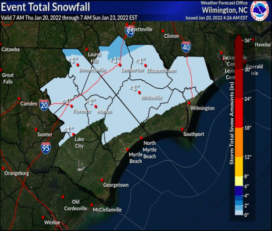
An updated forecast also shows a higher chance for snow in some parts of the Cape Fear region.
Related: Winter wonderland: Wilmington saw snowy Christmas after historic 1989 storm
Snow is now predicted for inland areas of Pender and Brunswick Counties and northern New Hanover County. But the snowfall probably won't accumulate because of the rain that's predicted to come before it, Bacon said.
Wilmington last saw measurable snow in January 2018. Since then, the area has seen a few snowflakes, but not enough to stick.
The storm stems from an "arctic cold front" that's predicted to move into the area on Thursday evening, which will help turn rain into ice, said Bacon.
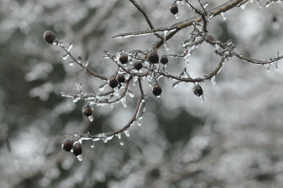
The ice accumulation has the potential to cause dangerous driving conditions and power outages in the area, Bacon said.
The city of Wilmington began preparing roads for the storm on Thursday by spreading brine - a mixture of salt and water - on sections of the roughly 400 miles of roads owned and maintained by the city, Dave Mayes, the director of Wilmington's Public Services Department, told reporters during a press conference Thursday morning.
Brining roads helps delay freezing and can help melt ice that forms, according to Mayes. Starting on Friday, Wilmington will also spread a sand and salt mixture on roads. Wilmington will focus on spreading the mixture on high-traffic and collector roads and those with an incline, Mayes said.
![Public Service Department Director David Mayes talks to members of the media Thursday Jan. 20, 2022 about the steps that are being taken to help keep the roads safer before this weekends weather and the effects it will have on our area. [KEN BLEVINS/STARNEWS]](https://s.yimg.com/ny/api/res/1.2/q48zTsPWRk0oe2ljslJCwQ--/YXBwaWQ9aGlnaGxhbmRlcjt3PTk2MDtoPTY0MA--/https://media.zenfs.com/en/star-news/76d5f6fa8a3731eb90edeec2b2e0e94d)
There's a chance rain predicted for the area could wash away some of the salt being applied to roads, Mayes said, which could force trucks to re-apply brine in some areas.
"When you put brine out on the road and it's followed by rain you lose the effectiveness," he said.
Although Wilmington and the N.C. Department of Transportation will work to maintain road conditions, Mayes encouraged residents to stay off of the roads during the storm.
"We'll do everything that we can to make the roads as safe as possible," he said. "If you don't have to go out, please don't."
In a call with reporters on Thursday afternoon, New Hanover County Emergency Management Director Steven Still reiterated that message, asking residents to stay off of New Hanover County roads on Friday if they can.
"We're going to urge everybody to please stay off the roads during that time," he said. "We are going to have ice. There's no doubt about that based on the forecast."
"It does not matter if you have a four-wheel drive vehicle in ice," he added. "If you try to brake in ice, you are not going to get that traction to slow your vehicle down."
During the last major ice storm in 2014, the area saw a considerable number of traffic accidents, Still said.
New Hanover County residents could also see power outages if the ice downs tree branches onto power lines. Still encouraged residents to have a plan in place in case they lose power and heat.
"Make sure that your plan covers how to stay warm in an event like this and how to do it safely," he said. "We've certainly had issues in the past with people using combustible materials, using grills indoors and that's something that we urge our residents not to do."
Still asked residents to stay indoors until temperatures warm and the ice starts to melt later in the weekend.
"It's going to be a short-lived event, so let's stay indoors, stay warm and we'll be looking for brighter skies and warmer temps on Sunday," he said.
Reporter Emma Dill can be reached at 910-343-2096 or edill@gannett.com.
This article originally appeared on Wilmington StarNews: Wilmington, NC weather: Ice storm warning, freezing rain, maybe snow

