Winds bringing dust storm through Oklahoma City, reducing visibility: What to know
The wind was literally sweeping down the plain in Oklahoma Tuesday, with gusts between 70 and 80 miles per hour in the panhandle and bringing with them a dust plume expected to cause visibility of one to two miles during rush hour in the Oklahoma City metro, the National Weather Service reported.
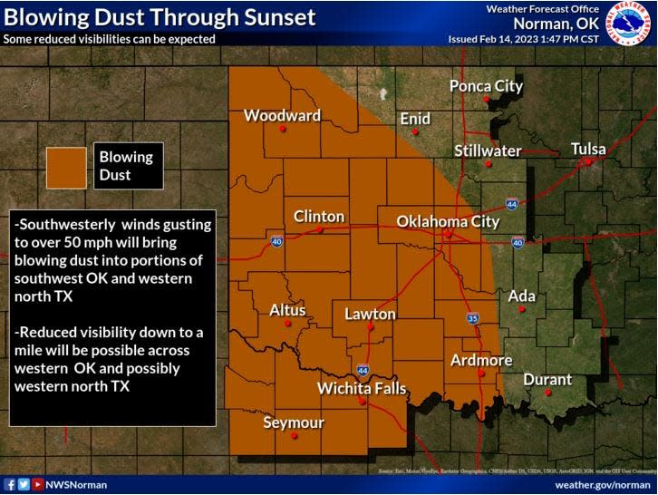
These southwest and westerly winds followed behind rain showers that crossed much of the state Monday. The National Weather Service in Norman issued a "Blowing Dust Advisory" for the western counties of Ellis, Roger Mills, Custer, Beckham, Washita, Harmon, Greer, Kiowa and Jackson, where visibility will be reduced to one quarter mile and one mile. Winds will be 25 to 35 miles per hour, with gusts up to 55.
We hope everyone tied their bonnets on extra tight today. Many locations have seen gusts over 50 mph and areas of dust will be moving over the area through late this afternoon. Winds will start to subside after 5 PM. Map is courtesy of the Oklahoma Mesonet. #okwx pic.twitter.com/s1CPCyx0FL
— NWS Norman (@NWSNorman) February 14, 2023
The Oklahoma Gas and Electric Company reported 8,200 customers were without power as of 4 p.m., due to the high winds that damaged power lines and equipment.
The Lubbock Avalanche-Journal reported blowing dust in the eastern portion of the Texas Panhandle dropped visibility down to less than 1/4 mile, and a wind gust over 80 mph was reported in Guymon, Oklahoma, according to Amarillo's National Weather Service meteorologists.
Brought to you by
This article originally appeared on Oklahoman: Winds bringing dust storm, low visibility to Oklahoma City

