Cloudy, cold with few flurries tonight; Chilly weekend with rain, snow mix Saturday night
QUICK-LOOK FORECAST:
Few flurries tonight
Snow, Mix Saturday night - Sunday
Cool next week
>> TRACK THE CONDITIONS WITH LIVE DOPPLER 7
DETAILED FORECAST:
TONIGHT: Blustery and cold for tonight with a few flurries or a passing sprinkle. Storm Center 7 Chief Meteorologist McCall Vrydaghs says temperatures will be falling into the 20s by morning with wind chills in the teens.
SATURDAY: Cold and cloudy in the morning Saturday with a passing flurry possible.
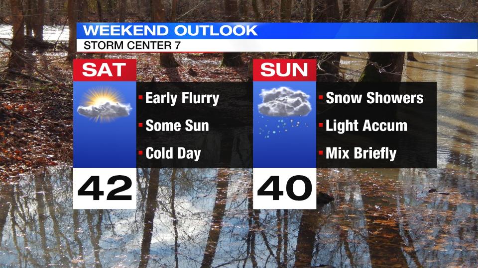
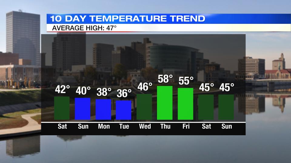
Clouds will break briefly for some sunshine during the day before clouds return. Temperatures will rise from the middle 20s early to a high around 40 degree. Clouds continue to thicken Saturday night with snow showers arriving from the southwest before dawn on Sunday.
SUNDAY: Waking up to light scattered snow showers on Sunday.
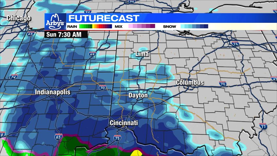
A light accumulation of snow, less than an inch, is possible before the sun comes up.

Once the sun rises the solar radiation will limit any additional snow accumulation.
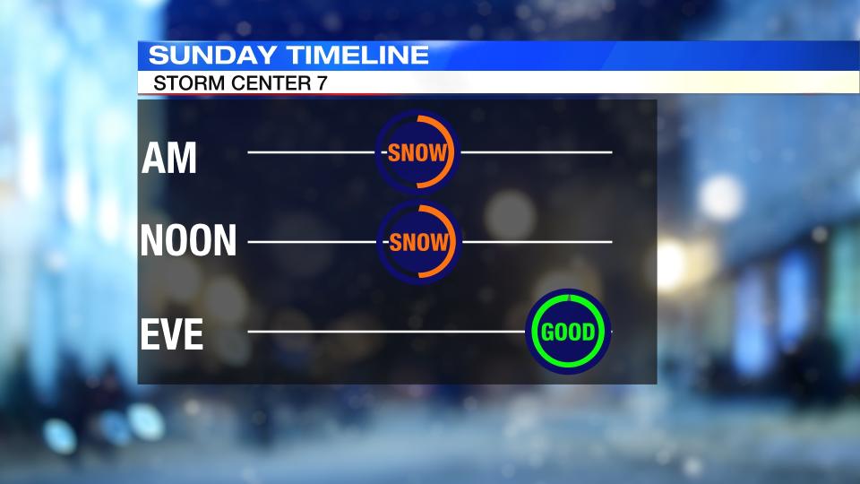
Roads will be mainly wet during the day with a few more snow showers mixing with rain through midday/early afternoon before ending. Temperatures will rise to a high around 40 degrees.
MONDAY: Staying cloudy and cold for Monday with a few more flurries or a passing snow shower. Highs will be in the upper 30s, but feeling colder due to windy conditions.
TUESDAY: Some clouds early will give way to mostly sunny skies on Tuesday. Highs in the middle 30s.
WEDNESDAY: Mostly sunny and a bit milder for Wednesday and closer to normal with a high in the middle to upper 40s.
THURSDAY: Mostly cloudy skies for Thursday with a passing shower possible, but most of the Miami Valley will remain dry. Highs for the day will rise to the upper 50s.
FRIDAY: Mostly cloudy with a few showers around on Friday that may end briefly as snow showers as temperatures drop. Highs in the middle 50s.

