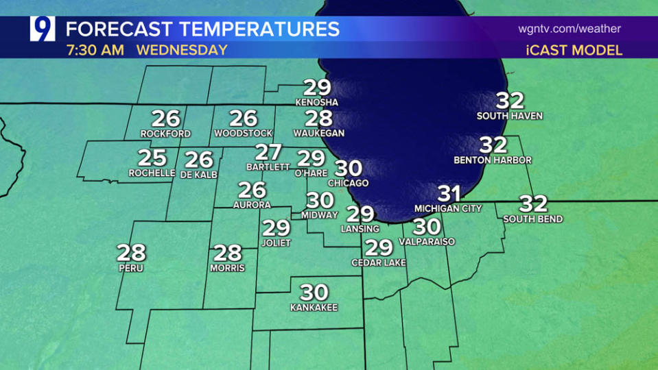
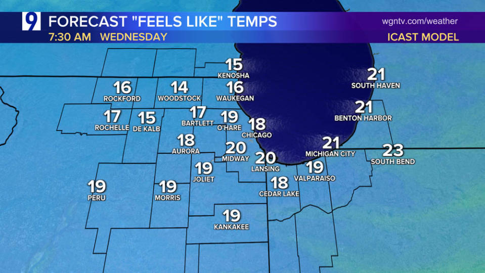
Winter-like chill Wednesday morning; high pressure takes control

Winter-like chill to open the day Wednesday

Tuesday’s cold front sent temps plummeting
High temperature reached the mid 50s late morning then fell throughout Tuesday afternoon


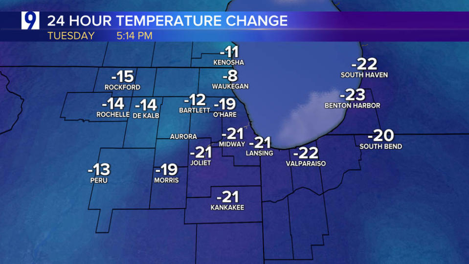

Tuesday’s relatively mild temperatures occurred in the late morning before readings tumbled throughout the afternoon

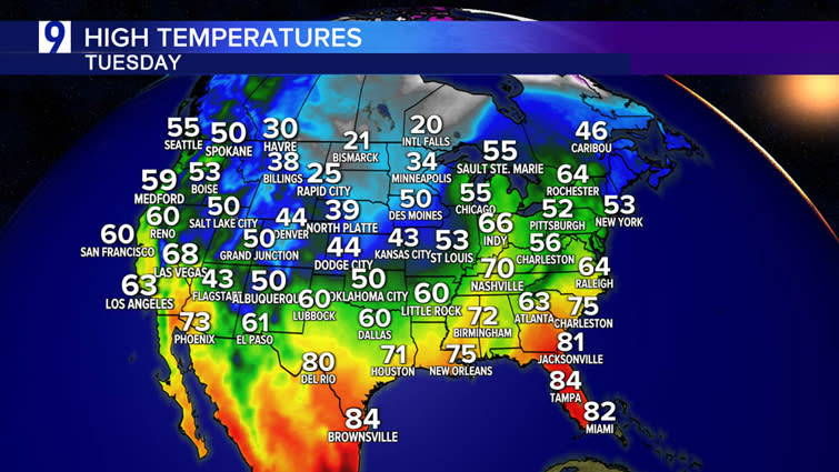
Tuesday highs—late season arctic air brought well below normal temperatures to much of the Plains and northern Rockies. A piece of that cold air arrives in Chicago Wednesday with daytime highs no warmer than the middle 40s, well below the typical low to mid-50s considered normal for this time of year

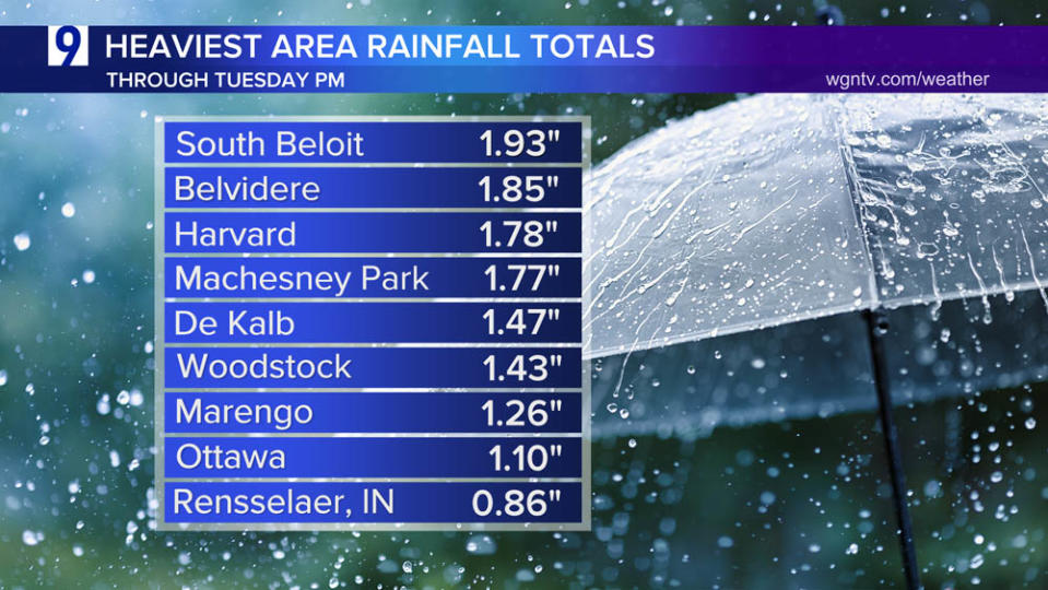
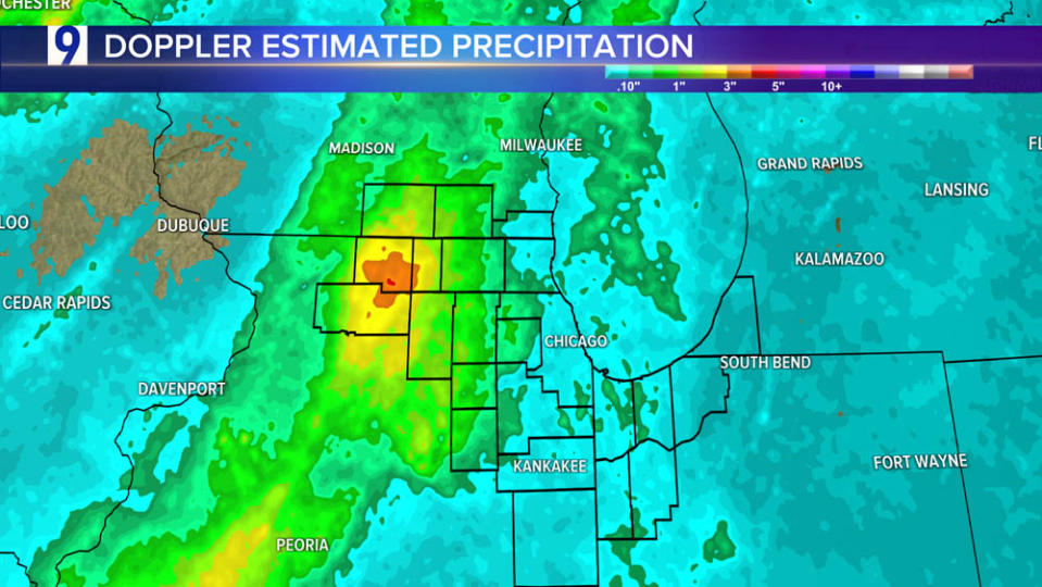
Much of the area received a soaking rain Monday night into Tuesday, but the heaviest totals were logged NW of Chicago
Gusty winds accompanied the cold frontal passage Tuesday
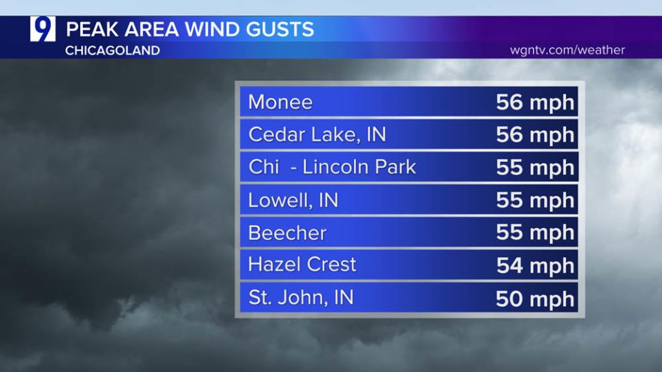

Powerful wind gusts accompanied the gusty cold frontal showers that hit toward midday.
Peak wind gusts nearly reached 50 mph at Midway Airport just before midday


Slow warming follows a Chilly Wednesday


Despite the lack of snowfall, March has been a wet month for both airports, especially at Midway Airport where the near 4″ tally is nearly 2.5 times the normal total to date

Snow piles up across the North Woods
More than 32% of the lower 48 under a covering of snow as of Tuesday evening

Updated Snowfall totals Sunday through Tuesday:


Total QPF next 7 days
Courtesy weathermodels.com

For the latest news, weather, sports, and streaming video, head to WGN-TV.

