Winter storm to bring 1-2 feet of snow to Oregon Cascade passes, impact Columbia Gorge
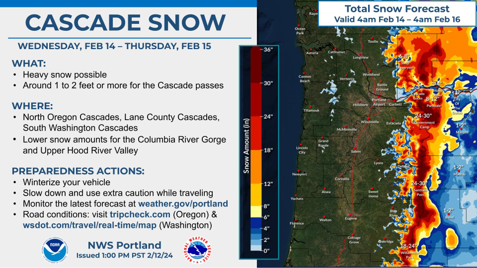
A winter storm is forecast to bring 1 to 2 feet of snow to Oregon’s Cascade mountain passes and could have a major impact on the Columbia Gorge Wednesday and Thursday, according to the National Weather Service in Portland.
There's also an outside chance for some Willamette Valley snowflakes, but little accumulation is expected.
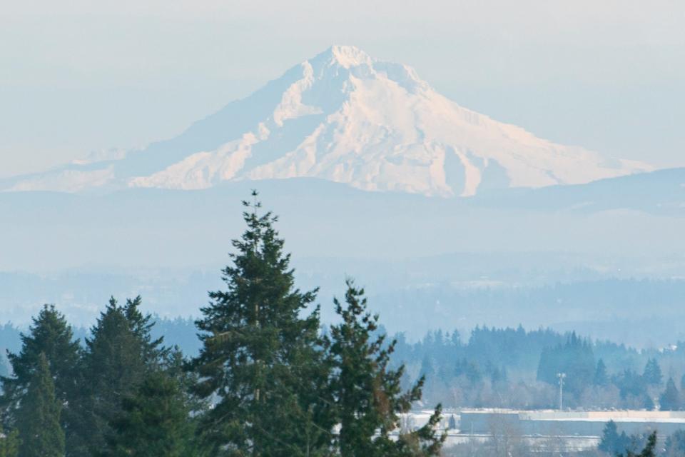
The heaviest snowfall and worst driving conditions are forecast for the Government Camp and Mount Hood area (Highway 26), Santiam Pass (Highway 20), Willamette Pass (Highway 58) and into the southern Oregon Cascades. Most of the snow is expected to fall above 2,500 feet.
“The combination of heavy snow and gusty winds may lead to whiteout conditions at times,” a winter storm warning from NWS said. “ Travel could be very difficult.”
Columbia Gorge could bring brutal travel conditions
Although the heaviest snow is forecast in the mountains, the worst traveling conditions could be on Interstate 84 in the Columbia Gorge.
The west and central gorge could see up to 12 inches of snow and a quarter-inch of ice, NWS said, making travel extremely difficult.
Any snow for the Willamette Valley?
It's not likely, but there's a 20% chance for snow on the valley floor in Portland over the coming few nights. It's not forecast to amount to much, but it is possible.
Down into the central and southern Willamette Valley, there is an even less likely chance of snowflakes.
Holiday weekend should bring improved travel conditions
By the holiday weekend, most of the worst impacts of the storm should have subsided, and treated roads should be in fairly normal conditions, NWS meteorologist Miles Higa said.
The forecast does call for a mix of rain, freezing rain and snow both in the Cascades and in the gorge.
“By the weekend, the precipitation will be winding down and I think people can mostly expect typical winter driving conditions,” Higa said.
He said the amount of freezing rain in the Cascades looked fairly small, although anyone traveling over the Cascades should be prepared for some ice and snow.
Storm to help snowpack, continue drought improvement in Willamette Valley
On the plus side, the snowfall should help boost Oregon’s flagging snowpack. Western Oregon has 81-88% of normal snowpack currently, and this storm could help boost it closer to normal levels.
The precipitation will fall mostly as rain in the Willamette Valley, with around a half-inch to one inch forecasted over the two days.
Currently, Oregon has the smallest amount of drought the state has seen since October 2019, according to the U.S. Drought Monitor.
Zach Urness has been an outdoors reporter in Oregon for 15 years and is host of the Explore Oregon Podcast. Urness is the author of “Best Hikes with Kids: Oregon” and “Hiking Southern Oregon.” He can be reached at zurness@StatesmanJournal.com or (503) 399-6801. Find him on Twitter at @ZachsORoutdoors.
This article originally appeared on Salem Statesman Journal: Oregon storm to bring heavy snow to Oregon passes, Columbia River Gorge

