Toronto remains under rainfall warning after storm brings messy mix to city
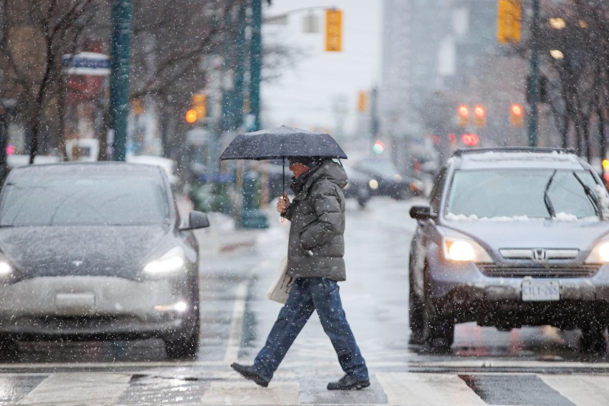
Toronto remained under a rainfall warning on Tuesday night after a winter storm dumped a messy mix of snow and rain on wide swaths of the province.
Environment Canada warned between 20 millimetres and 35 millimetres were expected for the city and surrounding areas. The rain was forecast to end in the evening or overnight.
"Significant rainfall is expected," the weather agency said in the warning.
A weather advisory for the Greater Toronto Area that had warned of difficult travel conditions due to snow and possible freezing rain ended as of 4:45 p.m.
For Toronto and immediately surrounding areas, snow that arrived mid-morning turned to rain in the evening as temperatures rose. The result was a slushy mess on sidewalks and roads.
Environment Canada said "ponding" on roads was possible due to the volume of rain.
"The frozen ground has a reduced ability to absorb this rainfall," Environment Canada said. "Localized flooding in low-lying areas is possible. Heavy downpours can cause flash floods and water pooling on roads."
Residents were urged to keep children and pets away from creeks and riverbanks.
Ontario Provincial Police Sgt. Kerry Schmidt said Tuesday was a stressful day for many motorists and a busy day for many officers. He said the OPP responded to dozens of crashes across the GTA throughout the "wet and sloppy" day.
"Even though it's raining, the roads are still slick," he said.
Schmidt urged motorists to drive to the conditions, which he said means having full headlights on, paying attention to what is happening in front and behind the vehicle, and looking way down the horizon to prepare to adjust driving for unexpected changes in traffic volumes or patterns.
"Give yourself lots of space so you can adjust your driving, your speed, your lane in plenty of time without having to make a panic or aggressive move," he said.
During the day, he said many motorists lost control, hit other vehicles, went into concrete walls, and slid off roads into ditches at on and off ramps.
"As this rain continues through the overnight hours, please drive accordingly," he added.
Earlier, Schmidt said significant amounts of rain can result in driving conditions that can be just as dangerous on the roads as large amounts of snow. Standing water, for example, can result in hydroplaning, which means wet and slippery roads, he said.
Areas north of the city, like in Caledon and Newmarket, were forecast to see 10 to 15 centimetres of snow accumulate but are also at risk of freezing rain later in the day.
A 'sprawling' Texas low system
David Phillips, senior climatologist with Environment and Climate Change Canada, said the storm was a "sprawling, expansive Texas low" that had been "sitting on Ontario's doorstep" for several days. A Texas low is an area of low pressure that forms over the Gulf of Mexico before heading north.
Phillips said a system like this would typically stay south of the Great Lakes, but this one was forecast to be "almost a spring-like storm that's going to ride right through the heart of Ontario, coming from Michigan."
It brought with it warmer air and moisture from the Gulf of Mexico that was expected to collide with the cold air that was sitting over the province, he said.
"So we're going to see a mix of precipitation," Phillips added. Temperatures are going to continue to rise throughout the day, and the storm could also bring blustery winds of up to 50 km/h, he said.
TTC says it's ready for winter weather
Some GTA school boards cancelled bus service in particular coverage zones before the storm.
Pearson airport said it did not anticipate any travel disruptions due to the blast of winter weather but cautioned travellers to leave plenty of time and check their flight status before heading out.
The TTC urged drivers to take public transit instead. In a statement, the TTC said it deployed extra employees and vehicles throughout the city that will spread salt, clear surfaces of snow. It also planned to run anti-icing trains to keep power rail and tracks clear of snow and ice, spray anti-icing through its transit network and provide frequent updates online, it said.
The transit service said it would actively monitor 56 bus stops in areas where heavy snow and freezing rain is known to impact bus service and advised customers to check if their stop is in service before traveling. Wheel-Trans service will continue, but service may be delayed.
It advised all riders find real-time updates on its website and plan for extra travel time.
Central, eastern Ontario to be hit hardest
Meanwhile, some regions in the central and eastern Ontario were put under a storm watch for Tuesday and into Wednesday morning.
The heaviest snow was predicted for central Ontario, including Sault Ste. Marie and Greater Sudbury, where Environment Canada called for between 15 and 30 centimetres starting Tuesday afternoon.
Ottawa and the surrounding area are also under a storm watch with Environment Canada predicted to see 10 to 20 centimetres of snow, possibly turning into freezing rain and ice pellets Tuesday night.
Toronto opens warming centres
The City of Toronto advised residents to take public transit, give themselves extra time to get around and travel with caution on Tuesday as weather conditions were expected to worsen.
It is also opened four warming centres for walk-ins starting at 5 p.m. at:
136 Spadina Road, south of Dupont Street.
75 Elizabeth Street, behind city hall and west of Bay Street, south of Dundas Street West.
North York Warming Centre at 15 Olive Ave., east of Yonge Street and south of Finch Avenue East.
885 Scarborough Golf Club Road, east of Markham Road and south of Ellesmere Road.

