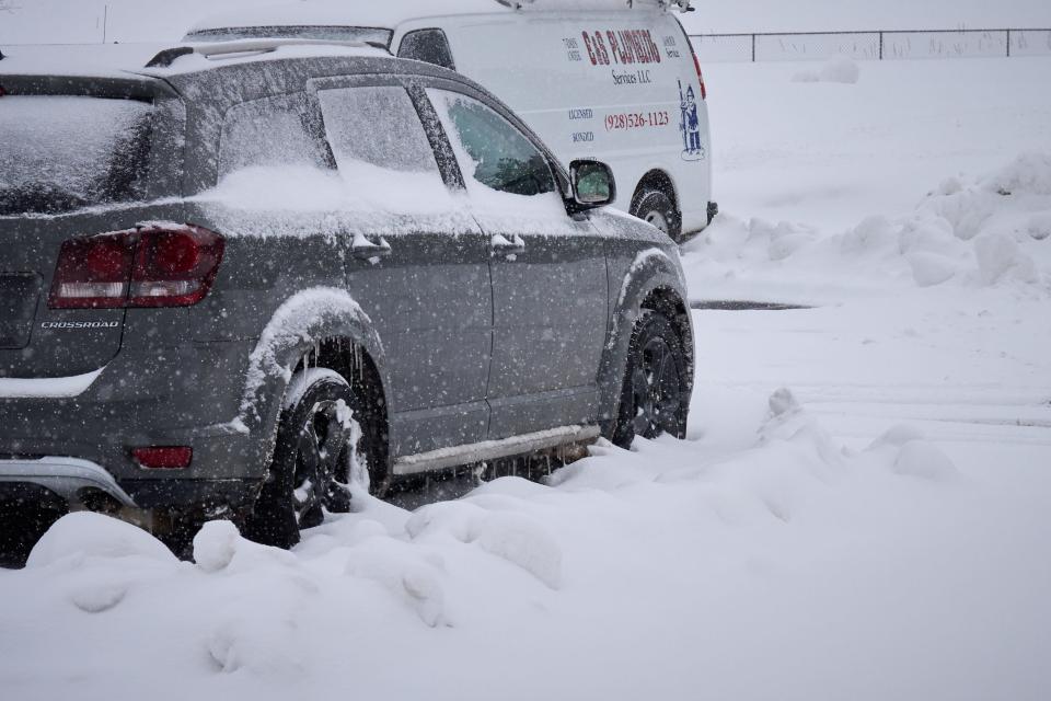
Winter storm to hit the high country on Saturday; hazardous driving conditions expected
Heavy, blowing snow and strong southerly winds will lead to hazardous travel conditions for the high country starting Saturday night and lasting through Sunday as another winter storm will hit high elevation areas starting Saturday evening, according to the National Weather Service in Flagstaff.
Snow will begin in western Coconino and Yavapai counties early Saturday evening, moving into Flagstaff by late evening and reaching eastern Arizona around midnight, the weather service said. The snow is expected to last through Sunday.
"Expect hazardous travel conditions, falling snow levels, windy conditions and areas of snow tonight and Sunday," said the weather service in Flagstaff. "A variety of Winter Storm Warnings and Advisories are in effect."
Hazardous driving conditions, travel delays and possible road closures are expected to accompany the weekend storm. The roads will be slick and visibility will be low due to the blowing snow, the weather service said.
A high hazardous travel warning is in effect starting Saturday at 5 p.m. and lasting through 5 p.m. Sunday, according to the weather service.
High elevation areas around the Kaibab Plateau through the Mogollon Rim can expect between 8 and 12 inches of snow Saturday and Sunday, with lighter snowfall expected in northeast Arizona through the weekend.
Snowfall will start in areas around 6,500 feet in elevation Saturday night and reach low elevation areas by Sunday morning, the weather service said. Some snow will fall as low as 4,000 feet on Sunday, but impacts are expected to be low or nonexistent.
High country residents will get a break from the winter snow on Monday and Tuesday as cool and dry conditions return, but it will be short lived as another cold, windy and snowy winter storm is expected to arrive by midweek.
Next week's storm could bring dangerous blizzard conditions, according to the weather service in Flagstaff.
"We will see how it evolves in the coming days," said the weather service in reference to next week's winter storm. "For now, focus on travel impacts Saturday night and Sunday."
A windy weekend in store for central Arizona
A wind advisory lasting through 8 p.m. Saturday night is currently in effect for La Paz, Yuma and eastern Maricopa counties as a cold front is expected to bring southwesterly winds between 15 and 20 mph, according to the National Weather Service Phoenix.
The wind advisory will resume on Sunday morning and last until 6 p.m. for those areas, with wind gusts reaching up to 45 mph throughout the weekend, according to the weather service.
The windy weekend is the result of a cold front passing through southwest and central Arizona. Along with the wind, the cold front is expected to bring scattered rainfall and a 15% chance of thunderstorms to the region on Saturday evening, lasting through Sunday morning.
"Gusty winds are anticipated ahead of the front across portions of southwestern Arizona early this evening," said the weather service in Phoenix in a forecast discussion. "Shower activity is also expected along and behind the front, particularly across central Arizona through Sunday morning."
The weather service warned there will be areas of blowing dust throughout the weekend, saying residents should beware of crosswinds along Interstate 8 and Interstate 10. The wind could cause difficult driving conditions for high profile vehicles.
Residents should be aware of patchy blowing dust, crosswinds and loose objects becoming airborne while driving.
The weather service in Phoenix recommended securing loose outdoor items and temporary structures like tents and trampolines to ensure they don't blow away.
Low desert areas can expect less than a quarter inch of total rainfall this weekend as the cold front moves through the state, while higher desert areas will see up to 1.25 inches as the storm makes it way out of the state.
Anticipated rain totals for the weekend are as follows:
Phoenix: 0.1-0.2 inch
Tucson: 0.1-0.2 inch
Gila Bend: 0.1-0.2 inch
Casa Grande: 0.1-0.2 inch
Yuma: 0-0.1 inch
Prescott: 0.5-1 inch
Payson: 0.5-1 inch
Globe: 0.5-1 inch
Sedona: 0.5-1 inch
Minor slippery roadways and the potential for flooding of higher terrain washes will accompany the weekend rain, the weather service in Phoenix said.
Temperatures in southwest and central Arizona will drop on Sunday before warming up again on Monday and Tuesday as dry weather returns early next week, the weather service said. Another winter storm is expected to drop temperatures Wednesday and Thursday next week.
"Well-below normal temperatures in the wake of this system will linger through next week," the weather service said.
Tucson to see cold temperatures and mountain snow
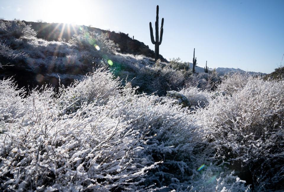
Valley rain, mountain snow and gusty local winds are on tap for southeast Arizona and the mountains surrounding Tucson as the cold front arriving Saturday will bring wind and rain to the low desert region and snow to the surrounding mountains, said the weather service in Tucson.
"A quick moving storm system arrives later tonight resulting in a cold and windy Sunday with periods of rain and snow," said the weather service in Tucson in a forecast discussion.
A winter weather advisory will go into effect starting Sunday morning for elevations above 6,500 feet in the region's southeast mountains, with some light snow expected in elevations as low as 3,000 feet.
Mount Lemmon will see 4 to 8 inches of snow this weekend, with possible snow-covered roads and closures starting Sunday morning for the mountain and those located south and east of Tucson, the weather service said.
Temperatures will drop in Tucson on Sunday, with a high of 55 and a low of 42. Cold temperatures and a possible freeze warning for metro Tucson is expected on Monday morning.
Temperatures will rise Monday and Tuesday next week before another cold winter storm moves across southeast Arizona starting Wednesday and Thursday, with snowfall at even lower southeast elevations expected, according to the weather service in Tucson.
This article originally appeared on Arizona Republic: Winter storm to hit Arizona, National Weather Service says

