Live updates: Morro Bay road closes as creek rises, Tally Ho evacuation warning lifted
Another atmospheric river pummeled San Luis Obispo County with heavy rains and high winds on Tuesday, causing flooding, evacuations and road closures across the region.
Some areas have seen as much as 3 inches of rain, which is expected to continue into the night.
Update, 11:30 p.m.:
As the rain picked up overnight, South Bay Boulevard in Morro Bay was closed between Los Osos Valley Road and Highway 1 due to potential of creek overflowing into roadway, according to CHP’s traffic incident report page.
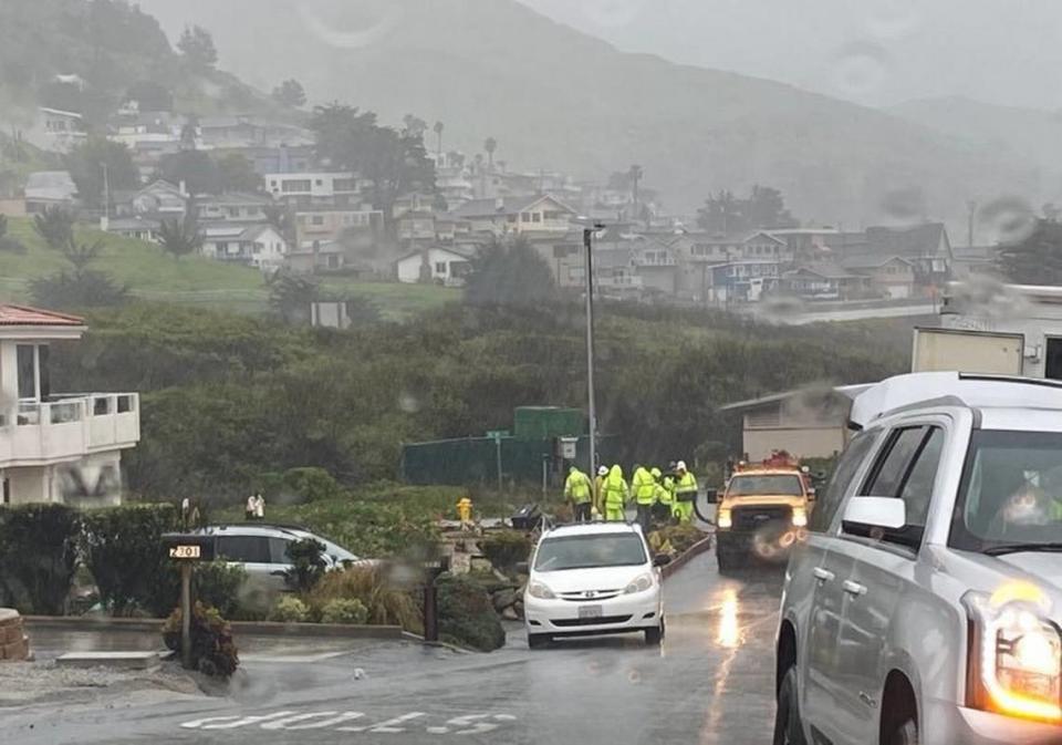
Pismo Beach police were also responding to reports of an active slide on Price Canyon Road, and there were reports of further flooding on San Luis Bay and Avila Beach drives outside of Avila Beach.
Earlier in the night, the city of Arroyo Grande lifted its evacuation warning for residents in the area of Tally Ho Creek.
Update, 4:20 p.m.:
Highway 41 will remain closed overnight in both directions from San Gabriel Road to Los Altos Road in Atascadero due to slide activity from inclement weather, Caltrans said in a news release.
The road closed around 2 p.m. Tuesday due to slide activity, downed trees and wires.
Caltrans advised travelers to use Highway 46 or Highway 101 as an alternate route, and to move over and slow down when driving through highway construction zones.
A team from the department will meet on site Wednesday to figure next steps to reopen the highway.

Update, 3:45 p.m.:
The flood and wind advisories issued by the National Weather service have been extended to 6 p.m. and 10 p.m., respectively, for much of the county.
A flood watch is also expected to last until 10 p.m.
One to 4 inches of rainfall have been recorded in the county, the advisory said, with 0.5 to 2 inches more expected to fall.
Grover Beach closed South Fourth Street between Farroll Avenue and Highland Way because there is “a very large tree across the roadway,” the city’s Police Department posted on Facebook.
That tree fell onto a business, while a second tree fell on the railroad tracks a few minutes later in the opposite direction. Union Pacific crews are working on removing the tree that fell on the tracks.

The area will be closed for several hours.
A tree also fell on Branch Mill Road in Arroyo Grande, the city’s Police Department said on Instagram. The road will be closed for about two hours.
Cambria Fire Chief Justin Vincent told The Tribune it appears the storm is moving faster than expected.
“We may have averted our worst fears,” he said.
Although the creek has risen 10 feet, it’s not at flood stage yet, he said, adding there’s still the potential for flooding, but “we’ve almost made it through the worst” of the storm.
In Atascadero, 557 customers were without power, according to PG&E’s outage map.
The preliminary cause is believed to be the weather, the energy company said, and it is unclear when power will be restored.
Update, 1:10 p.m.:
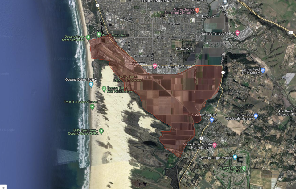
An evacuation order has been issued for residents south of the Arroyo Grande Creek Levee and near the Oceano Lagoon, San Luis Obispo County Office of Emergency Services said in a news release.
Residents in all areas south of the Arroyo Grande Creek Channel for one mile and west of Highway 1, as well as residents near Oceano Lagoon north and east of Strand Way and River Avenue, South of Pier Avenue to the ocean and east to the railroad tracks, along the tracks and back up to Pier Avenue should evacuate immediately.
Residents are directed to leave now and seek high ground.
“An American Red Cross Shelter is open on the SLO Veterans Memorial Building, 801 Grand Ave. in San Luis Obispo. Pets are welcome at the shelter,” the release said.
Update, 1:05 p.m.:
As of Tuesday afternoon, most of San Luis Obispo County has seen between 0.5 inches and 2 inches of rain in the latest storm.
Rocky Butte — often the rainiest spot in San Luis Obispo County — recorded 3.59 inches of rain as of 1 p.m., according to data from the SLO County Public Works Department.
The next highest was 2.29 inches in the Stenner Open Space off Highway 101 just north of San Luis Obispo, followed by San Luis Reservoir with 2.02 inches.
Most of the rest of the county saw around 1 inch of rain as of Tuesday afternoon, according to the data.

Update, 12:25 p.m.:
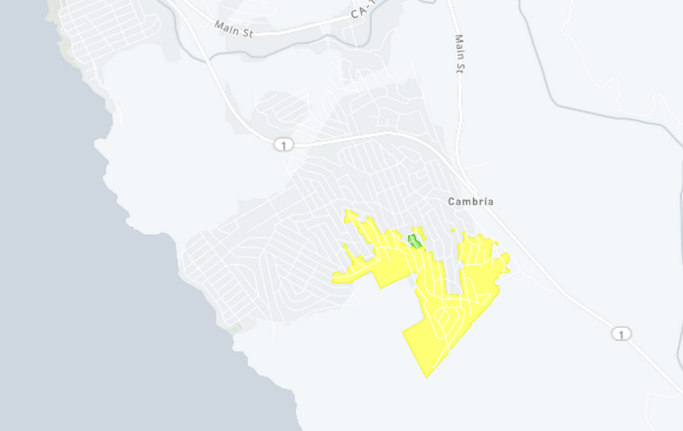
About 400 PG&E customers are without power in Cambria, according to the utility’s outage map.
The weather-related outage began at 11:40 a.m. and is located in the Top of the World neighborhood at the southern edge of Lodge Hill.
Crews have been dispatched to assess the outage, and PG&E doe not yet have a estimated time when power will be restored.
Update, 12 p.m.:
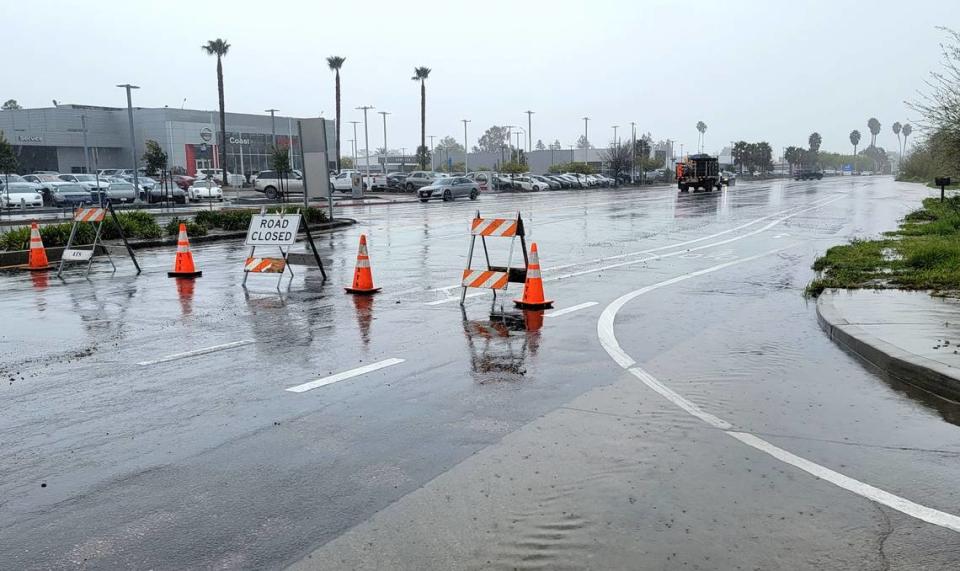
The city of Paso Robles closed a portion of 21st Street because of flooding in the area, the city said in a news release. The street is closed from Riverside to Pine Street until conditions improve.
A single car landed on its roof after crashing on the Cuesta Grade around 11:35 a.m.. No other vehicles were involved in the rollover crash, and the driver suffered minor injuries.
Traffic has not been impacted by the crash.

Update, 11:30 a.m.:
Intermittent closures are expected on Highway 41 near Old Morro Road and the Atascadero Creek Bridge as crews work to clear mudslides Tuesday, Caltrans said on Twitter.
Update, 10:10 a.m.:
A gas main is threatened in Cayucos after heavy rainfall and soil erosion exposed the pipe over Old Creek.
Brittany Paul, spokesperson for SoCalGas, told The Tribune that crews responded to reports of an exposed natural gas pipeline near Morro Strand State Beach in Cayucos around 11 p.m. Sunday.
On their arrival, crews identified a 6-foot pipeline that had been exposed due to heavy rainfall and soil erosion, Paul said. High waters from Old Creek are currently undermining the pipe.
“The pipeline serves the communities of Cayucos, Cambria and San Simeon. The pipeline is not damaged and there are no reports of customer impacts,” Paul said. “SoCalGas crews are actively monitoring the pipeline and are preparing to mitigate service disruptions to customers should the pipeline need to be isolated.”
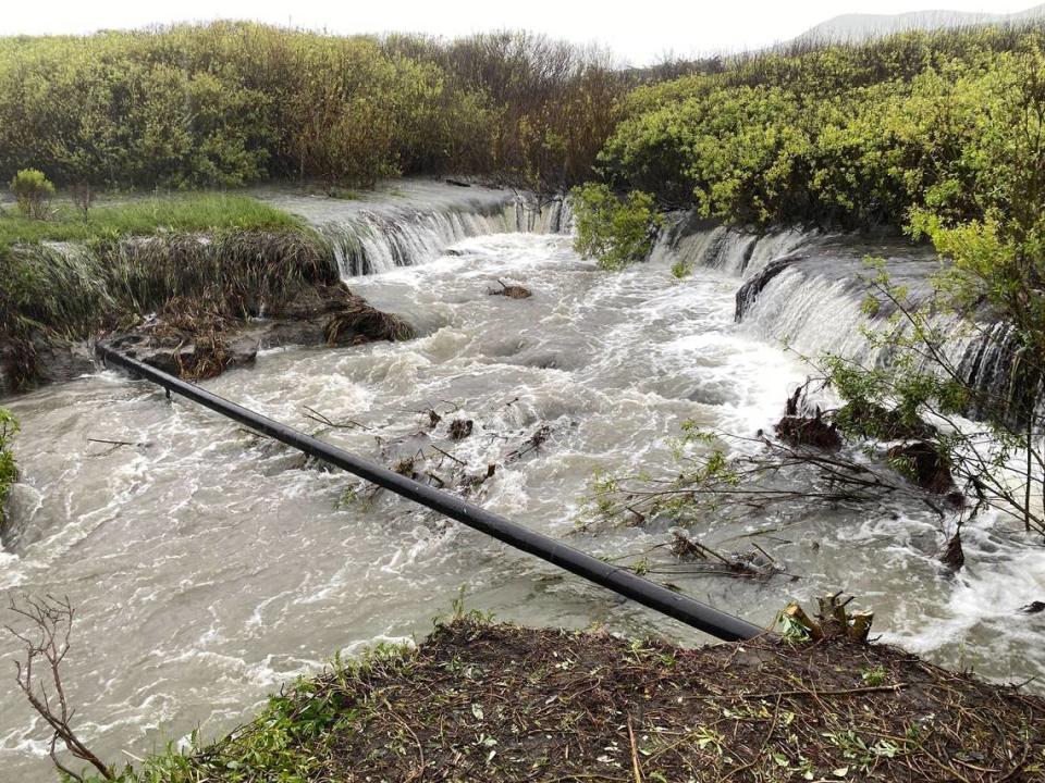
If the pipe breaks, it could pose a fire risk to the area.
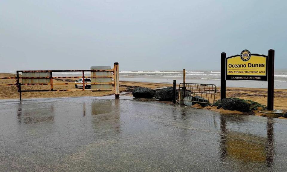
Oceano State Vehicular Recreation Area was closed Tuesday, according to a California State Parks ranger at the Pier Avenue entrance.
Update, 9:55 a.m.:
The National Weather Service issued an updated flood advisory, warning San Luis Obispo County residents that “flooding of roadways, creeks and streams are expected.”
The advisory said there will be a significant risk of mud and rockslides, especially on canyon roadways.
The advisory is in effect until 3:15 p.m.
“Flooding is ongoing or expected to begin shortly in the advisory area,” the Weather Service said.
Between one-half and 2 inches of rain have fallen on the county since last night, with 1 to 3 more inches expected — with the highest totals in the coastal foothills.
The additional rain combined with already saturated grounds will result in flooding, the Weather Service said. San Luis Obispo, the North Coast, North County and Five Cities area are all at risk of flooding, as well as Highway 101 over the Cuesta Grade, the advisory said.
Original story:
Only days after a destructive atmospheric river-fueled storm that left parts of San Luis Obispo County underwater, a second major storm has made landfall.
The latest storm dropped some rain throughout the region overnight, though the bulk of the precipitation was expected to fall throughout the day Tuesday.
As of Tuesday morning, the entire county was getting drenched with rainfall, according to the National Weather Service.
Nearly every area in SLO County is on a flood watch, and the Weather Service has also warned residents of high winds that could cause power outages and driving difficulties.
The storm is expected to drop between 2 to 4 inches of rain on coastal San Luis Obispo County, and between 5 and 8 inches in the mountains, according to the National Weather Service forecast.
SLO County officials warn of storm closures, evacuations
Officials announced a range of precautionary closures and evacuation warnings for parts of the county on Monday ahead of the storm, including warnings for residents living near Arroyo Grande Creek Levee in Oceano, Tally Ho Creek in Arroyo Grande and the Salinas River in Paso Robles.
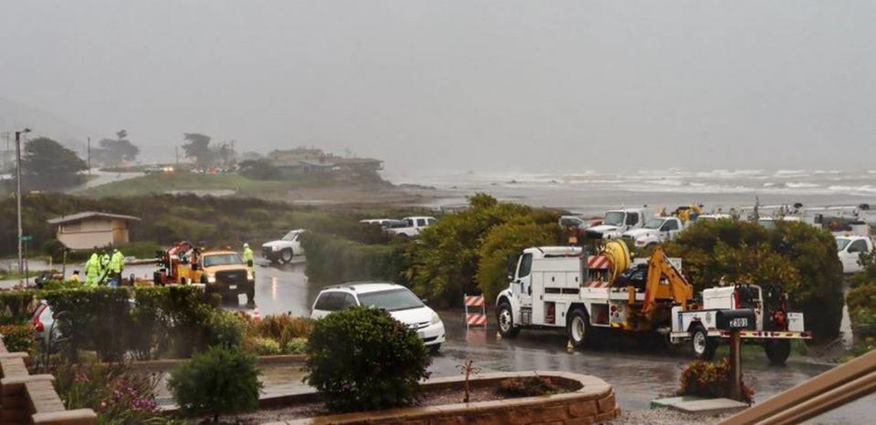
Parts of Cayucos and Morro Bay were also advised of potential evacuations due to flooding during what promised to be an unusually intense storm.
Meanwhile, the San Luis Coastal Unified and Coast Unified school districts announced that they were closing their campuses in light of the storm.

Homeless Animal Rescue Team (HART), a cat rescue organization in Cambria, successfully evacuated 19 cats Monday night in preparation for potential flooding of Santa Rosa Creek, the group said in an Instagram post.
The American Red Cross opened a pet-friendly shelter Monday for SLO County residents under evacuation warnings or displaced by flooding, the San Luis Obispo County Office of Emergency Services said in a news release.
The shelter is located at the Veterans Memorial Building, 801 Grand Ave. in San Luis Obispo.
Detailed maps of areas under evacuation warnings are available on ReadySLO.org.
Emergency officials will use wireless emergency alerts, a reverse telephone system and social media to notify residents if evacuations become necessary, Emergency Services said.
Flood watch, wind advisory in effect
On Monday, the National Weather Service issued a flood watch for most of the region — effective as of 4 a.m. — warning of potential flooding due to excessive rainfall.
At 4:54 a.m., the NWS upgraded its flood watch to last through Tuesday evening, with San Luis Obispo County beach area on a watch through 5 p.m. and inland SLO County and the southern Salinas Valley on a watch until 10 p.m.
“Rainfall rates of one-half inch to 1 inch per hour are possible during the peak of the storm,” the flood watch said.
The region is expected to receive 2 to 6 inches of rain, with the most in the foothills.
According to the National Weather Service, heavy rain and runoff could result in “dangerous flooding of rivers, creeks, streams and other low-lying and flood-prone locations” on Tuesday.

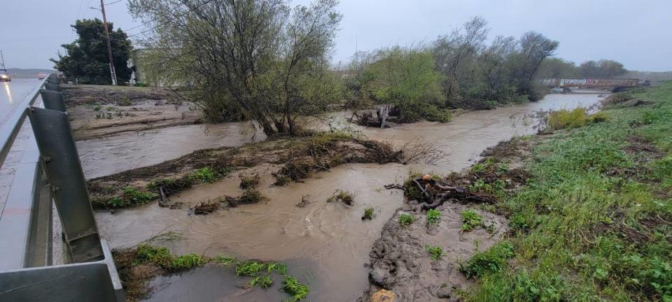
The Salinas River, Arroyo Grande Creek and Santa Rosa Creek could all be potentially impacted by the storm, the National Weather Service warned.
Extensive street flooding is likely, the Weather Service said, warning of possible mudslides and rockslides in and near steep terrain.
A high wind advisory was also in effect Tuesday, warning of 20 to 35 mph winds with gusts up to 50 mph, according to the National Weather Service. Those winds were expected to be strongest in the hills.
As of 5:34 a.m., the advisory is expected to last until 10 p.m. The Weather Service said the high winds could make driving difficult, and Highways 1, 41, 46, 101, and 246 may be affected by “gusty cross winds.”
Falling trees due to wind may cause a few power outages, the advisory said.

Hearst Castle closed due to rain
Hearst Castle in San Simeon will be closed Tuesday due to wet weather in the forecast, according to Dan Falat, superintendent of the California State Parks district that includes the Castle.
The move is precautionary to protect the safety of visitors and employees at media mogul William Randolph Hearst’s former estate, Falat said, adding that other State Parks facilities on the North Coast will also be closed Friday.
Among them are the San Simeon Pier, Washburn Campground in Hearst San Simeon State Park and the Morro Bay Museum of Natural History.
State Parks expects to reopen those facilities on Wednesday, weather permitting, Falat said.
What roads are closed due to storm?
As of early Tuesday morning, the Marsh and Higuera streets intersections in San Luis Obispo were closed along with the adjoining Highway 101 ramps.
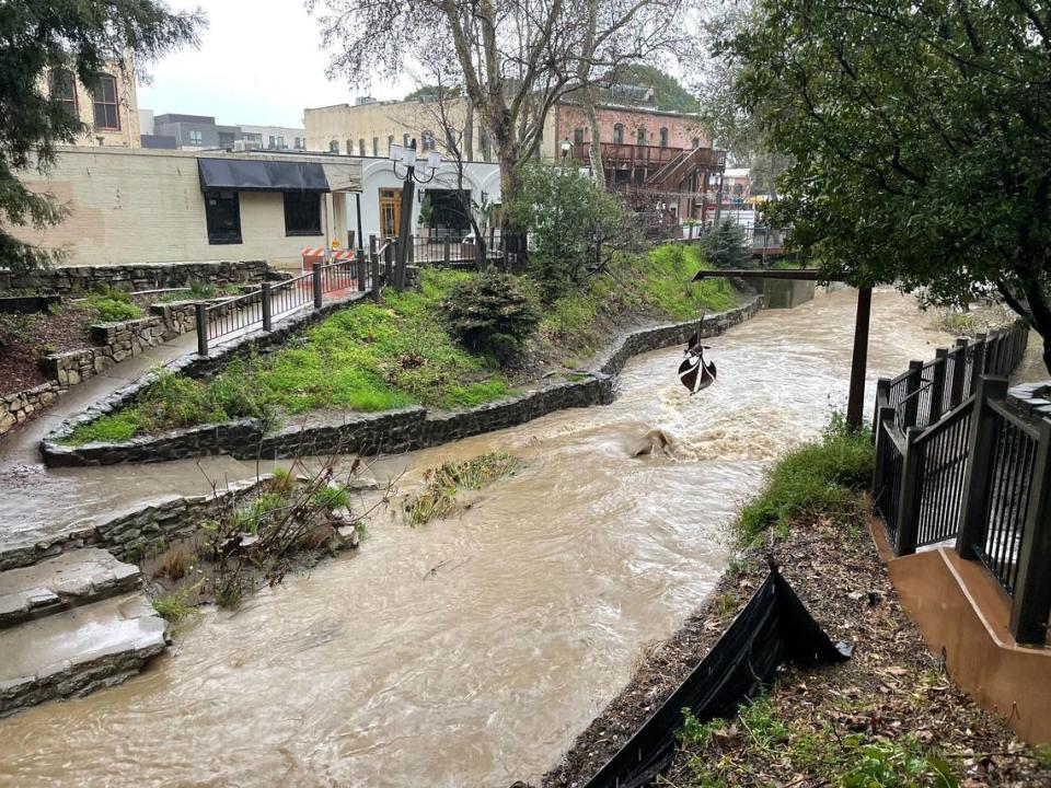
The city preemptively closed the on- and off-ramps on Monday afternoon due to concerns about the potential for flooding along San Luis Obispo Creek.
That stream flooded homes and businesses during the January storms, and has been a source of concern during recent rains as the water level crept closer to the Marsh Street bridge.
According to the California Highway Patrol’s traffic incident report page, a mudslide in Nipomo around 6 a.m. was blocking the northbound lane of Thompson Avenue at Wineman Road.

