Winter storm takes aim at New Mexico, Oklahoma, Texas

Feb. 11 (UPI) -- Forecasters issued a winter storm advisory for parts of eastern New Mexico on Sunday as the remnants of a massive atmospheric river storm that pummeled California last week move east, with the Texas Panhandle and central Oklahoma in its path.
The National Weather Service warned of icy, snow-packed roads and potentially dangerous travel as the slow-moving front headed east, giving parts of New Mexico their first measurable snowfall of the year and dumping more than 3 feet of snow over three days in northern Arizona.
Arizona Snowbowl, a ski hill in Flagstaff's 12,600 foot San Francisco peaks range, welcomed 55 inches from the recent storms, bringing its snowfall total to 140 inches this season.
All lifts and trails at the ski area were open Sunday, and the hill has not resorted to making artificial snow, thanks to the new snowfall.
Farther south, a rogue thunderstorm, replete with dangerous flashes of lightning and blowing hail, dropped a wintry mix of wind, rain and freezing slush, known as graupel, on parts of suburban Phoenix and left neighborhoods and intersections covered in a blanket of wet, sloppy slush, but gave the appearance of freshly fallen snow at night.

As the front moved east, the National Weather Service in Albuquerque said temperatures were in the mid-30s, which is as many as 25 degrees below normal.
"Hopefully, it will diminish by sunset," Jennifer Shoemake, a meteorologist for the weather service in Albuquerque, said Sunday.
She said the storm system appeared to be headed next to the Texas Panhandle and central Oklahoma, where warnings already were in effect.
The weather service forecast up to 8 inches of snow Sunday in the west Texas city of Lubbock, with 1.3 inches already on the ground in Amarillo in the Texas Panhandle.
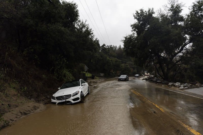
The storms are the remnants of the atmospheric river that dumped heavy rain and snow in California and other parts of the West beginning early Wednesday. It caused power outages, street flooding and hundreds of destructive mudslides around Los Angeles.
Shoemake said Albuquerque received 4 inches of snow Saturday, with the surrounding mountains reporting between 6 and 9 inches.
"Likely some decent skiing conditions," Shoemake said.
The heavy snow allowed the Sandia Peak Ski Area in Albuquerque to open for the first time since 2022. The hill reported top-to-bottom skiing open across 300 acres on all of its 35 trails.
"It's like we are in the clouds up there," snowboarder Jovanni Orozco told Albuquerque TV station KOB. "Literally, it is like low you can't even see nothing and then the snow just covers your goggles, but it's fun!"
The inclement weather forced the National Park Service to close the Bandelier National Monument near Los Alamos, N.M., on Saturday afternoon, but the agency reopened it Sunday after snow removal operations.

