Winter storm warnings, advisories issued as 2nd 'Pineapple Express' arrives in Utah
The remnants of a "Pineapple Express" system yielded even more precipitation in Utah than originally estimated last week, and there's more rain and snow on tap this week as a second similar atmospheric river arrives.
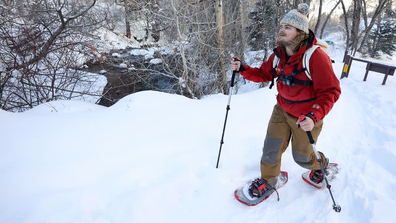
After some additional rain and snow on Monday ahead of a storm battering California, the National Weather Service on Tuesday updated winter storm warnings and winter weather advisories for the mountains all over Utah, where some ranges may end up receiving up to 2 feet or more of additional snow.
Some valley areas may end up with close to another inch of precipitation, as well.
'Pineapple Express' Part II
Places like Herriman, Mendon, Lehi and Stockton received close to or more than half an inch of precipitation Monday, but the brunt of the storm is again bringing in a wave of subtropical moisture.
It generated a slew of flood-related advisories and winter storm warnings across most of California, as well as several similar warnings and advisories in Arizona and Nevada. Many of those have expired in California as the system moves east.
The wave of precipitation is forecast to arrive in southern Utah first, providing a mix of valley rain and mountain snow in the region during the late morning and early afternoon hours, Johnson explained. The wave of moisture is expected to continue into late afternoon and evening, as it spreads almost everywhere across the state throughout the day.
The mix of rain and snow is forecast to continue off and on throughout most of Wednesday and into Thursday, possibly resulting in some valley snow in the state. The highest probability for that is on Wednesday and early Thursday.
"It'll be an ongoing event. It won't be consistent all day every day, but it'll come and go," he said.
Accumulation potential
The National Weather Service's Salt Lake City and Grand Junction office issued storm warnings for a handful of mountain ranges across Utah. They go into effect beginning as early as Tuesday morning in southern Utah and will linger into Thursday.
The various alerts offer different accumulation projections:
1 to 2 feet of snow is forecast for the Wasatch Mountains south of I-80, while 8 to 16 inches is forecast for the West Uinta, Wasatch Plateau/Book Cliffs and central mountains.
1½ to 3 feet of snow is forecast for the southern mountains.
10 to 20 inches of is forecast for the East Uinta, La Sal and Abajo mountain ranges
8 to 16 inches of snow is forecast for the Tavaputs Plateau
It also issued a winter weather advisory for the Wasatch Mountains north of I-80, where 5 to 10 inches of additional snow is forecast. The weather service wrote that drivers should slow down and use caution while traveling through all of the elevation routes over the next few days.
"Winter driving conditions can be expected along all mountain routes," the agency wrote. "If you must travel, keep an extra flashlight, food and water in your vehicle in case of an emergency."
Johnson said valleys could receive another 0.25 to 1 inch or more of precipitation by the end of Wednesday, most of which will fall as rain.
Some additional rain and snow showers are forecast for later Thursday and Friday across both northern and southern Utah. Full seven-day forecasts for areas across Utah can be found online, at the KSL Weather Center.
Building on last week's totals
This week's snow and rain forecast figures to build on the precipitation Utah already received from last week's storms, which ultimately overperformed expectations.
Salt Lake City received 1.08 inches of rain on Friday, breaking a daily record and making it the third-wettest February day in the weather service's 150 years of record-keeping. Utah's capital entered this week just 0.20 inches shy of its normal precipitation for the entire month.
Nearby Magna wound up with 1.36 inches of precipitation combined on Friday and over the weekend, while several places across southern Utah also ended up with at least 1 inch of precipitation. Alta Ski Area received a little more than 2 feet of new snow, while several other resorts picked up a foot of new snow.
"It was a great dumping of snow and water across the state," Johnson said. "This is the pattern we've needed because we want to keep that snow coming down on the mountains for drinking water in the summer."
Utah's statewide snowpack entered Tuesday at 105% of the median average for this point in the year, gaining an average of 1.4 inches of snow water equivalent statewide since Thursday, per Natural Resources Conservation Service data.
The statewide figure is also 62% of the yearly average median snowpack. The state's average snowpack collection peak is in early April.
Utah getting a major snowpack boost in February

