How much snow did Rochester NY region get during winter storm?
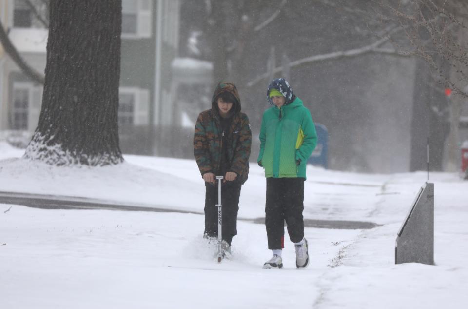
A winter storm dumped heavy, wet snow in parts of the Northeast on Tuesday, causing tens of thousands of power outages, widespread school closings, dangerous driving conditions and a plane to slide off a taxiway. The storm's path included parts of New England, upstate New York, including the Rochester region, northeastern Pennsylvania and northern New Jersey. Snow totals by the time it ends Wednesday were expected to range from a few inches to a few feet, depending on the area. About two feet of snow fell in parts of northern New York and the Catskill Mountains, with Indian Lake in New York’s Adirondack Mountains recording 31 inches of snow. Gov. Kathy Hochul said some areas could get an additional foot by Wednesday morning.
During the storm, a Delta Air Lines plane veered off a paved surface as it taxied for takeoff from a Syracuse airport Tuesday morning. Flight 1718, which was bound for New York City’s LaGuardia Airport, slid into a grassy area, forcing passengers off the plane and onto buses back to the terminal, according to airport officials. No one was injured and the airport remained open.
The weather service said expected snow totals from the storm, which is forecast to wind up Wednesday, ranged from more than 2 feet in higher elevations in New York, New Hampshire and western Massachusetts, to 4 to 6 inches in Boston.
How much snow fell in Rochester NY region?
The storm brought 2.7 inches of fresh snow to the Frederick Douglass Greater Rochester International Airport as of 2 a.m. Wednesday, which will account for the storm total, according to the National Weather Service in Buffalo. In Pittsford, 3.2 inches of snow was measured at midnight, said Weather Service Meteorologist Jon Hitchcock.
Areas east of Monroe County were hit harder, with about 8 inches falling in parts of Wayne County.
Here are latest snow amounts put out by the National Weather Service in Buffalo:
∎ Latest Snow Totals in New York
School closings in Rochester NY region
Several school districts in Ontario and Wayne counties have canceled classes for Tuesday ahead of the upcoming storm. These include Canandaigua and Geneva City School Districts, as well as Victor Central School District in Ontario County, and Palmyra-Macedon, Sodus, Lyons, and Wayne Central School Districts in Wayne County.
Finger Lakes Community College also canceled class and closed campus on Tuesday due to the wintry weather.
How much snow is expected in Rochester NY region?
National Weather Service in Buffalo Meteorologist Jon Hitchcock said the storm is predicted to bring between 6 to 10 inches of wet, heavy snow in Wayne and Ontario counties, with the greatest amounts of snow expected in slightly higher terrain areas away from the immediate lakeshore. Winds could gust as high as 40 mph, further complicating travel conditions.
In Monroe County, 3 to 6 inches of snow accumulation is predicted, starting around daybreak on Tuesday. The eastern suburbs in Monroe County could see as much as 5 to 8 inches of snow, according to the Weather Service.
The heaviest snowfall in Rochester is expected to fall late Tuesday morning and early afternoon, Hitchcock said. The storm is moving east to west, so communities east of Rochester are expected to get more snow, starting Monday evening.
Widespread heavy snow will impact central and eastern NY late today through early Wednesday morning, with moderate snow extending back into Western NY mainly Tuesday and Tuesday night. Be prepared for difficult travel at times. #nywx pic.twitter.com/ecMo1529eI
— NWS Buffalo (@NWSBUFFALO) March 13, 2023
Parts of the Catskills and Adirondacks could see up to three feet of snow, and parts of the Finger Lakes, Central New York (including Ithaca and Syracuse), upper Hudson Valley and Capital region near Albany are predicted to see up to 16 inches of snow.
Hazardous travel conditions expected during storm
The hazardous weather conditions could significantly impact both morning and evening commutes, with travel expected to be very difficult due to snow-covered roads and poor visibility. Hitchcock said the snow in Rochester will likely just be getting started in time for the morning commute, but the evening commute could become difficult.
Residents are being advised to avoid unnecessary travel during the storm if possible and to make necessary preparations for the potential impacts of the storm.
In advance of the storm, the Thruway Authority and New York State Police has banned tandem and empty tractor-trailers starting at 8 p.m. Monday on Interstate 84, Interstate 88, Interstate 87 (between Albany and Plattsburgh) and on Interstate 90, between I-87 and the Berkshire Spur.
Rochester NY weather news
March is a weather wildcard in RochesterLook back at some of the most memorable storms
What is 'thundersnow'?Rare weather phenomenon passes through Rochester during winter storm
School closings in Rochester NYHow districts decide when to cancel school in cold weather
Want to start your car to heat it up?Here's why doing so in winter weather may be a bad idea
What is lake effect snow? And why do Rochester and Buffalo get crazy amounts?
This article originally appeared on Rochester Democrat and Chronicle: Rochester NY Weather: How much snow did we get during winter storm?

