35 million at risk as South braces for tornadoes, flooding; heavy snow targets Northeast: Weather updates
Friday updates: Read the latest weather news here.
The massive clash of cold and warm air stretching from Ohio and Virginia down to Texas could produce a "blockbuster" storm with heavy snow to the north and severe thunderstorms and possibly tornadoes to the south, AccuWeather warned.
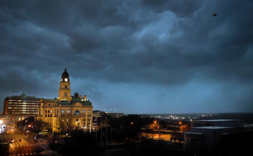
In all, some 35 million people live where severe thunderstorms (including tornadoes) are possible Thursday afternoon and evening, the Storm Prediction Center said. A tornado watch has been issued for parts of Texas, Oklahoma and Arkansas, including the entire Dallas metro area.
The storm follows a wave of damaging weather that has swept much of the nation for several days.
"Another chance for severe weather looks to arrive across the Mid-South late tonight into the early morning hours on Friday," the National Weather Service said in an advisory Thursday. "This second shot of severe weather looks more robust ... all modes of severe weather will be possible, especially heavy rainfall.
Elsewhere, the Pacific Northwest and Northern Rockies were hit by heavy snow Thursday before the wintry weather was expected to move toward the Upper Midwest and into the Northeast on Friday, according to the weather service.
Developing:
►A flood watch also extended from Oklahoma to Indiana as rain barreled across parts of the Southeast.
►Parts of Arkansas faces a "significant" threat late Thursday. Tornadoes, widespread damaging wind, and large hail are all possible, the weather service said.
►Some California residents could expect freezing temperatures and even winter storm conditions later this week.
WHAT IS THUNDERSNOW? Explaining how a thunderstorm can produce snow
WHAT IS A FLASH FLOOD WATCH OR WARNING? Here's what to know about this deadly weather hazard
Thunderstorms may trigger tornadoes in South
As several southeastern states face the highest threat of tornadoes, a twister touched down in south Shreveport, Louisiana, Thursday evening.
The tornadic activity lasted about 30 seconds and created damage across the area at about 5:30 p.m., according to the Shreveport Times. Damaged areas reported include around the Louisiana State University of Shreveport, a Vallero gas station, and a Kroger grocery.
In addition to Louisiana, Arkansas, Mississippi, and western parts of Alabama and Tennessee are expected to see destructive winds and possible tornado activity.
Meanwhile, the same clash of cold and warm air that will trigger heavy snow in the Upper Midwest and Northeast is also expected to produce severe thunderstorms across the South, according to AccuWeather.
A powerful storm system Thursday will bring excessive rainfall, damaging winds, large hail and tornadoes to areas from Texas to Ohio, the National Weather Service forecast.
The severe thunderstorm threat will continue Friday as the storm shifts into the Ohio Valley, AccuWeather forecast.
Snow in Texas, Maine
A system that blasted the Midwest earlier in the week was expected to drop 4-8 inches of snow across parts of Maine on Thursday. The new system bringing severe weather and heavy rain to the southern tier states was responsible for snow in parts of Texas.
"The snow is really coming down here," the weather service office in El Paso tweeted Thursday, warning that low visibility was creating hazardous driving conditions.
The front will lift northward Friday and spread a swath of moderate to heavy snow from northern Illinois to the New England coast. Snowfall totals are likely to be 6-10 inches with locally higher amounts over the higher terrain of the Northeast, the weather service said.
Californians face more bitter cold, heavy snow
California Gov. Gavin Newsom declared a state of emergency in 13 counties and activated the Guard as the state continued to be hammered by severe winter weather. A freeze warning extended in central California on Thursday as officials warned that cold temperatures could kill crops and potentially damage outdoor plumbing.
Heavy snowfall prompted the closures of California national parks, including Joshua Tree National Park and Yosemite National Park. Over 75,000 California households remained without power Thursday morning.
Parts of Northern California are also expecting a winter storm watch over the weekend, and heavy snow was possible in higher elevations above 1,000 feet. Snowfall could reach up to 2 feet in some higher ridges, according to the National Weather Service in Eureka, California. Officials warned that travel could be “nearly impossible” along mountain roads.
Flooding conditions possible in the South
A flood watch was in effect Thursday in the Southeast and parts of the Midwest, impacting areas of
Thunderstorms were expected to bring heavy rain into the area on Thursday. But “prolonged” showers could lead to 4 inches of rain in some areas Thursday night into Friday morning, mainly north of Interstate 40, the National Weather Service warned.
The rain could cause flash flooding, officials said, and people who live in areas “prone to flooding should be prepared to take action.”
SLEET VS. FREEZING RAIN:What's the difference?
IS A TORNADO WATCH OR WARNING WORSE? What to know about preparing for these violent storms
Winter storm tracker
National weather radar
This article originally appeared on USA TODAY: Winter weather updates: 35M at risk from severe storms in the South

