Winter suddenly arrives for the Rockies three days after temperatures hit 100 degrees

The calendar might still read early September, but the snow and cold temperatures look and feel more like early November.
As many as 15 inches of snow fell over parts of western South Dakota overnight Monday into Tuesday, with heavy snow expected to continue through the day.
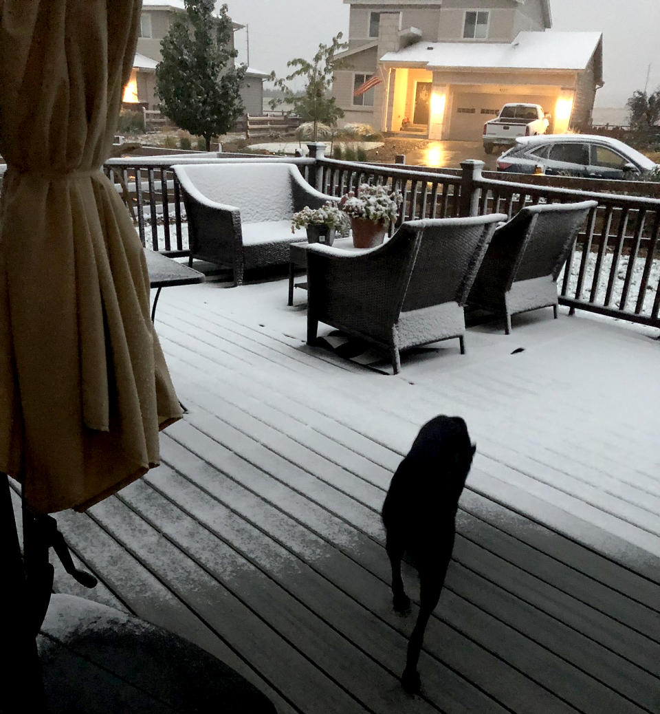
Across parts of the northern and the central Rockies, including Denver, some 6 million people were under winter alerts Tuesday. Across this region, 4 to 8 inches of snow could fall, with locally higher amounts of 12 to 18 inches at the highest elevations through Wednesday. As the day broke, snow was already falling across parts of Idaho, Utah and Wyoming and moving into northern Colorado. By midmorning Tuesday, the snow was expected to spread across Colorado and last through Wednesday morning.
Winter hadn't just arrived through precipitation: Temperatures 30 to 40 degrees below average were forecast to lead to numerous records Tuesday and Wednesday.
Video: Staying safe from COVD-19 as cold weather brings activities inside
Lows were forecast to dip into the teens and 20s with wind chills in the single digits, with highs that will struggle to get out of the 30s for several locations from the Rockies to parts of the Plains.
The widespread record cold (and associated snow) is due to an anomalously strong dip in the jet stream causing cold air to blast down from Canada. The cold plunge is actually connected to Typhoon Maysak in the Pacific last week. As the calendar turns to the fall, typhoons in the Pacific often amplify the jet stream downstream, thereby influencing the weather in North America.
But what makes this preseason winter blast particularly remarkable is that the same areas seeing snow Tuesday experienced a stretch of record heat, which in some places exceeded 100 degrees, only a few days ago.
Take Denver: On Saturday, the city hit 101 degrees. Not only was that a daily record high, But it also set an all-time hottest temperature record for the month of September in the city, and it was the furthest into September the city had ever hit 100. The previous record was 98 degrees, set last September.
On Monday, Denver hit a high of 93 degrees, making it the 73rd day in 2020 to exceed 90 degrees. That tied the all-time record of 73 days set in 2012.
Just 12 hours later, Denver was nearly 60 degrees colder Tuesday morning, with light snow beginning to fall around the area.
So, in three days, Denver went from a record-shattering 101 degrees to one of its earliest snowfalls on record.
From sweating to snow shovels. "Rare" barely begins to describe the climate shifts.
But Coloradans can't put away their T-shirts just yet. Denver is forecast to reach a high back up near 70 by Friday.

