WNC 'dynamic storm system' will bring heavy rain, possible flooding to Asheville area
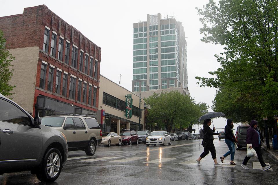
ASHEVILLE - Western North Carolina is bracing for heavy rain, gusty winds and possible flooding as a "strong storm" heads in from the west, meteorologists say, which could drop up to 6 inches of rain in coming days, with the most expected for areas south of Asheville.
Jeffrey Taylor, a meteorologist out of the National Weather Service's Greenville-Spartanburg office, cautioned that wet soil and 45-mph gusts in Asheville could mean downed trees and scattered power outages.
“We’ve got a strong low pressure system that’s moving out of the southern plains, as we speak,” Taylor told the Citizen Times at 10 a.m. Jan. 8 “It’s a big system, so it’s going to create weather across a good chunk of the U.S. as it makes its way northeastward."
An 11:30 a.m. update from the office said winds could gust as high as 70 mph across mountain peaks and ridgetops.
In addition, a "severe storm threat" is evolving from late Jan. 9 into the afternoon across the Piedmont region, said the update. Storms will pose a threat of brief damaging wind gusts of 60 mph or more, along with isolated brief tornadoes. In Asheville, general, non-severe thunderstorms are possible, with higher risks further south, into South Carolina.
Taylor said excessive rain and gusty winds are the "main concerns" for the Asheville area. Rain will begin the night of Jan. 8 and last through Jan. 9.
A winter weather advisory has been issued for Buncombe and surrounding counties, beginning Jan. 8 at 9 p.m., warning of some freezing rain and ice, mainly near the Blue Ridge Escarpment and upper French Broad Valley. Light icing of around a tenth of an inch is possible, resulting in a few slick spots.
Taylor said "wraparound moisture" late Jan. 9 could conjure snow showers on the North Carolina/Tennessee border, with a potential for flurries in Asheville, but no accumulation likely in the city.
A 24-hour wind advisory is in effect beginning at 7 p.m. for Western North Carolina, including Asheville and Buncombe County, which could blow around "unsecured objects" with winds of 15-25 mph. Gusts up to 55 mph are expected.
Rounding out the slate of advisories is a flood watch for much of Jan. 9, cautioning that excessive runoff may result in flooding of rivers, creek, streams and other low-lying and flood-prone locations.
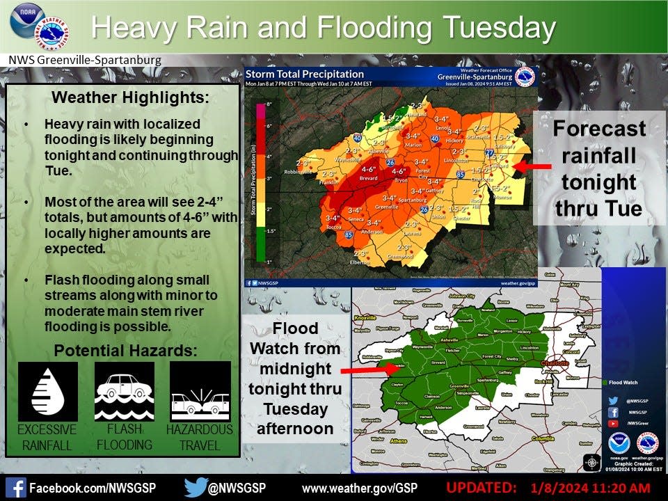
Taylor said Asheville will see an estimated 2.8 inches of precipitation. To the south, in areas of Buncombe, Henderson, Haywood and Transylvania counties, there could be up to 6 inches of rain.
It's not an unprecedented storm for this time of year, Taylor said, with large low-pressure systems more typical in the winter, but it is strong.
"This will probably be one of the stronger ones we get for the whole winter," Taylor said.
Sarah Honosky is the city government reporter for the Asheville Citizen Times, part of the USA TODAY Network. News Tips? Email shonosky@citizentimes.com or message on Twitter at @slhonosky. Please support local, daily journalism with a subscription to the Citizen Times.
This article originally appeared on Asheville Citizen Times: Heavy rain, localized flooding forecast for WNC, Asheville

