New York City may be hit with snow next week as Nor’easter looms after unseasonable warmth
Millions of Americans in the nation’s busiest corridor along the Northeast will soon experience weather whiplash, going from record February warmth to a potential nor’easter next week that will bring heavy rains, gusty winds and plowable snow, with even much of the I-95 corridor in play for snowfall.
First, Friday and Saturday will be record-setting as temperatures climb into the 50s and 60s.
Numerous record-high temperatures will be set in major cities throughout the Northeast as millions of people will feel spring-like weather.
That will be a distant memory as a developing nor’easter arrives late Monday, the FOX Forecast Center said.
Low pressure will roll into the Northeast and slide over the Atlantic Ocean early Tuesday.
Meanwhile, colder air will get pulled down from Canada, dropping temperatures close to or below freezing Monday night through Tuesday.
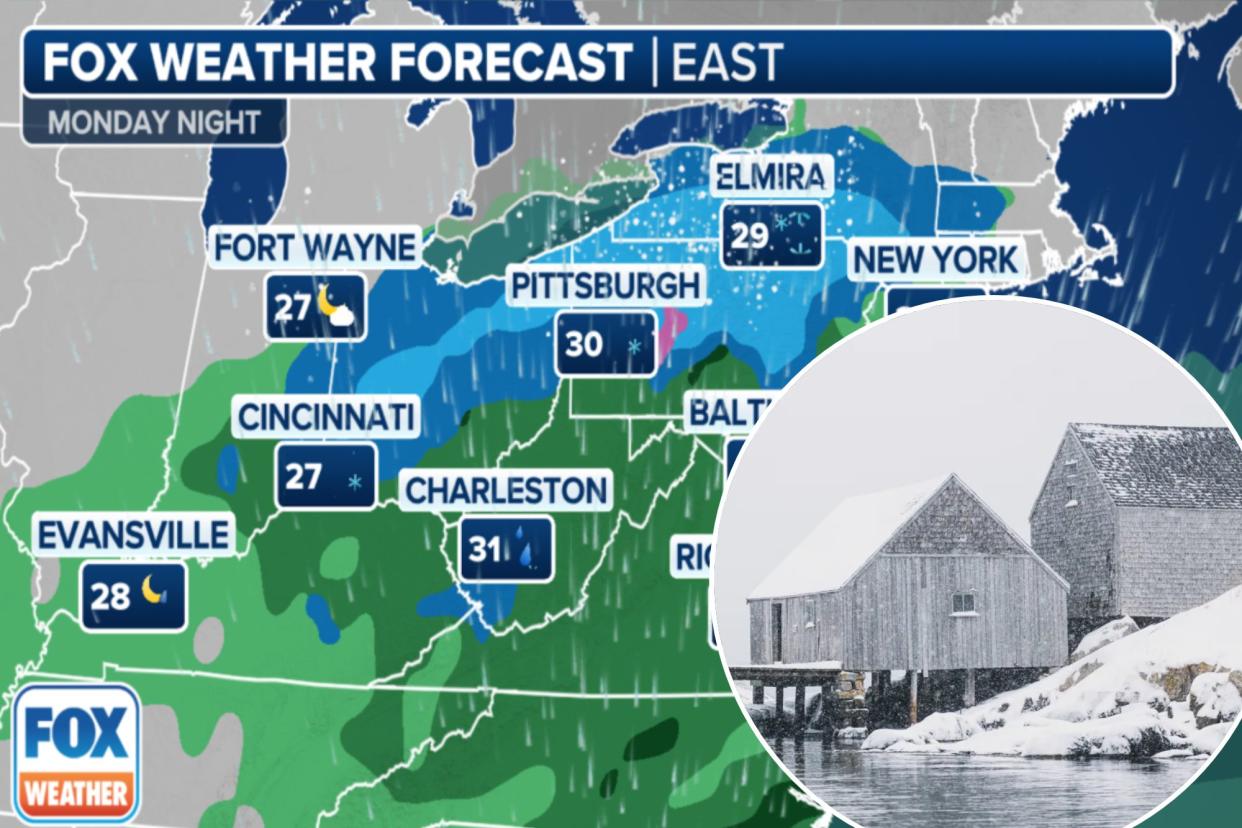
The storm may briefly start as rain for some areas along the Atlantic Coast Monday night, but as the storm strengthens, it’ll be able to continuously tap into colder air, ensuring a rain-to-snow changeover that won’t revert at any point, the FOX Forecast Center said.
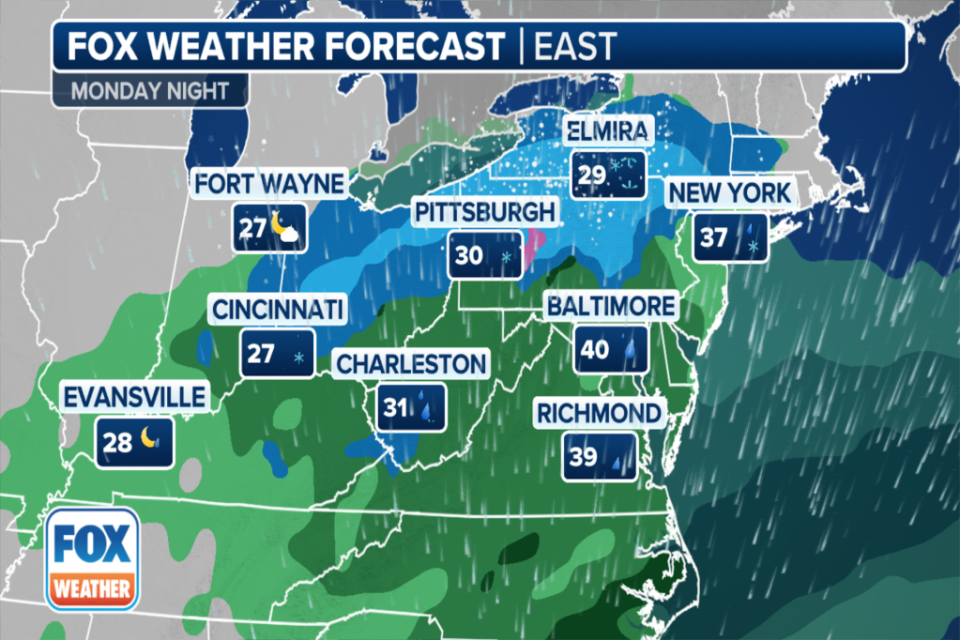
Based on current forecast trends, the track of the low will produce a fairly widespread swath of moderate-to-heavy snow from Pennsylvania to Massachusetts through Tuesday.
Computer forecast models are trending toward a stronger storm system, so the FOX Forecast Center is talking about higher snow totals being a possibility.
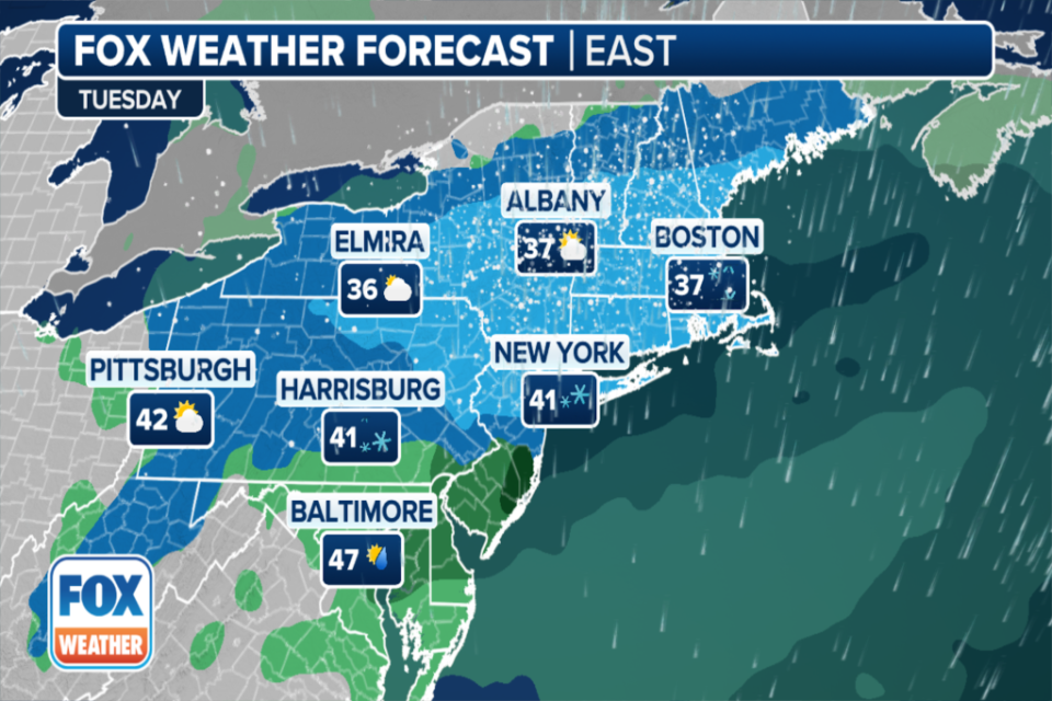
Right now, major cities such as New York City, Philadelphia, Boston, Hartford, Washington, D.C., and Pittsburgh are all in play for accumulating snow.
However, we’re still just a bit too far out to determine exact snow amounts, but there is the potential for a moderate-to-heavy snow event for these populated cities.

The storm’s exact track and ability to strengthen will be key factors in determining how much snow will fall and where.
With the low strengthening off the coast, gusty winds will become a concern along the I-95 corridor on Tuesday. This may lead to reduced visibility and maybe even some coastal beach erosion.
Wind gusts to 30-40 mph are possible, which could lead to significant travel problems for major interstates in the Northeast and Mid-Atlantic.
Anyone commuting or with travel plans for early next week should be keeping a close eye on this forecast, as the storm can potentially create chaos for some of the nation’s busiest airports and roads.
Prior to arriving in the Northeast, the storm will produce a stripe of snow from the Southern Plains into the Ohio Valley Sunday into Monday.
Ground temperatures at or above freezing will make good accumulating snow hard to come by east of the Texas Panhandle, except where high snow rates develop. Those in cities such as Oklahoma City, Tulsa, Springfield, Missouri, and perhaps St. Louis will see the flakes fly.

