New York prepares for possible flooding from snowmelt while the West girds for heavy rain and snow
- Oops!Something went wrong.Please try again later.
New York is preparing for possible flooding due to warm temperatures expected to melt the several feet of snow that piled up from a deadly winter storm, while the West is expecting heavy rain and snow to continue falling through the end of the week, according to the National Weather Service.
Highs in the mid-40s are expected in New York City and Buffalo on Thursday, where temperatures will likely climb into the low-50s the next two days. Earlier this week, the Buffalo area saw temperatures as low as 4 degrees, according to the agency.
New York won't be alone: Temperatures across much of the country "will undergo a drastic warm up in comparison to those near the start of the week," the weather service said in a bulletin Thursday morning, with Eastern states seeing highs into the 50s and the 60s. The forecast comes a day after the nonprofit organization Berkeley Earth said 2022 is likely to be the fifth-warmest year on record.
Dallas could see a high of 71 degrees Thursday, while Chicago and Washington, D.C., could see a high of 57 degrees. Dallas will see highs in the 60s and low-70s this holiday weekend, while the nation's capital will see highs in the high-50s and the low-60s. Highs in Chicago will be comparatively more moderate, in the low-50s between Friday and Sunday.
Snow to melt in Buffalo as travel resumes
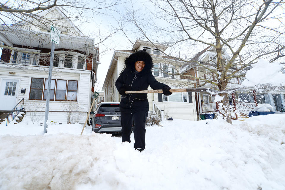
The warmup will help melt snow in areas across western New York that remain buried under several feet.
Across western New York, snowmelt alone does not normally cause major or widespread flooding and usually needs to occur simultaneously with a heavy rain event, which is not in the forecast for that region — though some localized flooding may occur in the coming days.
The New York State Division of Homeland Security and Emergency Services warned in a tweet that “the mix of higher temps, rain & snowmelt may cause basement flooding, ponding of water in low-lying areas & ice jams” and urged people to contact their local fire department or emergency management office if they have concerns about flooding.
Gov. Kathy Hochul on Wednesday directed state agencies to prepare to respond to flooding caused by the snowmelt. The state has more than 300 pumps, more than 300 generators and more than 775,000 sandbags available to deploy in the event of flooding, according to a news release from her office.
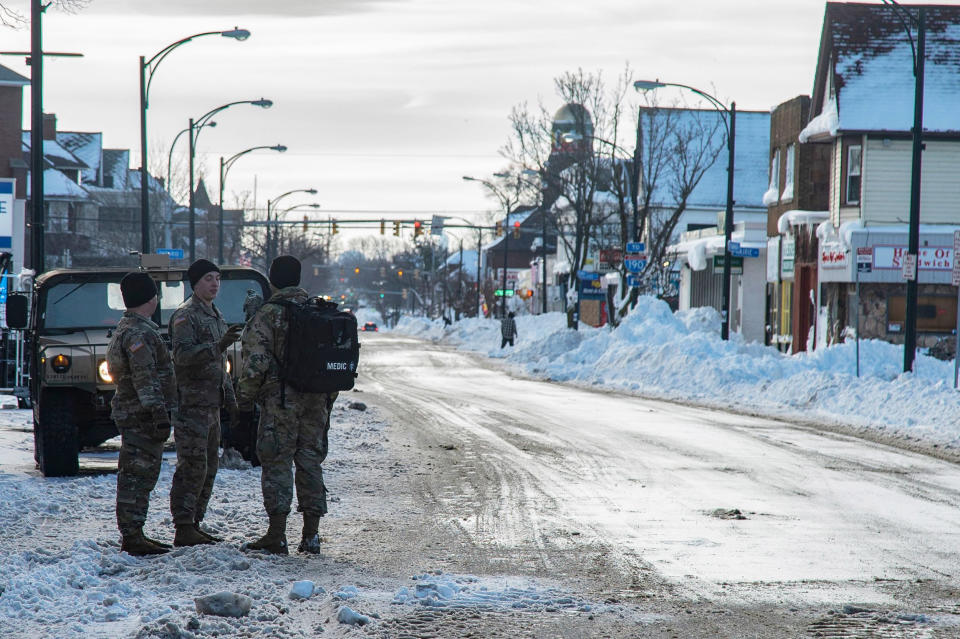
The anticipated snowmelt comes as Buffalo — the epicenter of the storm in Erie County — lifted its travel ban at 12:01 a.m. Thursday, following an announcement from Mayor Byron Brown late Wednesday. A travel advisory remains in place for the area, with Brown asking people to avoid driving unless necessary. Erie County remains under a state of emergency, officials said.
“Some people have not been able to restock groceries, to restock medications, to get to medical appointments, and being able to lift the travel ban safely now will allow people to do those important things,” Brown said.
All major state highways in western New York, including the Erie County portion of Interstate 190 and several state routes, also reopened at midnight, Hochul announced. And the Buffalo Airport — where nearly 52 inches of snow fell during the storm, according to the weather service — reopened Wednesday.
Erie County Executive Mark Poloncarz told reporters Thursday that flooding is expected to be minimal.
He also apologized Thursday "for letting my emotions get the best of me" after he disparaged the city of Buffalo — and Brown — at a news conference Wednesday for taking too long to remove snow from the streets. Poloncarz said he called and texted the mayor Wednesday night to discuss his comments but that they had not yet spoken as of Thursday afternoon.
The mayor's office didn't immediately respond to a request for comment from NBC News on Thursday.
In a tweet early Thursday, Poloncarz urged locals to exercise caution when walking or driving given that “hundreds of very large pieces of equipment will still be out clearing streets from curb-to-curb.”
Ohio Gov. Mike DeWine announced Thursday he sent support from the state Department of Transportation — including 28 workers and more than a dozen vehicles — to New York to help with snow removal over the next six days after the New York Emergency Management Agency made a plea for help Wednesday.
Poloncarz said in a tweet Wednesday night that 500 National Guard members have conducted nearly 850 welfare checks on residents who had long-term power outages.
As of Thursday afternoon, 244 energy customers — most of whom are customers of New York State Electric and Gas — remained without power in Erie County, according to PowerOutage.us.
Search and rescue teams were returning Thursday to check locations where bodies had been reported but could not be confirmed — either because of the amount of snow or the vagueness of location, according to Buffalo Police Commissioner Joseph Gramaglia.
In Erie County, 39 people died from the storm, Poloncarz told reporters Thursday, adding that 31 of those deaths were in Buffalo, seven were in the surrounding suburbs and one was in an unknown location. The majority of the dead — 17 — were found outside, while 11 were found in their homes, four were found in their cars, four died of cardiac events while shoveling and three died following a delayed response from emergency medical personnel.
Most people who died — 20 — were Black, while 18 were white and one was Hispanic, hez said. White people constitute nearly half the population of Buffalo, making up 48%, while Black people make up 33% of the population and Hispanic people constitute about 12%, according to the most recent data from the U.S. Census Bureau.
At least 78 people died in the storm overall, according to an NBC News tally, with weather-related deaths also reported in Colorado, Kansas, Kentucky, Ohio, Nebraska, Missouri, Oklahoma, Michigan, South Carolina, Tennessee, Wisconsin, Illinois and Vermont.
Stormy weather conditions from separate storm systems also proved fatal earlier this week in Oregon. Trees falling on cars led to the deaths of five people — including a 4-year-old girl — in three separate incidents on Interstate 84 and Highway 26 on Tuesday, according to Oregon State Police.
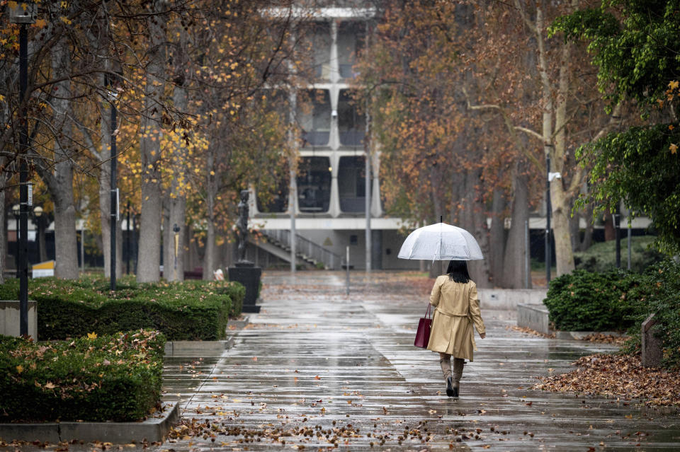
Rain and snow likely in the South and the West
The South and the Gulf Coast could see strong thunderstorms Thursday, including the cities of Houston, Shreveport, Louisiana, and Little Rock, Arkansas. The main risk will be damaging winds followed by hail and a low chance of a tornado.
Thunderstorms had begun to blossom across parts of eastern Texas, Louisiana and Arkansas by Thursday afternoon. No severe thunderstorm watches are expected, but there could be an isolated damaging wind gust or weak tornado Thursday afternoon or evening until the storms wind down later in the day. Flood watches are also in effect for the area for thunderstorms that could produce rainfall rates of 1 to 2 inches per hour, which could cause isolated instances of flash flooding. The system will head east Friday, bringing rain to the Southeast and eventually the Mid-Atlantic and the Northeast by Saturday.
A strip of snow was also moving through parts of the central Plains and the Upper Midwest, where winter weather advisories are in effect for an anticipated 1 to 3 inches of snow through the afternoon. While not a high-impact event, the system could cause slick roadways along major interstates, such as I-80 across Nebraska.
Meanwhile, a series of storms will hit the West — and California in particular — Thursday into the weekend. The West Coast and parts of the Deep South will receive "moderate to heavy precipitation" following a series of storm fronts that will move in through the West and exit across the Plains, according to the weather service.
Seventeen million people across the West are under flood watches, winter weather alerts and wind alerts.
As many as 15 million people are under flood watches in Northern and central California, where rainfall is expected to surpass 5 inches in some areas.
Northern and central California and parts of southwest Oregon are slated to receive heavy rain and snow, with 3 to 6 inches of rainfall forecast in the latter region through early this weekend, possibly leading to "scattered instances of flash flooding," the weather service said. Snowfall in the higher elevations of the Sierra Nevada, above 9,000 feet, could see up to 5 feet of snow.
Moderate to heavy snow could also fall across northern Nevada by Friday night, the agency said.
On New Year’s Eve, heavy rain will fall in the Southeast up to the Ohio Valley during the day and the mid-Atlantic into the Northeast during the evening, while the West will face a flood risk and continued heavy mountain snow.
On New Year's Day, lingering rain showers are expected in New England, above-average temperatures are set for the South and rain and snow are expected in the Southwest.
This article was originally published on NBCNews.com

