All about Zealandia, the Earth’s potential 8th continent
Zealandia is a microcontinent that broke off from Australia millions of years ago and is mostly submerged in the South Pacific Ocean. The region was considered to be Earth’s eighth continent before the majority of it got lost under the sea. After over 300 years, Zealandia was found and experts were able to create a map of it, leading to interesting findings regarding the movement of land on Earth throughout its history.
What is Zealandia?
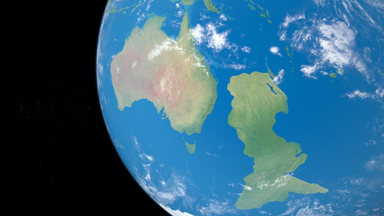
Zealandia is a landmass that “broke off from Antarctica about 100 million years ago, and then from Australia about 80 million years ago,” according to National Geographic. It was originally a part of the supercontinent Gondwana but mainly became covered by water. The microcontinent is “about half the size of Australia, but only 7 percent of it is above sea level,” the outlet added. The country of New Zealand and some surrounding islands make up the exposed portion of Zealandia.
The 1.89 million square mile continent had been “hiding in plain sight” for almost 375 years with experts speculating whether it existed at all, according to BBC. Zealandia became submerged before humans populated the region. The first to hint at the continent’s existence was when explorer Abel Tasman claimed he found “the great southern continent” when he came upon the South Island of New Zealand in the 1600s.
Europeans, at the time, believed that there was one large southern continent that they called Terra Australis, that spanned from the south pole up to even as high as 60 degrees south latitude, according to Oxford Reference. Later this “continent” was discovered to be two continents: Antarctica and Australia. However, there was a missing continent all along.
How was Zealandia discovered?
Zealandia was only officially discovered in 2017 by a group of geologists. The road to discovery took over 100 years with many researchers discovering pieces of evidence pointing to Zealandia’s existence. The nail in the coffin was satellite data that was “used to track tiny variations in the Earth's gravity across different parts of the crust to map the seafloor,” revealing the microcontinent as a “misshapen mass almost as large as Australia,” BBC continued. "This is an example of how something very obvious can take a while to uncover," Andy Tulloch, a geologist at the New Zealand Crown Research Institute GNS Science, who was also part of the discovery team.
Most recently, researchers have managed to map the entire area of Zealandia, according to a new study published in the journal Tectonics. The experts “dredged the northern two-thirds of the submerged area, pulling up pebbly and cobbley sandstone, fine-grain sandstone, mudstone, bioclastic limestone, and basaltic lava from a variety of time periods,” Popular Mechanics reported. The researchers were then “able to map the major geological units across North Zealandia,” by “dating the rocks and interpreting magnetic anomalies.”
In analyzing the data, researchers found a “large fault zone along the south border of Zealandia,” likely a "’scar’ in Earth's crust, formed when Zealandia broke off from Antarctica and Australia,” Forbes reported. “During this process, the continental crust was stretched and thinned out.” Scientists also discovered sandstone that was 95 million years old containing “older granite and volcanic pebbles,” pointing to volcanic activity over 100 million years ago before the continent submerged. “This work completes offshore reconnaissance geological mapping of the entire Zealandia continent,” the study noted.
What questions remain?
The fault line on the border of Zealandia has been a point of curiosity for the researchers. It shows signs of “extensive stretching between different parts of Gondwana that eventually snapped apart to create Zealandia's surrounding sea floors,” Science Alert explained. The report noted that there appeared to be evidence of up to 65 degrees of stretching of the continental crust, allowing for Zealandia to break off from the larger continents. “How Zealandia's crust managed to stretch so thin before breaking away, has long puzzled geologists,” the outlet continued. “These findings create a solid foundation for a more detailed analysis for this strange stretching of the earth.”

