Zwift releases Urukazi expansion of the Makuri Islands map
This article originally appeared on Velo News
There are fresh roads available to explore in Zwift just in time for winter.
The immersive virtual training software company set live the Urukazi expansion of the Makuri Islands today, bringing the total amount of roads in the map to over 40 miles, including both tarmac and off-road.
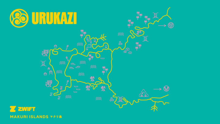
There are eight new routes to explore in total, ranging from 4 kilometers to 40 kilometers, and including tarmac, gravel, and a new surface that Zwift says isn't found anywhere else in the game. The routes include:
Mech Isle Loop
A short, industrial loop.
Distance: 2.5 mi / 4 km. Elevation gain: 127 ft / 38.7m
Bridges and Boardwalks
The biggest island in Urukazi.
Distance: 3.9 mi / 6.3 km. Elevation gain: 195 ft / 59.5m
Island Hopper
All of the islands of Urukazi in a single lap.
Distance: 11.2 mi / 18 km. Elevation gain: 421.6 ft / 128.5m
Fine and Sandy
An off-road loop with mangroves and sandy beaches.
Distance: 6.5 mi / 10.6 km. Elevation gain: 253 ft / 77.1 m
Island Outskirts
Race around the outskirts of Urukazi
Distance: 7 mi / 11.3 km. Elevation gain: 295 ft / 90.1 m
Makuri 40
A 40 km loop around Makuri
Distance: 24.9 mi / 40 km. Elevation gain: 1006 ft / 306.6m
Country to Coastal
A route filled with open fields and open oceans.
Distance: 20.7 mi / 33.4 km, Elevation Gain: 899 ft / 274 m
Turf N Surf
A race from city streets to sandy beaches.
Distance: 15.3 mi / 24.6 km, Elevation Gain: 642 ft / 195.8 m
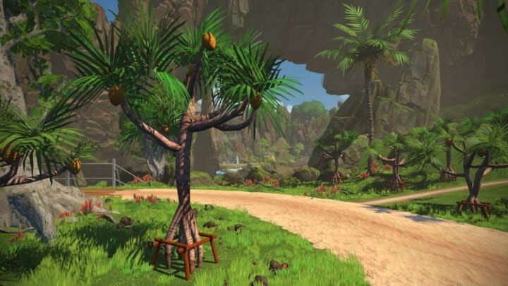
Urukazi continues the Japan inspired theme of the Makuri Islands. Its name is a combination of two Okinawan words: "uru" meaning "shore," and "kazi" meaning "breeze." Zwift says the name "is meant to evoke the serene, untouched character of the Southern Japanese archipelago." It is the second expansion to the Makuri Islands, following the Neokyo expansion last November.
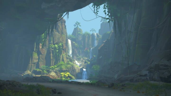
The new roads are connected into the greater Makuri Islands map, so riders can either start directly in Urukazi or in Yumezi or Neokyo and head south. Traveling from Yumezi to Urukazi takes riders through a slot canyon, while starting in Neokyo brings riders through a cave system.
Urukazi, along with the rest of the Makuri Islands, is available to explore now.
For exclusive access to all of our fitness, gear, adventure, and travel stories, plus discounts on trips, events, and gear, sign up for Outside+ today.

