What to expect: Polk under tornado watch and wind advisory as storm system approaches
Polk County is under a tornado watch as a line of severe thunderstorms moves our direction with the potential to create chaos with Polk County's evening rush hour.
The National Weather Service issued a tornado watch for Polk and 20 other counties as a front of storms is expected to work its way through the area Tuesday afternoon between 2 and 6 p.m. Polk had been under a wind advisory for much of the day.
NWS Tampa meteorologist Stephen Shiveley said wind gusts between 30 and 35 mph are likely with some stronger gusts up to 45 mph possible. There is the possibility of isolated tornadoes popping up in Central Florida Tuesday evening, Shiveley said, advising residents should stay alert.
"We have a strong cold front coming through. Ahead of it is a breeze that's warmer, and it's kicking up moisture," he said. "The cold front will bring a squall, or think a strong line of thunderstorms."
Shiveley said most Florida residents should expect severe thunderstorms to impact the area for 30 to 45 minutes. Heavy rainfall is expected of 0.5 to 1.5 inches, with some higher local totals possible.
The system is moving from north to south, coming in from the Midwest. Lakeland residents living north of I-4 should expect to see action around 3 to 4 p.m. while southern edges of Polk in Frostproof should anticipate severe weather between 5 and 6 p.m., Shiveley said.
The National Weather Service has advised drivers to exercise extra caution, especially if operating a high-profile vehicle. Homeowners are advised to take in or secure outdoor objects.
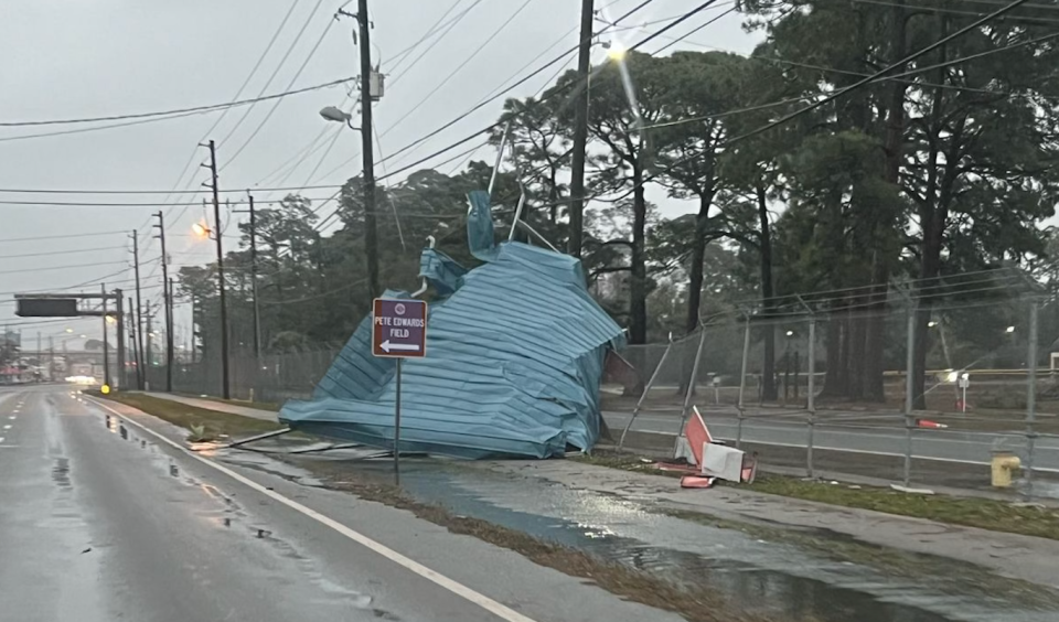
The Florida Panhandle has already felt the cold front's impact Tuesday morning. The National Weather Service confirmed several tornadoes touched down in the area, including in Panama City, Marianna and Santa Rosa Beach. The storms caused significant damage and several roads are closed, but so far no injuries are reported.
Live Damage reported after possible multiple tornadoes. Threat not over for Florida
Polk County Public Schools and the Schools of McKeel Academy announced Monday that all after-school activities would be canceled Tuesday.
What's causing the severe storms?
Florida has seen a series of brief but severe thunderstorms over the past two weeks, bringing heavy rains, gusts and pop-up tornadoes to the area.
"We're in El Niño season, when we've been in La Niña for the past few years," Shiveley said. "When its La Niña, we tend to have a drier, quieter winter. El Niño is the opposite."
The El Niño is a naturally occurring climate phenomenon that has combined with a low-level jet stream that's lying over Florida, Shiveley said. He compared the jet stream to a street, providing a road map for storms and weather systems to travel or move along.
"Any weather system that develops out West, the system that forms will travel along the street," he said. "Any system forming out west is going right through Florida."
When Florida is dealing with La Niña or a neutral system, most of these severe storm systems pass to the north not impacting the state, Shiveley said.
"Normally this is our quiet season," he said. "It's been more active now than it was during the summer months."
Sara-Megan Walsh can be reached at swalsh@theledger.com or 863-802-7545. Follow on X @SaraWalshFl.
This article originally appeared on The Ledger: What to expect: Polk under tornado watch as severe system approaches

