Flood stages on Sangamon River subside; rise on Illinois River still expected
Flood stages at Oakford and Chandlerville on the Sangamon River have come down while the Illinois River was expected to continue to rise because of ice jams at places like Havana and Beardstown, according to the National Weather Service in Lincoln.
All of those locales have seen at least minor flooding, with some moderate flooding in the forecast for the Illinois River for the next several days.
The elevated levels, said NWS meteorologist Nicole Albano, are a combination of snow melt, rain, and the frozen ground. The cold temperatures, she added, caused some ice activity on both rivers.
More: Homicides down in Springfield for third consecutive year
While the observed stages at Beardstown in Cass County and Havana in Mason County were expected to rise later this week, weather watchers are also eyeing the Kankakee River closer to Chicago area.
That's because ice, a concern earlier on the Kankakee, feeds into the Illinois River, meaning fluctuations could be felt further downriver in Peoria and into Havana and Beardstown.
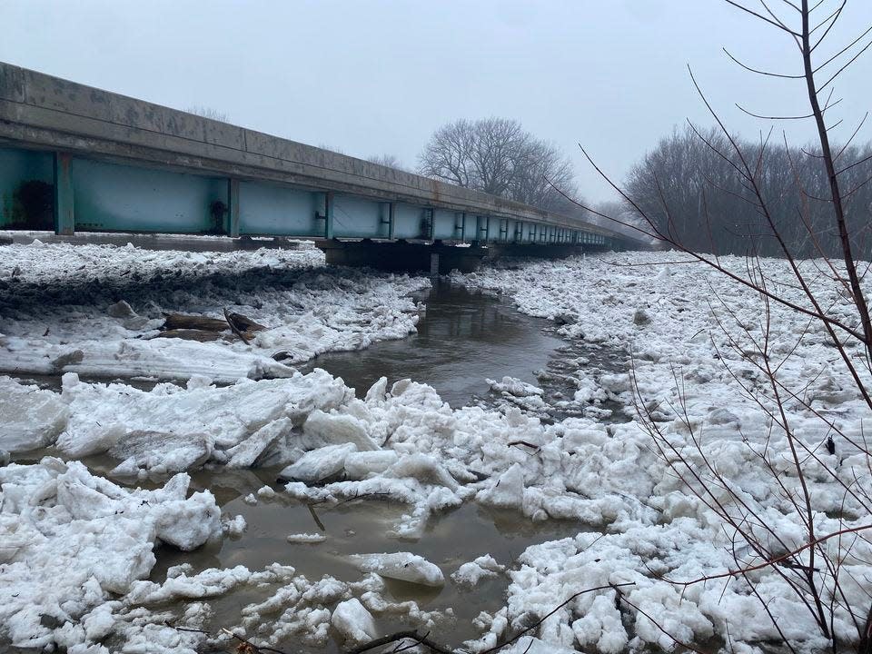
Stages at Oakford in Menard County and Chandlerville in Cass County, once in the moderate area, have come down the past couple of days, Albano said.
An ice jam at Oakford dissipated Friday. Levels there did get up to close to 473 feet and held steady there most of Friday, Albano said.
"It's actually below the action stage of the river (now) which is 469 to 470 feet," she said. "It could rise a little bit, but it's expected to mostly stay below that action stage."
Chandlerville stayed above what is considered the moderate flood stage, close to 460 feet, into Friday evening, although "it came down pretty quickly and they're below flood stage at this point," Albano said.
Wooded and farming areas and grasslands were impacted by the flooding in those areas, Albano said.
"There may still be some ice on the Sangamon," Albano added, "so we do need to stay vigilant for maybe some ice jam or ice activity, but with temperatures continuing to stay mild and even increasing this week, we should start to see a decrease in ice activity, at least along the Sangamon."
The Illinois River at Beardstown was expected to be around 18 feet, which is in the moderate flood stage, reaching 20.5 feet by Saturday, according to the Minneapolis-based River Forecast Center. It is expected to stay at flood stage for a while, Albano said.
More: Lincoln teenager dead after crashing into tree at Madigan State Park
That could lead to seepage problems in the South Beardstown Drainage and Levee District.
"The Illinois River does take some time to settle back down," she added. "We can probably expect the river to stay elevated into flood stage into the first part of February."
There was a similar forecast for Havana, she said. There, it will reach close to 20 feet by Saturday evening and could lead to the closure of an access road to the north campground at Anderson Lake.
Ice further north on the Kankakee "could lead to some impacts," Albano said. Along the Illinois River, "we do have a lot of the locks and dams and there are ways they can get boats out there to help break up some of the ice."
Temperatures in central Illinois will moderate, with highs Thursday and Friday near 50.
A mitigating factor for the flooding, Albano said, is that there aren't significant amounts of rain on the horizon.
"That will help," she said.
Check out river forecasts at www.water.weather.gov.
Contact Steven Spearie: 217-622-1788, sspearie@sj-r.com, twitter.com/@StevenSpearie.
This article originally appeared on State Journal-Register: Illinois, Sangamon rivers under flood warning due to ice jams

