'Active pattern': Storm to bring heavy rain, wind, possible flooding Tuesday, Wednesday
Just two days after the first major snowstorm of the season brought snow, sleet and rain to Rhode Island, forecasters say another storm Tuesday and Wednesday could bring heavy rain, damaging wind and flooding.
The storm could bring up to 3 inches of rain and winds of 30 to 40 mph with gusts up to 60 mph, the National Weather Service says.
The latest RI weather update: No snow, but storm could bring strong winds that knock power out for 'multiple days'
Heavy rain falling on the snowpack "has the potential to result in significant flooding" of rivers, streams and areas with poor drainage, the weather service says in its forecast discussion. Coastal flooding is also possible.
The weather service has issued high wind and flood watches to begin Tuesday night and continue until Wednesday afternoon.
"Damaging wind could blow down trees and power lines," the weather service says. "Power outages are possible. Travel could be difficult, especially for high-profile vehicles."
After dry but cold weather Monday, Tuesday should start out dry, but clouds will build and rain should move in Tuesday afternoon or evening, according to the weather service. With temperatures in the 40s, the precipitation is expected to fall as rain in Rhode Island, but it could start as snow in some higher elevations in Massachusetts.
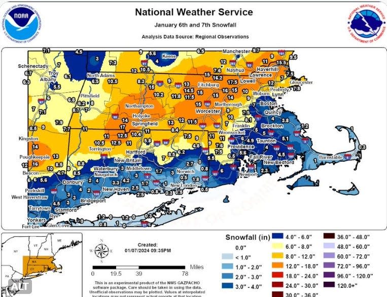
More: How much snow has fallen? Rhode Island snow storm updates
Commercial forecaster AccuWeather says the storm will "gather a great deal of moisture from the Gulf of Mexico and the Atlantic quickly and wring that moisture out over the mid-Atlantic and New England."
AccuWeather Senior Meteorologist Dan Pydynowski said, "A general 1-3 inches of rain alone that falls on the saturated ground from prior storms back through December is enough to lead to rapid flooding in poor drainage areas and along small streams."
Conditions will be even worse at sea. For Rhode Island and Block Island sounds, a storm watch will go into effect Tuesday evening for winds of 35 to 45 knots with gusts up to 55 knots and wave heights of 11 to 16 feet possible.
![A pedestrian keeps dry from above and below while walking east on Angell Street in Providence in Sunday morning's rain-snow mix. [Kris Craig/Providence Journal]](https://s.yimg.com/ny/api/res/1.2/5tErctC_VroxlWBiMNGrmA--/YXBwaWQ9aGlnaGxhbmRlcjt3PTk2MDtoPTU4MA--/https://media.zenfs.com/en/the-providence-journal/829a85525ad5ac32182b4f777cb43b42)
"Not out of the question, there could be occasional Hurricane Force Wind (74 mph or greater) gusts across ocean waters," the weather service says.
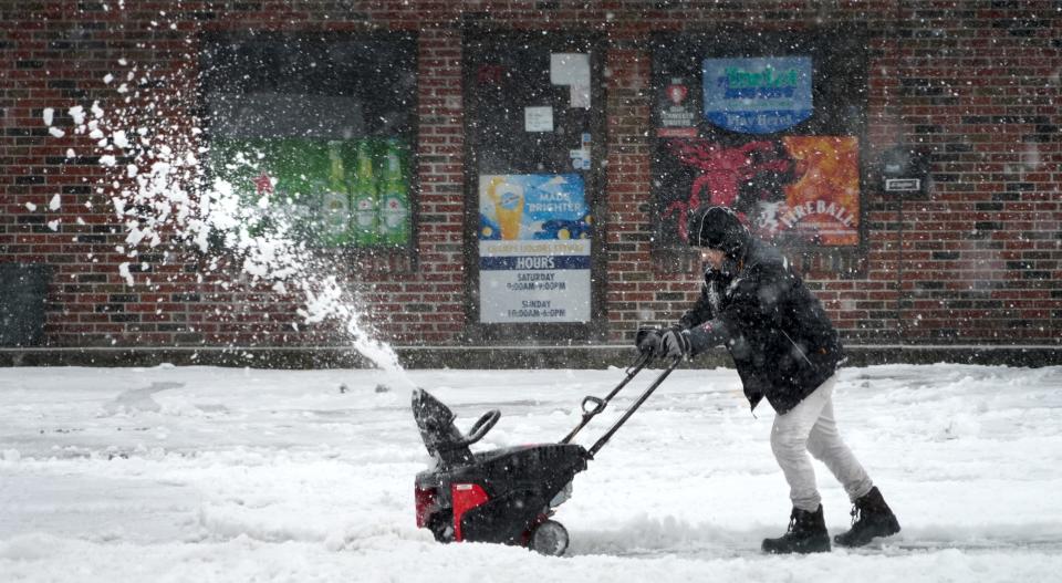
After a weekend storm brought as much as 11 inches of snow to Rhode Island, many communities delayed the start of school Monday.
Forecasters say that an "active pattern" is in effect across the region and that another storm could hit late Friday into Saturday.
This article originally appeared on The Providence Journal: Heavy rain, damaging wind, flooding possible Tuesday, Wednesday

