NWS expects more snow in the Hagerstown region Friday, issues winter weather advisory
The National Weather Service has issued a winter weather advisory for the Tri-State area on Friday, starting at 1 a.m. and going into Friday night.
A practically all-day snow is expected to affect morning and afternoon commutes, meteorologists said.
Some school systems began announcing Friday school closures on Thursday afternoon.
For Jan. 19, 2024: Snow forecast leads to cancellations, delays throughout area for Friday. Here's the list.
How much snow to expect in Hagerstown, Martinsburg, Chambersburg areas
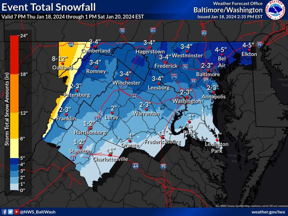
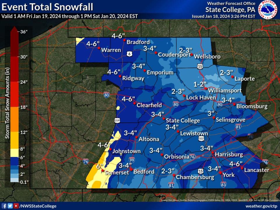
As of Thursday afternoon, forecasted snow accumulation numbers had increased to about 3 inches to 4 inches for Washington County and West Virginia's Eastern Panhandle; 2 inches to 4 inches in southern Franklin County, Pa.
The worst-case scenario south of the Pennsylvania state line could be around 5 inches, said Brendon Rubin-Oster, a meteorologist with the Baltimore/Washington Forecast Office.
The winter weather advisory for the local Maryland and West Virginia area continues through 7 p.m. Friday, while it goes to 10 p.m. in Franklin County.
Rubin-Oster said there could be an inch of snow by daybreak Friday, with another inch or two between the morning rush hour to about lunchtime. Then maybe another inch after that.
The snow is expected to be dry and fluffy, good for skiing and shoveling, not so much for building snowmen, said meteorologist John Banghoff with the State College (Pa.) Forecast Office.
Still, the snow could get a bit wetter as the day goes on and with accumulating snow, there could be slippery conditions for drivers, meteorologists said.
Hopefully, people have options to work from home, Rubin-Oster said.
By sundown, the bulk of the storm should move out of the Washington County area, he said.
Tri-State can still expect a bitterly cold weekend
The weather service is still calling for bitterly cold wind chills Saturday through Sunday morning in the Tri-State area.
Wind chills are expected to be around 3 to 7 degrees during the day Saturday, then dip to close to 0 to 3 degrees that night, Rubin-Oster said.
Sunday afternoon the wind chills could be in the low teens before the bulk of the wind dies down.
For Southern Franklin County, Banghoff said it could feel like 5 or 6 degrees during the day Saturday and near 0 overnight and Sunday morning.
By Sunday afternoon, it could feel like 12 degrees.
The temperature is still expected to get above freezing on Monday and the Tri-State area could see temperatures in the 40s by midweek.
This article originally appeared on The Herald-Mail: NWS expecting higher snow amounts Friday in Md./W.Va./Pa. region

