'Oh my gosh, it's colder than we expected': Florida weather not quite bragworthy
It’s the time of year when Floridians boast about wearing shorts and flip flops while enjoying mild temperatures and blue skies, and tourists flock to the Sunshine State to escape gloomy weather back home.
Well, maybe not this year.
Florida has been stuck in a weather rut lately: chilly temperatures, gray skies, rain, tornado-packed storms.
“It’s very beautiful here when the sun is out, but oh my gosh, it’s colder than we expected,” Cassie Sines said while bundled up in the only sweater she packed for her one-week vacation from Ohio. “When the wind blows it feels like Ohio.”
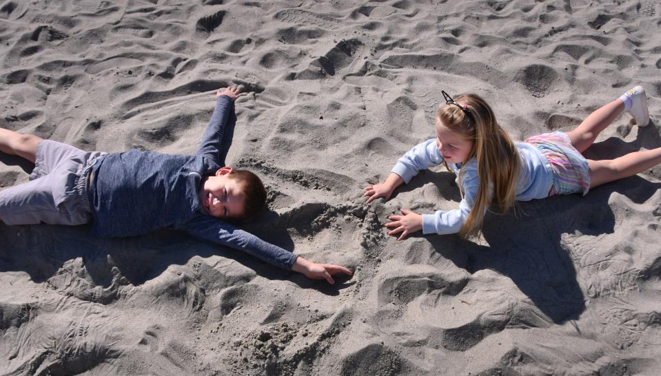
Sines recently visited Cocoa Beach Pier with her husband and two children, but instead of taking a dip in the ocean they came to the tourist destination to buy sweatshirts.
Sweaters and pants will likely be wardrobe staples for the foreseeable future in Brevard County. But why? What happened to the envious winter weather Florida is known for? The kind of picture perfect scenes that prompt those "Wish you Were Here" postcards.
“It really boils down to El Nino, that’s about 80% of the reason,” said Jared Heil, meteorologist with the National Weather Service in Melbourne.
For Central and South Florida, El Niño tends to bring rain and gray skies in the fall and winter.
What is El Niño
El Niño is a pattern of warmer than usual water — by 0.5 degrees Celsius — in the Pacific Ocean that influences air and moisture movement around the globe. It pushes the jet stream farther south, over Central and South Florida. That's good during hurricane season because it creates shearing westerly winds that tear apart possible tropical cyclones before they form. But in the winter the same pattern also brings frequent low-pressure systems, favorable for storms.
That being the case, Central Florida usually gets one or two inches above the eight to 10 inches of winter rain the region sees in a typical non-El Niño winter, according to long-term data from the National Weather Service.
But this El Niño is shaping up to be one of the strongest in recent memory. During more extreme El Niño years, some parts of Central Florida can see five inches above average wintertime rainfall.
Increased rain and clouds during El Niño tend to result in cooler winter months in the Southeastern United States, although some studies suggest the opposite might be the case in Florida during some El Niño winters.
Even when average winter temperatures are lower in Florida during El Niño, the climate conditions it creates tend to decrease risk of freezes because of El Niño's strong subtropical jet stream that keeps cold arctic air from moving into the southeast, reducing likelihood of severe cold.
Tornadoes also can double. Under El Niño conditions such as this winter, around 15 to 20 tornadoes on average can be expected per year in Central and South Florida, twice that of neutral or La Niña years, according to 60 years of data from the National Oceanic and Atmospheric Administration (NOAA).
The worst tornadoes in Florida tend to happen at night, adding to the danger. Many twisters form at night or in the early morning hours because that's when low-level winds within the first few thousand feet of atmosphere — what's called the "nocturnal low-level jet" — tend to be most active.
Heil said the last time this area was affected by El Niño was the winter of 2015-2016.
More: Storm passes, temperatures drop with more rain for Brevard by the weekend
What weather should Brevard expect next?
The gray skies, strong winds and favorable tornado conditions will likely be sticking around for most of the winter. Sorry.
“The current projection is that the El Niño is peaking now or going to peak in the next month or two,” Heil said. “We expect the effects of El Niño to last through the remainder of the winter season.”
This winter’s coldest temperatures will probably make an appearance in the next few weeks.
“Don’t put the winter clothes away because we expect cold fronts this winter that will have the potential to drag down more cold air,” Heil said. “Folks coming down from the north are not going to be too happy.”
While Sines’ 7-year-old son and 4-year-old daughter made sand angels on the beach, Army veteran Dave Opperman took a seat closer to the shoreline to enjoy the ocean view.

Dressed in jeans, a sweatshirt and Vietnam Vet ballcap, the Iowa City resident said the cooler-than-normal temperatures were not ruining his trip to the south.
“It’s much better than the 20-degree weather back home,” Opperman said.
Spitzer can be reached at mspitzer@floridatoday.com.
This article originally appeared on Florida Today: Florida weather cold, rainy, grey in winter 2024 thanks to El Niño

