Central Iowa snow squall brings taste of possible blizzard to come
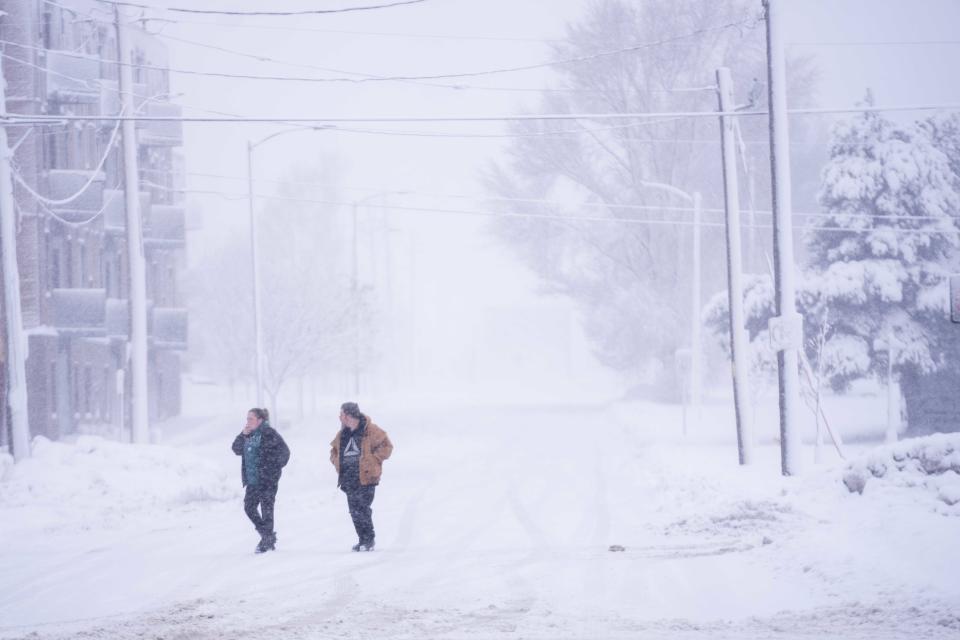
A snow squall poured fresh flakes down on Des Moines, Ames and other parts of central Iowa late Wednesday as the area braced for another winter storm arriving Thursday.
Extending from Osceola to Marshalltown, the squall, bringing intense bursts of heavy snow, packed wind gusts of up to 20 mph. The National Weather Service said Interstates 80, 35 and 235 were affected. With the roadways covered by snow and visibility reduced, accidents were reported, according to the Iowa 511 travel information system.
LIVE UPDATES: Follow coverage as blizzard comes for Iowa on Friday
It was perhaps a taste of what's to come. With almost a foot of snow on the ground from the winter storm earlier this week, including record snowfall for Jan. 9, the National Weather Service is again placing the Des Moines metro under a winter warning from 9 p.m. Thursday to midnight Friday. The warning extends throughout the entire state.
New snow could reach 13 inches in the weather system sweeping across the state, and forecasters said that with high winds expected, there was a definite possibility the storm could develop into a blizzard.
Conditions similar to those in the Des Moines metro are expected from Atlantic and Carroll to Marshalltown and Ames.
⚠️Winter Storm Warning for most of Iowa tonight-Friday
❄️Widespread 6-10" of light, fluffy snow
🌬️Strong NW winds creating significant blowing/drifting with near whiteout conditions Friday afternoon
🥶Dangerous cold Friday night through the weekend and early next week#iawx pic.twitter.com/mH5IfWiTPb— NWS Des Moines (@NWSDesMoines) January 11, 2024
Brad Small, meteorologist with the National Weather Service in Des Moines, said he expects there to be “near-blizzard or even blizzard conditions” by Friday morning. That’s because the snow will be lighter and fluffier than what hit Iowa earlier this week, blown by winds that could gust in excess of 40 mph. Sustained winds Friday are expected to be 20 to 25 mph.
Extreme cold coming on heels of new storm
Following the storm will be “prolonged” arctic-like temperatures for several days, Small said. Sunday should be the worst of it, with a high below zero during the day and a possible low of 20 below. That’s before the windchill, Small said, which could reduce the feels-like temperature another 10 degrees.
Monday ― Iowa Caucus day and the Martin Luther King Jr. holiday ― will be only slightly less frigid.
More: Iowa Caucus Day is expected to be bitterly cold. Here are the records for coldest caucuses:
“It will easily be the coldest temperatures we’ve seen this season,” Small said.
After a slight warm-up Tuesday, another cold blast could arrive the following day, weather service forecast guidance says.
Gov. Kim Reynolds announced Wednesday evening that she had issued a proclamation to ease restrictions on transporting and accessing heating fuel through Feb. 9.
The weather service advises that anyone going outside:
Dress appropriately for cold weather by adding layers.
Adjust their schedule to avoid prolonged exposure to the cold.
Pack a winter survival kit for their vehicles.
What were the snow totals in Des Moines, central Iowa?
More: December snowfall is near record low. When will Des Moines don its winter whites?
Here is a look at the latest snowfall totals reported as of 8 a.m. Wednesday:
Des Moines (airport): 11.2 inches
Waukee: 8 inches
Ames: 8.8 inches
What are some of the highest snow totals in Iowa?
Information as of 8 a.m. Wednesday:
University Heights: 15.1 inches
Lowden: 13.5 inches
La Porte City: 12.8 inches
Dubuque: 12.6 inches
Knoxville : 12 inches
Patterson: 12 inches
Sergeant Bluff: 11.6 inches
Oskaloosa: 11.5 inches
Indianola: 11 inches
Davenport: 10.8 inches
This article originally appeared on Des Moines Register: Snow squall hits central Iowa with blizzard possible starting Thursday

