Sarasota and Manatee could see severe weather from cold fronts Saturday and Tuesday

A series of low-pressure areas will create the potential for severe weather in Sarasota and Manatee counties in the next few days, starting with a cold front Saturday morning, according to an advisory Friday from the National Weather Service in Ruskin.
Another cold front will reach the area Tuesday afternoon.
Saturday’s cold front should impact the area near sunrise, between 7 and 8 a.m., noted Ali Davis, a forecaster with the National Weather Service in Ruskin.
“We’ll see storms then moving across the area during the later hours, 9, 10 and 11 a.m.,” Davis said, then added that the majority of the front should be clear by 2 p.m.
She stressed that the front will not have the same impact as a mid-December front that raised concerns of coastal flooding.
For that front, the low pressure center developed in the gulf, while the low-pressure center for this storm is farther north in the Ohio valley.
“While there is a risk of a foot or two of coastal flooding it doesn’t look to be nearly as significant an event as the December storm,” Davis said.
What to expect Saturday
The forecast calls for a marginal risk of thunderstorms with the high approaching 76 degrees and a low of 62 degrees.
Isolated wind gusts and isolated tornadoes cannot be ruled out. The NWS web site suggests south-southwest winds from 15 to 22 mph, with gusts as high as 31 mph.

“We’re probably looking at maybe some water spouts,” Davis said, with a possibility of a water spout moving onshore. “Overall we’re looking at more of a rain and thunderstorm activity with a few embedded stronger storms.”
A small craft advisory will be in place from Friday night through Saturday morning, with a high risk for rip currents all day Saturday.
By afternoon, the area may experience lingering showers.
Sunday and Monday may include some beneficial rain, until the next front approaches Tuesday afternoon.
What to expect Tuesday
Tuesday’s cold front could have a more significant impact, in part because it will arrive in the afternoon, when it will be influenced by daytime heating.
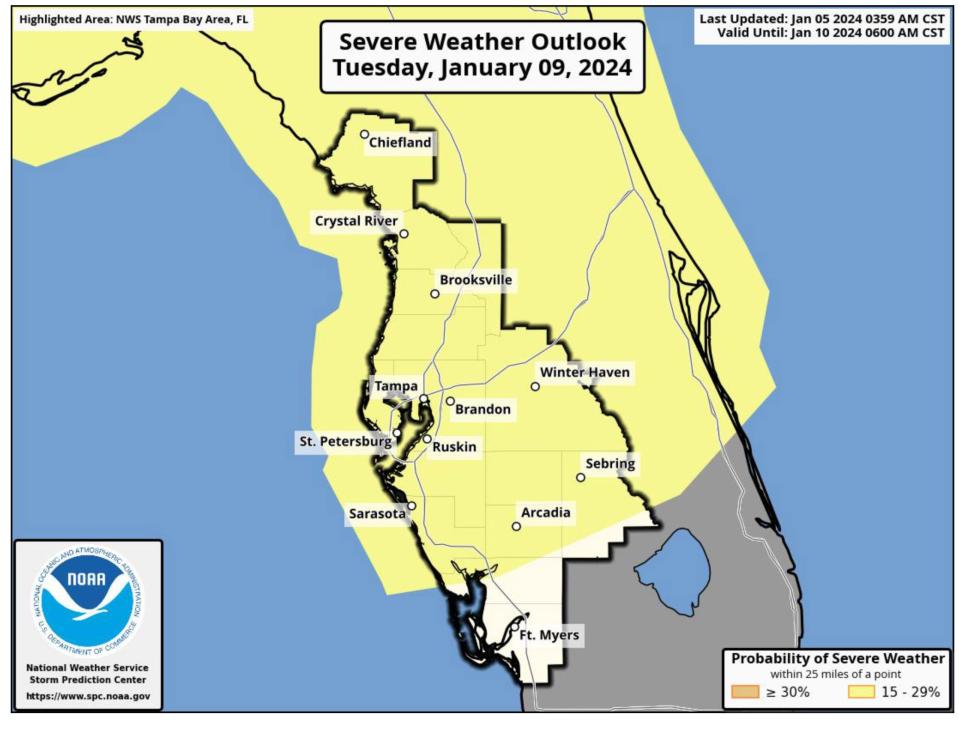
Because that is still outside the three-day forecast, the NWS severe weather outlook suggests a 15-29% probability of severe weather.
The current forecast on the website calls for mostly cloudy skies with a high near 76 degrees and south-southeast winds from 22 to 28 mph, with gusts as high as 41 mph.
Coastal impacts from Tuesday’s front include a possible period of coastal flooding late Tuesday into Wednesday, possible sea fog impacts Monday night through Tuesday morning; hazardous to dangerous seas Monday through Wednesday and poor beach conditions Monday through Wednesday.
This article originally appeared on Sarasota Herald-Tribune: Saturday storm front may bring damaging winds to Sarasota, Manatee

