These spots often flood in Delaware. With storm, you may want to avoid them
- Oops!Something went wrong.Please try again later.
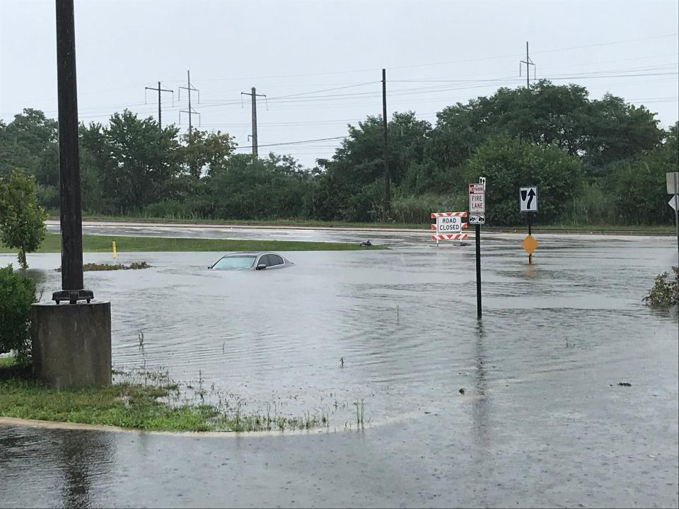
The story is as old as time: Heavy rain pummels Delaware, causing roads to flood.
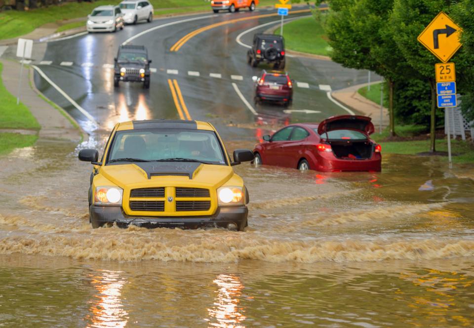
Then, drivers who either don't realize how deep the water is or who naively think their car is the one that can make it through get stuck, oftentimes requiring fire department rescue.
As the National Weather Service predicted the winter storm that rolled through Tuesday night would cause "moderate to major flooding" in Delaware − especially the northern part of the state − motorists may want to avoid frequently flooded areas in the state.

Given this is not an exhaustive list, always remember that even 6 inches of water can knock a person down, and just a foot of moving water can sweep vehicles away. Turning around and making a slight detour will save far more time than dealing with a ruined car, being stranded and potentially needing rescue.
The Delaware Department of Natural Resources and Environmental Control also offers an interactive flood planning website designed to help residents determine flood risk in Delaware. It can be found at floodplanning.dnrec.delaware.gov.
STORY: With 'major' flooding expected in many Delaware coastal areas, here's how to remain safe
New Castle County
Governor Printz Boulevard: The throughway, between Edgemoor Road and East Lea Boulevard, frequently floods. This includes Merchants Square plaza, where the Food Lion is located.
Smith's Bridge: The covered bridge and nearby, Centreville-area roads, including Smithsbridge and Brandywine Creek roads, often overflow.
Rockland Falls: Rockland Road by Adams Dam Road in Rockland is prone to flooding.
Airport Road: A number of spots along the New Castle-area road are known to flood.
Capitol Trail: Route 2 (Capitol Trail) at Red Mill Road also often sees water accumulation.
Fox Run Shopping Center: This plaza in Bear has signs warning drivers that the roads are prone to flooding, but even so, it can get pretty flooded pretty quick.
Stanton underpass: The Stanton underpass on Stanton Christiana Road near Christiana is a known flooding spot. Both Minquas Fire Company and Christiana Fire Company personnel have previously rescued stranded motorists there.
East 12th Street: East 12th Street near I-495 in Wilmington has been known to flood. In September 2021, Howard R. Young Correctional Institution was temporarily locked down due to standing water in parts of the facility's parking area that affected access.
Northeast Boulevard: The neighborhood bounded by Northeast Boulevard, Vandever Avenue and East 12th Street in Wilmington has been known to flood.
Newark: The city of Newark has a list of flooding-prone streets, which can be found here: newarkde.gov/883/Streets-Prone-to-Flooding.
Sussex County
Marian R. Okie Memorial Wildlife Preserve: The preserve, off Long Neck Road in Long Neck, is often one of the first places in the area to flood during heavy rainfall.
Dewey Beach: Read Avenue and Van Dyke Avenue on the bay side of Dewey Beach have previously flooded. Much of the town is prone to flooding during heavy rainfall.
Route 1: Route 1 (Coastal Highway) between Rehoboth Beach and Fenwick Island often floods.
River Road: River Road in Oak Orchard has also flooded significantly during periods of heavy rain.
Lewes: A number of roads in the area flood, including the far ends of Camp Arrowhead and Bookhammer Landing Road in Angola area of Lewes, Sweetbriar Road at Red Mill Pond, the east end of Savannah Road along the marsh.
Kent County
Woodland Beach: The roads leading to Woodland Beach, east of Smyrna on Route 6, are prone to flooding.
Bowers Beach: Southeast of Dover Air Force Base, the roads around Bowers Beach often see flooding.
Got a tip? Send to Isabel Hughes at ihughes@delawareonline.com or 302-324-2785. For all things breaking news, follow her on X at @izzihughes_
This article originally appeared on Delaware News Journal: Frequently flooded spots to avoid in Delaware during storm

