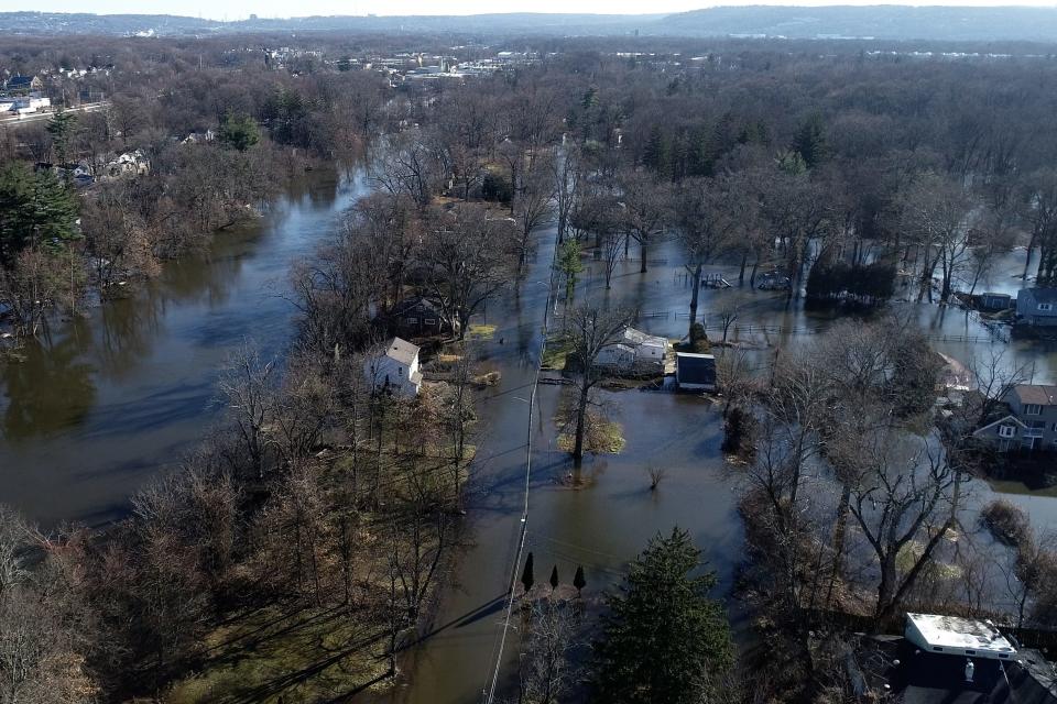
This week's storm could lead to flooding as bad as December in North Jersey
North Jersey residents should prepare for heavy rainfall and potentially significant river flooding and flash floods with the arrival of the next major storm, starting Tuesday afternoon and going into late Wednesday morning, meteorologists say.
The area is expected to see anywhere from 2 to 4 inches of rain, with Morris and Passaic counties seeing the heaviest rainfall, between 3 and 4 inches.
NJ flooding potential
Meteorologist Bryan Ramsey of the National Weather Service said heavy downpours will likely lead to numerous flash floods and some significant river flooding.
There is potential that flooding from this storm could near the amount seen during December's intense rainstorm that caused major flooding, evacuations and school closures around North Jersey.
"Somewhere around the ballpark of what we saw last month is probably a good gauge at this point," said Mike Lee, another meteorologist with the National Weather Service. "We're still creating the forecast and working with other forecast centers, but we're expecting some significant flooding from this event, so something near to around what we saw last month is accurate."
As of Monday morning, North Jersey had been placed on a flood watch by the National Weather Service. The flood watch is set to remain in effect from Tuesday afternoon to Wednesday afternoon.
The Raritan River and the Passaic River are the top concerns of meteorologists at the moment, but they said any small streams or rivers have the potential to flood.
Additionally, the snow that is still on the ground from the past weekend's winter storm could increase the likelihood of flooding, Lee said. The combination of packed or melting snow and an already saturated ground will likely lead to additional runoff into rivers and streams.
Snow melt is likely, as temperatures are expected to reach the low to mid-50s before falling into the low to mid-40s on Wednesday.
Staying prepared
If you live in an area that regularly deals with flooding, it is important to be prepared ahead of such a storm.
The National Weather Service is asking that people "monitor later forecasts and be alert for possible Flood Warnings. Those living in areas prone to flooding should be prepared to take action should flooding develop."
The Morris County Office of Emergency Management sent out a statement Monday morning acknowledging the potential for flooding.
"We are concerned with our streams, creeks, and rivers reaching flood stage as well as the potential wind gusts forecast for tomorrow night at 40 to 50 mph, which could be enough to bring down some limbs and/or power lines," said Jeffrey Paul, director of emergency management for the county.
"We are asking the public to pay attention to local municipal messaging and follow the guidance and recommendations of the local municipality," Paul said. "Stay safe!"
You can also check out the National Weather Service's flood safety resource page for information about how to be prepared and what to do before, during and after a flood.
This article originally appeared on NorthJersey.com: Major rain and flooding coming to NJ with Tuesday storm

