We're getting more snow, Central Indiana. Here's what to know about the days ahead.
The National Weather Service in Indianapolis shared on Wednesday morning that we will see more snow in Indiana on Thursday morning.
A second round of snowfall is possible late Thursday night into early Friday morning. With temperatures remaining below freezing throughout the rest of the week, total snow accumulations are estimated to be between 1 to 3 inches.
Keep an eye out for snow covered, untreated roads and overpasses as you're finishing out the rest of your work week.
Snow will return Thursday into Thursday night. Some light accumulations are likely. Tonight will remain cold with lows in the single digits above zero, but wind chills will be below zero. #inwx pic.twitter.com/niwWIYwAf0
— NWS Indianapolis (@NWSIndianapolis) January 16, 2024
Current snow accumulation predictions

Twimg
Embedded content: https://pbs.twimg.com/media/GECQ5UbbYAAjYIm?format=jpg&name=large
On Thursday night, the current chance of precipitation is 80% in Indianapolis, 70% in Lafayette, Winchester and Bloomington and 50% in Vincennes.
More: Indiana has snow in the forecast. Here's how to drive with common sense in icy weather
How to track snow removal updates in Indianapolis
Indianapolis residents can follow the Indy Department of Public Works on X, formerly known as Twitter, for updates about snow removal.
Indy Department of Public Works also manages Indy Snow Force, their winter weather operations team, with an online map showing what roads have been plowed already in the city.
The Indy Snow Force road map can be found online at maps.indy.gov/IndySnowForceViewer. You can also follow them on X, @IndySnowForce.
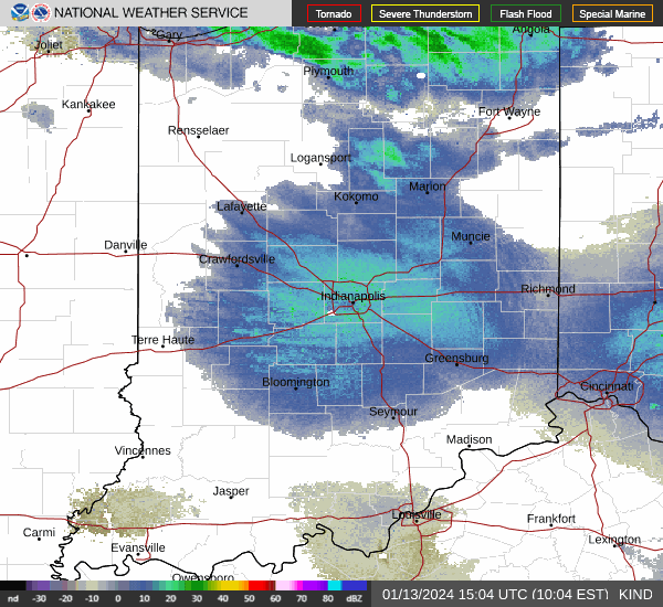
Indianapolis weather radar
Katie Wiseman is a trending and breaking news intern at IndyStar. Contact her at klwiseman@gannett.com. Follow her on Twitter @itskatiewiseman.
This article originally appeared on Indianapolis Star: Central Indiana braces for more snowfall heading into the weekend

