Wind advisory issued for Asheville area, flood warning for Buncombe, Henderson Jan. 12
ASHEVILLE — The National Weather Service has issued a wind advisory and flood warning Jan. 12 for Buncombe County as a low-pressure system makes its way through Western North Carolina.
The wind advisory is in effect until 1 p.m. Jan. 13 for 10 counties including Buncombe, with Asheville expected to see strong winds as well.
"We are expecting southwest winds around 30-40 mph that's going to be sustained, with gusts up to 55 mph," meteorologist Ashley Rehnberg with NWS told the Citizen Times.
Other than Buncombe, counties under the wind advisory include Avery, Madison, Yancey, Mitchell, Swain, Haywood, Graham, Macon and Jackson.
"Winds are just now starting to pick up," Rehnberg said around 11:30 a.m. "We are really expecting them to increase late this morning into this afternoon."
Asheville has not seen gusty winds as of Friday morning, but wind speeds should pick up in the next hour or two, hitting in the early afternoon, Rehnberg said.
“Gusty winds will blow around unsecured objects,” the advisory said. “Tree limbs could be blown down and power outages may result.”
“Winds this strong can make driving difficult, especially for high profile vehicles. Use extra caution.”
Spokesperson Stacey Harris with Buncombe County Schools said they are monitoring the forecast, but there are no schedule changes for county schools at this time.
Forecast for Jan. 12: Blue Ridge Parkway, Buncombe county river parks still closed; more rain incoming
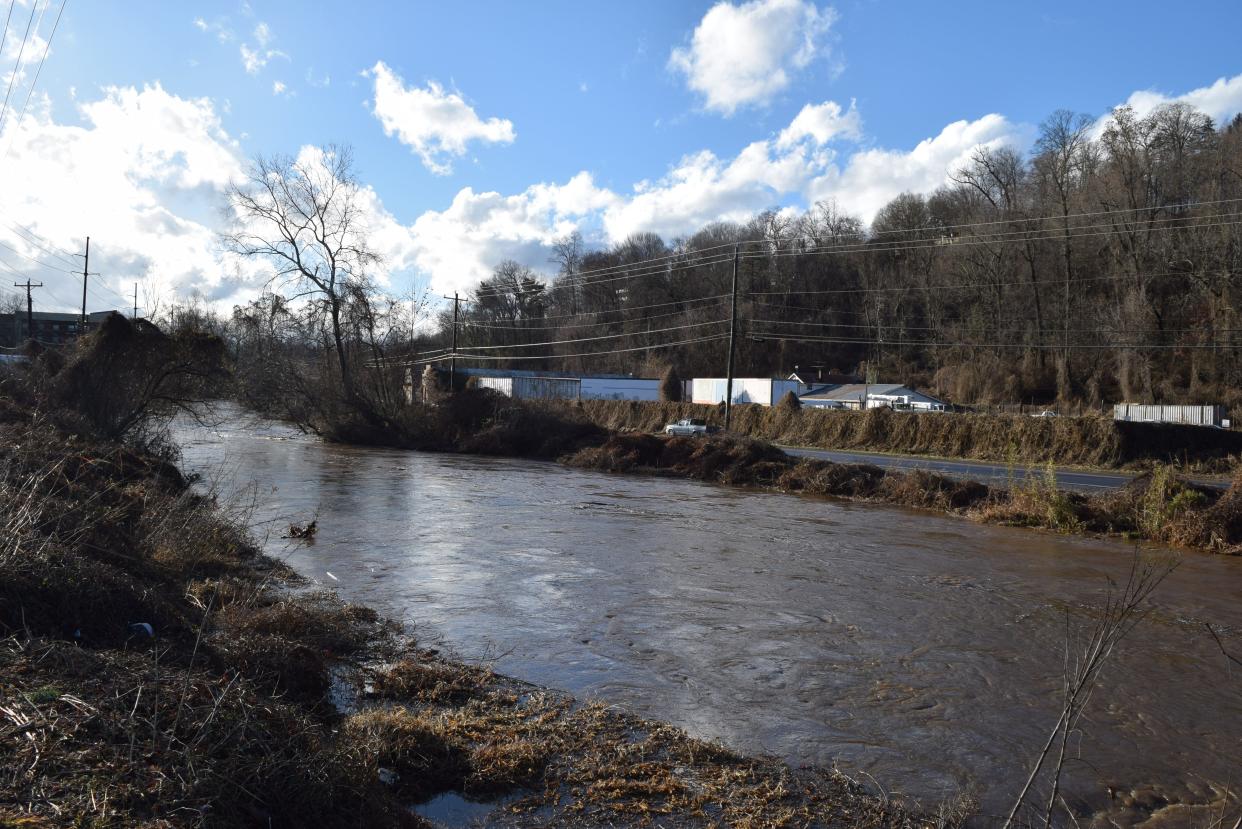
Flood warning for Buncombe, Henderson counties
Buncombe and Henderson counties are also under a flood warning from the NWS, particularly for the French Broad River near Fletcher. The warning went into effect just after 9 a.m. Jan. 12 and will continue until 7 p.m. Jan. 13.
At 8:45 a.m. Jan. 12, the river was at flooding levels of 11.7 feet with observed flooding at minor severity, according to NWS. The river is expected to fall to 6.4 feet by Jan. 17.
More rain is expected to hit Asheville between 1 and 2 p.m. Jan. 12 with a slight chance of thunderstorms, according to Rehnberg.
"Showers and thunderstorms will continue over the area and move out roughly between 7-8 p.m.," Rehnberg said.
The French Broad and the Swannanoa rivers jumped their banks earlier this week, when heavy rainfall spurred a flash flood warning on Jan. 9. The Swannanoa River hit the highest flooding since August 2021, rising to nearly 9 feet on Jan. 9, according to data from the U.S. Geological Survey.
“Even 6 inches of fast-moving flood water can knock you off your feet and a depth of 2 feet will float your car,” the warning said. “If you come upon flood waters, stop, turn around and go another way.”
Butler Bridge Road in Fletcher is closed after being “inundated with up to 6 inches of floodwaters from the French Broad River,” the alert said.
Flooding in Asheville Jan. 9: Scenes of flooding around Asheville Jan. 9 during severe weather
Drought conditions improve
After the area received heavy rainfall earlier this week, the Drought Management Advisory Council removed the severe drought classification for all of WNC, except for Cherokee and Clay counties.
Asheville received 3.5 inches and Hendersonville received 5.5 inches of rain from the last weather system that rolled through WNC Jan. 9, according to meteorologist Scott Krentz with the NWS.
Severe weather in WNC Jan. 9: Jan. 9 weather roundup: state of emergency; high rain, winds, flooding. What to know
“The forecast for this week shows two chances for additional rain, so drought conditions statewide are likely to continue to improve,” chair of the DMAC, Klaus Albertin, said in a news release from Gov. Roy Cooper’s office. “Stream flow, groundwater levels, and reservoir storage have all improved significantly thanks to the wet pattern we are now in.”
Parts or all of 11 counties remain in moderate drought, including Buncombe County, and 13 counties still have areas of abnormally dry conditions, including Henderson County, according to DMAC.
Ryley Ober is the Public Safety Reporter for Asheville Citizen Times, part of the USA Today Network. Email her at rober@gannett.com and follow her on Twitter @ryleyober
This article originally appeared on Asheville Citizen Times: Wind advisory, flood warning in effect for Buncombe County

