Brrring it on: An arctic air invasion will bring fierce cold to much of the US
Bundle up: It's about to get really biting out there.
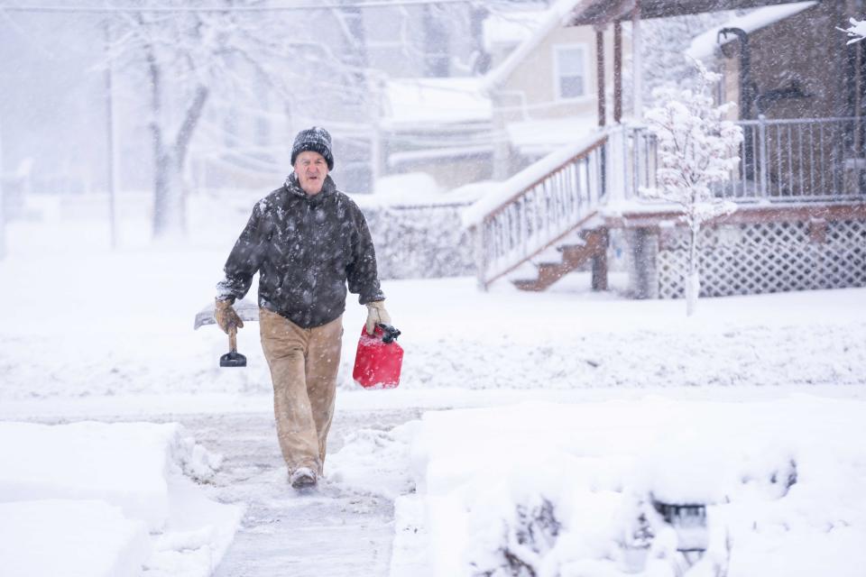
Much of the country should brace for bitter cold coming the end of this week and into next week, forecasters said Thursday. The polar plunge could threaten century-old record low temperatures, cause hypothermia and frostbite and damage infrastructure.
The National Weather Service warned that arctic air will bring subfreezing temperatures as far south as southern Texas and the Florida Panhandle by early next week. The cold wave will start in the northern Rockies and Plains on Thursday night and advance farther south and east. Snow is likely in the interior South – where the first wintry weather of the season is expected – and mid-Atlantic by Monday and the Northeast by midweek.
Afternoon highs won't reach above zero degrees across much of Montana and into North Dakota on Friday, and Central Plains states into Iowa and Minnesota will see highs only up to the 10s. The icy air mass will be "lengthy" and persist well beyond this week, the weather service said.
"Temperatures will be brutal compared to the relatively mild conditions that have been experienced for much of the winter season up to this point in time," the National Weather Service said.
Iowa could have its coldest Caucus Day yet
Iowa may have its coldest Caucus Day ever on Monday as arctic temperatures descend on the state, although there is no snow in the forecast for the day.
By 6 p.m. Monday − when people will be lining up to check-in before caucusing for Republican presidential primary candidates − temperatures are expected to be -1 to -5 degrees depending on which part of the state you're in. Wind chills in the evening could dip to nearly -20 degrees, meteorologist Brad Small said.
The bitter cold comes after Des Moines saw a record 8.3 inches of snow on Tuesday, breaking previous records for Jan. 9 snowfall, the National Weather Service said. The previous record for Jan. 9 was 7.3 inches, set in 1957.
− The Des Moines Register
Chiefs, Dolphins to face off in piercing wind chills
It will be dangerously cold Saturday when the Kansas City Chiefs battle the Miami Dolphins at 8 p.m. in Kansas City. The National Weather Service in Kansas City said the temperature could struggle to rise above zero degrees, and wind chill could hit -10 to as much as -35 degrees.
By evening at Arrowhead Stadium, AccuWeather predicts the temperature should be -5 degrees but feel more like -23, with wind gusts up to 30 mph.
Chiefs Coach Andy Reid said the team can't rely on its opponents struggling in the frigid weather.
“You can’t bank on that. That’s where you get into trouble,” Reid told the Associated Press. “We’re not having a snowball fight.”
Wind chills will be falling into the minus 20s at Arrowhead Saturday at 8 PM for the Chiefs and Dolphins Wild Card game.
Winds out of the NW gusting to 20-25 mph with actual temperatures falling below zero into the later evening. Skies should be crystal clear. pic.twitter.com/NtZhSCUtWy— Ryan Maue (@RyanMaue) January 10, 2024
Northwestern states to see temps well below normal
A cold air mass will bring temperatures 20 to 40 degrees below normal over the next few days to the Rockies and Northwestern states, the weather service said.
The cold air will affect states from northern Washington to Idaho and Montana, through Kansas, forecasters said.
The cold will follow the storm system that is expected to ramp up later Thursday in the Great Plains region and strengthen as it tracks across the mid-Mississippi Valley through the end of the week, bringing heavy snow. States from eastern Nebraska through lower Michigan will likely get at least 4 inches of snow.
Blizzard conditions are expected in the Midwest and Great Lakes region late this week, where several big cities including Chicago, Milwaukee and Kansas City could be hard hit by snow, AccuWeather said. Meteorologist Ryan Maue also said on social media this next storm could become a rare overland "bomb cyclone" – which is like a winter hurricane with high winds, heavy blizzards and sub-zero temperatures.
Another storm system to hit same states
Another massive winter storm is expected to dump snow, rain and dangerously low temperatures starting later Thursday through the weekend across the same parts of the country still reeling from the deadly system that brought tornadoes and flooding earlier this week.
South and southeastern states are once again at risk for thunderstorms and tornadoes through late Friday evening, the weather service said. Rain should overall be less troublesome up the East Coast than it was earlier in the week. But parts of the mid-Atlantic and Northeast could still see an additional 1 to 2 inches, and flooding is possible.
The last storm system left five people dead across the South on Tuesday as tornadoes tossed mobile homes about and downed trees, while the Midwest saw massive amounts of record-breaking snow. The storm then wreaked havoc up the coast and into New England on Wednesday: Wind gusted as strong as 95 mph and rain triggered flooding.
Contributing: Doyle Rice
This article originally appeared on USA TODAY: Extreme cold will blanket US as arctic air brings record low temps

