Road conditions in Johnson County area slowly improving after a number of snow-related crashes
Heavy snowfall, slick road conditions and frigid weather combined for the perfect storm on Tuesday, causing crashes and disruptions that have impacted Wednesday’s travel plans.
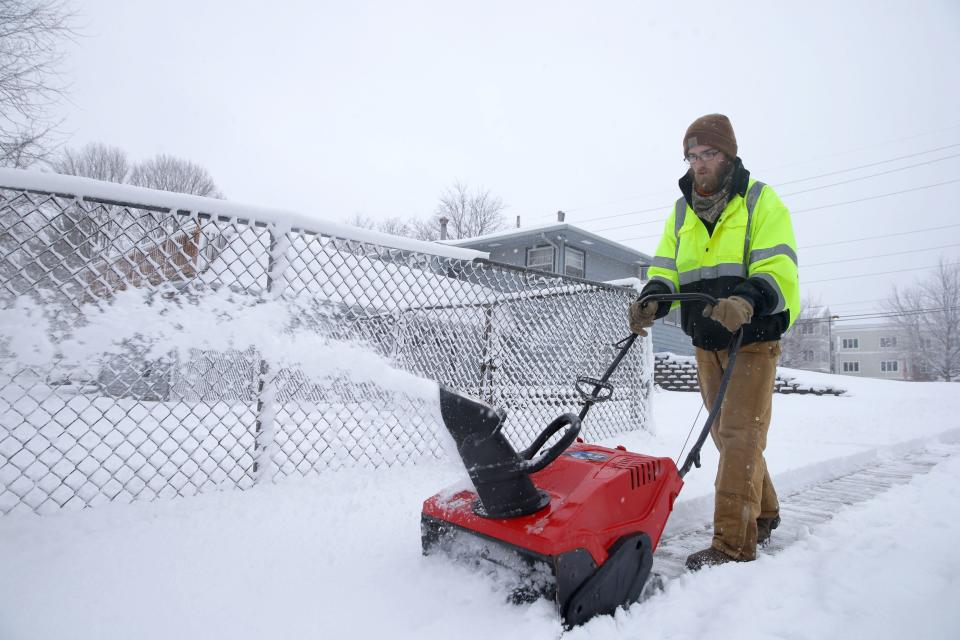
More than a foot of snow was dumped on Johnson County in 36 hours, with Iowa City and North Liberty each reporting 15 inches.
"We haven't seen anything like this since the 2011 blizzard," Dave Wilson, the county's Emergency Management Coordinator for the last 16 years, told the Press-Citizen. "This is the second-largest snow event that we've had since I've been here."
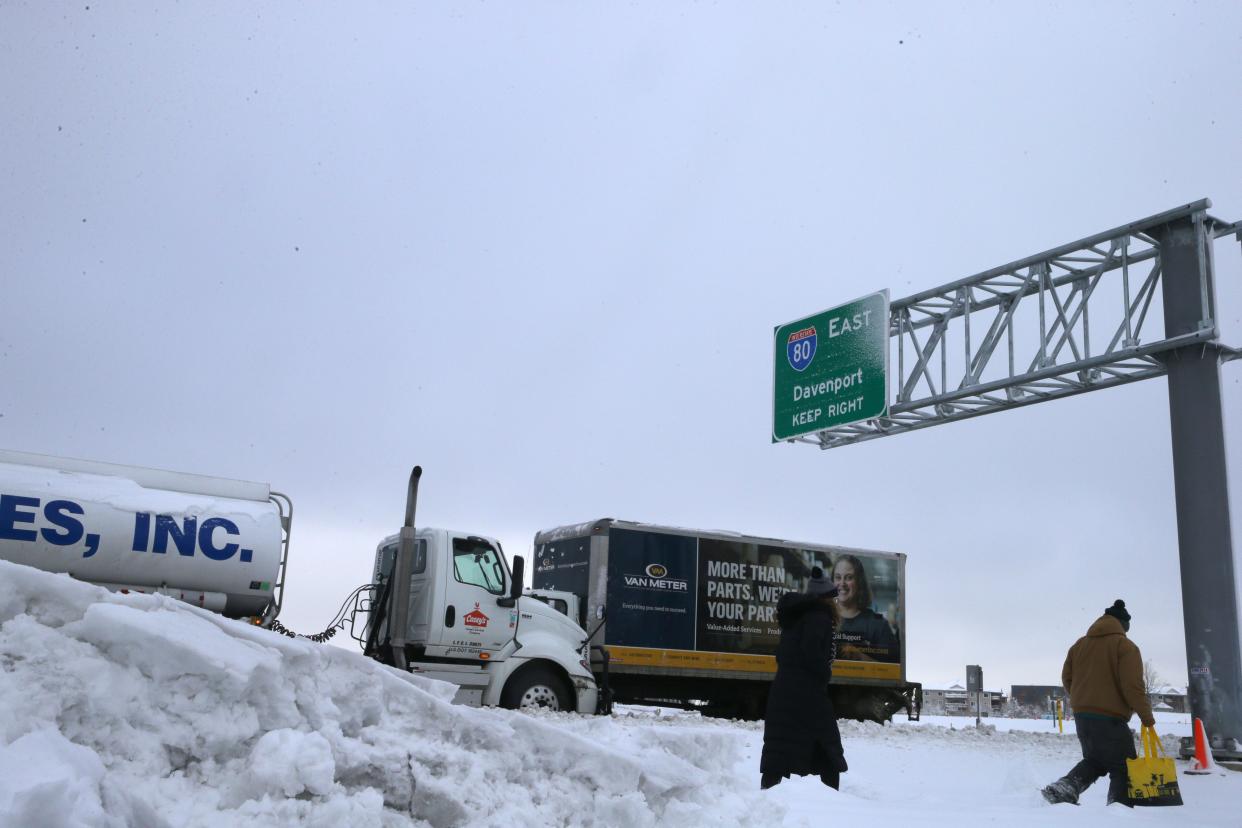
Interstate 80 was closed multiple times Tuesday due to crashes caused by heavy snowfall and whiteout conditions. Issues trickled into Wednesday morning as the Iowa Department of Transportation still asked motorists to find alternate routes between a seven-mile stretch from Iowa City’s Dodge Street exit to the Interstate 380 interchange outside of Coralville.
By noon Wednesday, that stretch of I-80 had been cleared.
Snow storm causes string of accidents
Drivers braving the treacherous conditions made for a busy 48 hours for the Johnson County Sheriff's Office, which responded to 165 calls for service between Monday morning and 8 a.m. Wednesday. More than 20% of incidents, 37 in total, were for trouble on I-80.
The sheriff's office assisted 127 motorists and responded to 23 car accidents during the storm. Exactly 100 assists were during the heaviest snowfall from Tuesday morning into Wednesday morning.
The Iowa State Patrol responded to 238 crashes across Iowa from 8 a.m. Jan. 8 to 10 a.m. Wednesday. No fatalities were reported, and 688 motorists were assisted throughout the storm. A state trooper's car was struck from behind Tuesday afternoon along I-80 between Ladora and Victor, causing significant damage to the patrol car but ultimately resulting in no injuries.
I-80 near the 203 MM
Thankfully, this ISP Trooper was OUT of his car checking on a stalled semi when his patrol car was struck from behind. No injuries were reported, but we want to get the message out...
TRAVEL IS NOT ADVISED ON I-80 BETWEEN DES MOINES AND THE ILLINOIS BORDER! pic.twitter.com/AhqBqROqun— Iowa State Patrol (@iowastatepatrol) January 9, 2024
More: Iowa City area blanketed by nearly a foot-and-a-half of snow, bus routes impacted
Interstate crashes slow snow removal
Accidents and stopped vehicles along I-80 on Tuesday caused long-term problems for DOT crews attempting to clear the road. Snow plows could not clear stretches of I-80 because of traffic-related blockages, including the still-slick Iowa City stretch of the highway.
DOT Information Specialist Tracey Bramble told the Press-Citizen that the high volume of traffic incidents created a “significant snowpack” on the interstate. As temperatures dropped overnight, the DOT's salt brine solution used to clear roads became far less effective, meaning that the snowpack had to be scraped by crews, Bramble said.
Travel is still not advised on I-80 around Iowa City. The crashes yesterday caused a hard snowpack that our crews couldn't treat because of the stalled vehicles. We've worked all night and will keep at it until its cleaned up, but we need your help.
Please AVOID THIS AREA. pic.twitter.com/i8Q9A2GyIa— Iowa DOT (@iowadot) January 10, 2024
The road surface along stretches of I-80 near Iowa City was still slick as of 10 a.m. Wednesday, she said. With more drivers than crews out and chilly temperatures, tire tracks have started to freeze yet again. As road temperatures rise, Bramble said the DOT hopes to clear the Iowa City-area stretch of interstate "soon."
Temperatures are forecasted to drop to seasonal lows over the next few days. Bramble said the DOT will lean on their decades of in-house experience and loads of data to best clear still-covered roads.
"As we all have experienced, conditions can change quickly in Iowa," she wrote in an email to the Press-Citizen. "Because of that, we’re always pivoting to use the best methods for the condition when clearing snow and ice."
More: Johnson County schools announce more cancellations as winter storm drops nearly a foot of snow
More snow is in the forecast
Johnson County's abrupt introduction to winter doesn't seem over just yet.
The National Weather Service predicts additional snowfall between one and three inches in eastern Iowa late Wednesday, adding even more to Tuesday's totals.
The Quad Cities NWS office is also calling for additional winter storms to impact the Iowa City area, with the brunt of the storm arriving on Thursday evening and passing through by noon on Friday.
The National Weather Service is giving the Iowa City area a 57% chance of snowfall totals to surpass six inches. However, the areas most likely to see greater than six inches of snow will be along the Mississippi River and east into Illinois.
Here are our current thoughts on when and where most impactful winter weather is expected Thursday evening into Saturday morning. This will change as we get closer to the event, so pay attention to future forecasts. pic.twitter.com/XIWWstk14V
— NWS Quad Cities (@NWSQuadCities) January 10, 2024
Residents planning to travel this week are encouraged to monitor the Iowa 511 website, which provides location-based road condition updates. The 511 site also provides camera images from around the state and from inside snow plows.
Temperatures are expected to plummet Saturday night, with lows touching -9 with a Sunday high of two degrees. Monday's forecast, which is Martin Luther King, Jr. Day and the date of the Iowa Caucuses, will bring a high of -1.
Ryan Hansen covers local government and crime for the Press-Citizen. He can be reached at rhansen@press-citizen.com or on X, formerly known as Twitter, @ryanhansen01.
This article originally appeared on Iowa City Press-Citizen: I-80 stretch in Johnson County improving following snowstorm

