This will almost certainly be the warmest winter ever in Wisconsin's recorded history
We are well on our way to what will almost certainly be Wisconsin's warmest winter in recorded history.
The National Weather Service defines winter as the months of December, January and February. Wisconsin's two-month average of temperatures from December 2023 and January 2024 was 11.1 degrees above average, said local NWS meteorologist Andy Boxell, which already puts this winter "pretty far ahead" of all others on record.
The next-warmest winter was 2001-2002, which was 10.4 degrees above average by the end of January. This is followed by the winter of 1931-1932, which was 8.7 degrees above average by the same point in the year.
At 10.9 degrees above normal, December 2023 was Wisconsin's warmest last month of the year on record, according to the State Climatology Office.
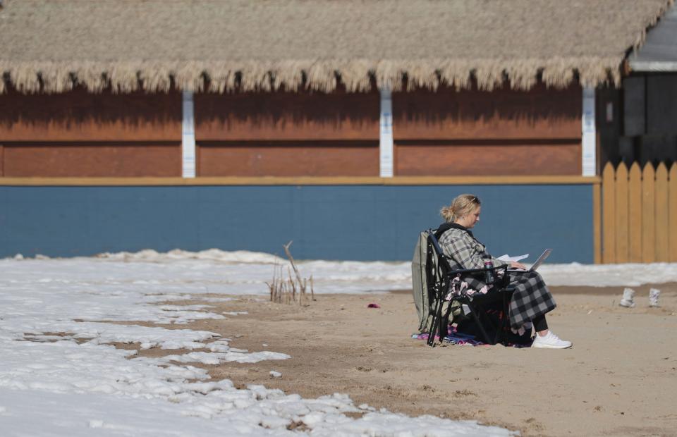
Additionally, this month, we've seen the warmest start to February on record in Milwaukee, with high temps in at least the upper 30s (and some days as high as the 50s) each day since the month began. For context, normal high temperatures this time of year are between 31 and 33 degrees.
"With how warm we're starting out February, it's fair to say that this will likely be the state's warmest December-January-February of all time," Boxell said.
"11.1 versus 10.4 doesn't seem like a lot in the grand scheme of things, but that's a pretty big difference to have 0.7 degrees. And now, we're halfway through the month of February, and we're well above average for February, so far. So, it's pretty likely that we're going to finish the winter as the warmest on average for the state."
Despite the cold snap, 2024 saw one of Wisconsin's warmest Januarys of all time
It turns out, every month this winter has been record-setting.
NWS announced Monday that January 2024 was Wisconsin's 10th-warmest January on record, according to records dating all the way back to 1871. The month was 8.5 degrees warmer, on average, than normal. This record was set despite nine days of well-below-normal temperatures during mid-January's frigid cold snap.
Only one state, Minnesota, had a warmer January. For our neighbors to the northwest, the month was 9.2 degrees warmer, on average.
Without the cold snap, January no doubt would have finished higher in the top 10 for Wisconsin, Boxell said.
According to data from the State Climatology Office, temperatures in Milwaukee were above normal Jan. 1 through 13, and then again Jan. 22 through 31. Jan. 24 and 25 even set records for the highest daily low temperatures on record ― 36 and 37 degrees, respectively.
What were the top 10 warmest Januarys in Wisconsin history?
According to NWS data, Wisconsin's warmest January occurred in 2006. It was 15.3 degrees warmer than normal, on average. This is followed by January 1990, which was 11.7 degrees warmer than normal.
Here are Wisconsin's top 10 warmest Januarys on record, according to NWS records dating back to 1871:
2006
1990
2002
1944
2023
1933
2020
1931
1989
2024

Why has this been the warmest winter in Wisconsin history?
The primary culprit behind Wisconsin's unseasonably warm winter is a weather phenomenon known as El Niño.
An El Niño event is caused when sea surface temperatures in the central and eastern Pacific Ocean warm to above average for several months. During an El Niño, the polar jet stream is shifted northward, which limits cold air intrusions from the north, NWS explains.
In general, El Niño brings above-average temperatures to the northern United States, which often result in below-average snowfall in moderate-to-strong El Niño years.
Last year, local NWS said this winter's El Niño was on track to be one of the strongest on record.
According to the weather service, during the past seven winters with strong El Niño effects, temperatures across southern Wisconsin were "near average to 6 degrees above average." Additionally, snowfall has been as much as 18 inches below average in southern Wisconsin during strong El Niño winters.
This winter, from Dec. 1 through Feb. 12, Milwaukee has received 16.2 inches of snow, Boxell said. Average winter snowfall by this time of year is nearly double that, 30.5 inches, meaning we're at a deficit of 14.3 inches.
It is important to remember that El Niño conditions ― warmer-than-average temps and below-average snowfall ― apply to the winter season average. Individual days can still see lots of snow, as Milwaukee saw in early January, or below-normal temperatures, as we saw in the middle of last month.
More: Wisconsin is experiencing a historic lack of snow this month
More: El Niño looks strong this year. That could mean a warmer, and wetter, Wisconsin winter.
This article originally appeared on Milwaukee Journal Sentinel: Winter 2024 likely to be warmest ever in Wisconsin's recorded history

