We'll get weather from all four seasons this week in Wisconsin, National Weather Service says
The Milwaukee area will experience all four seasons in a matter of days to start the last week of February.
There will be temperatures into the 60s followed by a cold snap with highs in the teens and a possible thunderstorm in the mix.
"You wouldn't have it any other way in Wisconsin," said Andrew Quigley, a National Weather Service meteorologist. "Kind of almost like a spring-like pattern, but happening just a little bit earlier this year."
Here's what you need to know.
What's the Milwaukee weather forecast for the week?
Unseasonably warm with temperatures reaching as high as the 60s on Monday and possibly near 70 in some areas of southeastern Wisconsin on Tuesday.
"We're going to be well above normal (temperatures) for February and even early March standards today and tomorrow," Quigley said.
Why is it so warm this week?
Quigley said an upper disturbance from the Rocky Mountains moved toward southeastern Wisconsin, bringing breezy, southerly winds on Monday and Tuesday. This will bring a warm, mild air mass from the south central plains to Wisconsin.
More: This will almost certainly be the warmest winter ever in Wisconsin's recorded history
What is the average temperature for February in Wisconsin?
Quigley said the average temperature this time of year is a high of 30 and a low of 19.
"We could be 35 to 40 degrees above average in some places this week," Quigley said.
It will get very cold in Wisconsin on Wednesday
Behind that warm air that will be in the area on Monday and Tuesday is a cold front that will cause a "very strong northwest wind shift," Quigley said.
"That's going to pull a good chunk of very cold kind of arctic air out of Canada that's going to bring it down into the area Tuesday overnight and during the day on Wednesday," he added.
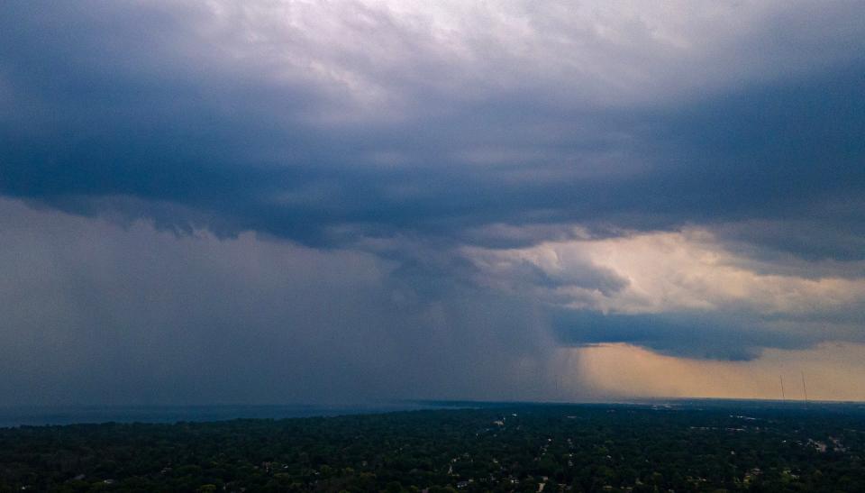
Wisconsin could be in for some severe thunderstorms, large hail and damaging wind this week
In addition to all the high and low temperatures in the area, southeastern Wisconsin could see severe thunderstorms Tuesday afternoon with a chance for large hail and damaging wind gusts. The best chances to see that are south of Interstate 94 and east of Interstate 39.
Tuesday evening into Wednesday morning is when cold air will move into the area, which the National Weather Service is warning could cause flash freezes during the Wednesday morning commute.
Why is it so warm this winter?
The primary culprit behind Wisconsin's unseasonably warm winter is a weather phenomenon known as El Niño.
An El Niño event is caused when sea surface temperatures in the central and eastern Pacific Ocean warm to above average for several months. During an El Niño, the polar jet stream is shifted northward, which limits cold air intrusions from the north, NWS explains.
In general, El Niño brings above-average temperatures to the northern United States, which often result in below-average snowfall in moderate-to-strong El Niño years.
Last year, the Milwaukee area NWS said this winter's El Niño was on track to be one of the strongest on record.
Claire Reid contributed to this report.
This article originally appeared on Milwaukee Journal Sentinel: Milwaukee weather to experience all four seasons this week, NWS says

