Where are the wildfires in Texas right now? Map shows extent of devastation
The Smokehouse Creek Fire, an uncontained blaze in the Texas Panhandle region, continued to burn Thursday and force evacuations from homes and businesses. A combination of dry conditions, unseasonably warm weather and strong winds has fueled the growth of the fire, which began Monday.
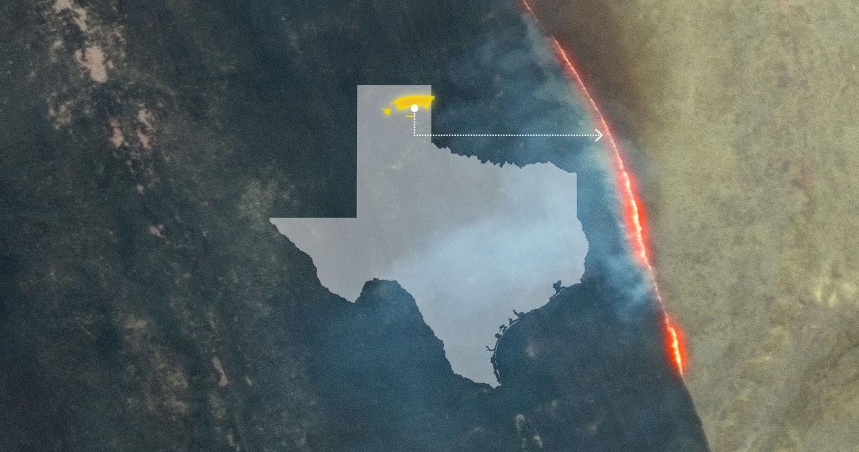
How big is the Smokehouse Creek Fire?
At 850,000 acres, or roughly 1,300 square miles, it's the second-largest wildfire in the state's history.
The Pantex Plant, a nuclear weapon plant northeast of Amarillo, reopened Wednesday after it was determined the plant's property was safe from the burn area.
For a size comparison, this is what the burn area of the Smokehouse Creek Fire would look like compared to the state of Connecticut:
And here's how a 500,000-acre burn area compares with Manhattan:
In imagery released by Maxar Technologies on Wednesday afternoon, the devastation could be seen from space, as in this example of the town of Fritch, Texas.
Where wildfires are burning in Texas right now
Tracking the fires: Texas fires map: Track wildfires as Smokehouse Creek blaze engulfs 500,000 acres
Contributing: Ramon Padilla, Karina Zaiets, Javier Zarracina, Julia Gomez, Associated Press, Amarillo Globe-News
This article originally appeared on Oklahoman: Map of the Texas wildfires shows where devastating blaze has spread

